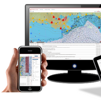
Teledyne Acquires ChartWorld International

Teledyne Technologies Incorporated announced today that it has acquired ChartWorld International Limited and affiliates. ChartWorld, headquartered in Cyprus, with additional locations in Hamburg, Singapore, Vancouver and Tokyo, is a provider of digital marine navigation hardware and software provided through a subscription-based model. Terms of the transactions were not disclosed.Commercial maritime subscribers to ChartWorld’s software as a service (SaaS) receive free type-approved Electronic Chart Display and Information Systems (ECDIS), a lifetime warranty and global 24/7 support.
e-Navigation Underway (North America) 2016

San Jacinto College and the Seamen’s Church Institute will host e-Navigation Underway (North America) 2016, the third in the annual North American series of conferences focusing upon the development and application of e-navigation. The event will be held at the San Jacinto College Maritime Technology and Training Center, La Porte, Texas, a new facility that opened in Spring of this year. e-Navigation is an initiative of the International Maritime Organization (IMO), the goal of which is to provide a decision support environment for the maritime community.
Unmanned Vessels: The Future is Now

There is a global boom in the development of unmanned systems, from below the ocean’s surface to high in the sky to the world’s roads. Add to this list the maritime industry, on both military and civilian vessels. Maritime Reporter & Engineering News examines in depth recent developments taking place in Europe to discover general thoughts and technical trends driving the future of unmanned shipping. The joint European Research Project MUNIN was finalized in August 2015, a project…
McMurdo Introduces Real-time Fleet Management
McMurdo has announced PRISMA Connect, a web-based integrated fleet management system that connects ship to shore in real-time for improved communication and operational efficiencies, as well as increased crew productivity with two-way messaging and electronic forms capture. The innovative system, which is based on proven Boatracs BTConnect and BTVessel software, is the first product announcement under McMurdo’s new suite of PRISMA (Preparation, Response, Identification, Surveillance, Management, Acceleration) software solutions.
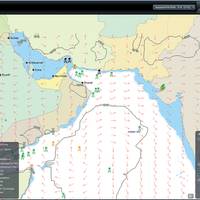
54% of Tankers Comply with ECDIS Mandate

SOLAS regulations on the mandatory carriage of Electronic Chart Display and Information System (ECDIS) for all tankers of 3,000 gross metric tons or more come into force July 1, 2015. Of the more than 8,750 tankers in the global fleet that are required to comply with these regulations by their first survey following this date, 54 percent are now using ENCs (Electronic Nautical Charts) on ECDIS, according to United Kingdom Hydrographic Office (UKHO). Progress has been made in recent months…
UKHO ‘Living with ECDIS’ Seminars at Nor-Shipping

The United Kingdom Hydrographic Office (UKHO) has announced the details of its free-to-attend ECDIS Seminars at Nor-Shipping, which have been updated to include the implications for shipowners and operators of the updated IHO ENC (Electronic Nautical Charts) Standards. The UKHO’s ‘Living with ECDIS’ Seminars will take place on Wednesday, June 3 and Thursday, June 4 at Nor-Shipping and will be presented by Captain Paul Hailwood, a renowned expert on ECDIS and integrated bridge operations, and Tom Mellor.
Fight Piracy – Intelligently
While global piracy is constantly changing, modern technology adapts to exploit the weaknesses in the pirates’ mode of operation. Intelligence gained from such technologies enables voyage planners and navigators to steer clear of harm – but what kind of information is required? While the image of the Somalian pirate is still high in the public’s mind as the number one piracy threat, the reality is not as straightforward. Pirates have had to change their tactics in the last few years…
German Pilots Choose SevenCs Software
German Pilot Associations choose SevenCs to Develop Portable Pilot Unit Software. Five German Pilot Associations for the Elbe, Emden, Hamburg, Jade/Weser II and Kiel Canal I (Brunsbüttel) have chosen Hamburg-based maritime navigation specialists SevenCs GmbH to supply their Orca Pilot Portable Pilot Unit (PPU) software. At the same time, SevenCs, in conjunction with the Pilots, will develop new next generation PPU software, and deliver training to all the associations’ 625 pilots. Commenting on the new project, Capt.
TEN-T Contributes to MonaLisa Project
The “MonaLisa” project, an action in the Baltic Sea region aimed at improving the quality of maritime transport, will benefit from €11.23 million (nearly $16 million) in EU contribution from the 2010 TEN-T Multi-Annual Call. The project, which forms part of TEN-T Priority Project 21 “Motorways of the Sea,” will run until 2013 and includes the participation of three Member States (Denmark, Finland and Sweden). The “MonaLisa” project aims at improving quality of maritime transport, safety at sea, exchange of maritime data and facilitation of environmental performance of shipping and implementation of e-Maritime relevant applications. Although three Member States are currently participating in the project, more will be able to join once the project is underway.
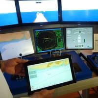
NG Training Packages for NROTC
Naval Reserve Officer Training Candidate (NROTC) students at college campuses in San Diego have become the first to use an advanced navigation training package supplied by Northrop Grumman Corporation’s (NYSE: NOC) Sperry Marine business unit. The computerized learning DVDs contain 16 interactive courseware (ICW) training lessons on the use and operation of Sperry Marine’s Voyage Management System (VMS) ship navigation software. They are being used in the navigation training curriculum for NROTC students at the University of San Diego and other greater San Diego college campuses. “The eLearning courseware will give the NROTC students an opportunity to become familiar with the standard electronic navigation system used throughout the U.S. Navy surface and submarine fleets.
Transas Receives VAR Status
Transas Ltd. has received Value Added Reseller (VAR) status for the IC-ENC (International Center for ENCs) official electronic nautical charts (ENC). Transas successfully passed all the tests and assessments and is now authorized to distribute the ENC data produced by national Hydrographic Offices and primarily designed for use with Electronic Chart Display and Information Systems (ECDIS). Hydrographic offices are the only national institutions, which can produce and/or authorize the production of ENCs of their own territorial waters. There’re only four VAR’s that have been appointed so far, including Transas, which is the only ECDIS manufacturer to also supply official electronic charts in System ENC (SENC) format to be used with ECDIS.
Northrop Grumman to Supply Integrated Bridge System for SFPA
Northrop Grumman Corporation received orders to supply bridge navigation and communication electronics for a new offshore patrol vessel under construction for the Scottish Fisheries Protection Agency (SFPA). The equipment, to be supplied by Northrop Grumman’s Sperry Marine business unit, will include a complete networked system that ties together all of the ship’s navigation sensors and steering controls into an integrated bridge system (IBS) running on electronic nautical charts. The new 84-m, 2,181 gross ton patrol vessel is being built at the Remontowa Shipyard in Poland for delivery in 2007. The ship’s diesel electric variable pitch propulsion system will provide a top speed of 18 knots and an endurance of 30 days on patrol.