Arctic Ice Melt Has Begun

NOAA Environmental Visualization Lab reports ice now shrinking.
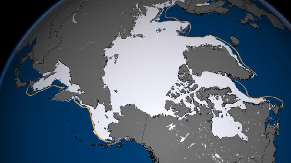
After reaching its maximum extent for the year on March 15, 2013, the average extent of sea ice in the Arctic has begun shrinking and will probably reach its minimum extent sometime in mid-September.
This year’s maximum extent was the sixth lowest in the satellite record, according to the National Snow and Ice Data Center. At 15.13 million square kilometers, the maximum extent was 733,000 square kilometers below the 1979 to 2000 average of 15.86 million square kilometers, and occurred five days later than the 1979 to 2000 average date of March 10. The lowest maximum extent occurred in 2011.
The ten lowest maximums in the satellite record have occurred in the last ten years, 2004 to 2013. This image shows the satellite-based measurement of the sea ice extent on March 15, 2013.