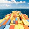
Closing of 2009 Navigation Season

The Great Lakes - St. Lawrence Seaway System announced the closing of the 2009 Navigation Season. Mariners are reminded that there is always a possibility that severe climatic conditions may occur during the closing period. Should this happen, there is a chance that the dates outlined below, for the Montreal-Lake Ontario Section or the Welland Canal, may not be met.
Closing Dates
Montreal-Lake Ontario Section
• The Corporations have decided to waive the operational surcharges on December 21, 22, 23 and 24.
• Any transit of the Montreal-Lake Ontario section of the Seaway after 23:59 hours, December 24, if permitted, will be subject to prior written agreement. Arrangements are to be made at our St. Lambert office.
• Irrespective of operating conditions, in the Montreal-Lake Ontario section of the Seaway, all vessels must be clear of this section at 23:59 hours on December 29th.
Welland Canal
• The Welland Canal will remain open until 23:59 hours on December 26th.
• Any transits of the Welland Canal after 23:59 hours, December 26th, if permitted, will be subject to prior written agreement. Arrangements are to be made at our St. Catharines office.
• Vessels will be allowed to transit the Welland Canal up to 23:59 hours on December 30th, weather and operating conditions permitting.
Sault Ste. Marie Locks and Canal (United States)
The official closing date for the Sault Ste. Marie Locks (U.S.A.) is 2400 hours January 15, 2010.
Ports East of the Seaway
Vessel owners and operators are advised that there are a number of ports east of the Seaway (St. Lambert Lock) on the St. Lawrence River that remain open to navigation during the winter months.
Detailed Closing Procedures
For the 2009 navigation season, the Seaway entities have agreed to apply the closing procedures outlined below. In these procedures, the following definitions are used:
a) The clearance date, as defined in Seaway Practices and Procedures, will be December 20th, 2009 at 23:59 hours;
b) The closing period: the period beginning December 1 and continuing until the last ship has completed its transit.
During the closing period, the following procedures will be in effect:
1. Reporting
a. Commencing at 0001 hours, December 1 and for the duration of the closing period, each upbound ship entering the Seaway at CIP 2 or departing upbound from a port, dock, wharf or anchorage in the Montreal/Lake Ontario Section must declare the furthermost destination of its voyage.
b. Commencing at 0001 hours, December 17 and for the duration of the closing period, each downbound ship entering traffic control Sector 4 at mid-Lake Ontario must declare the furthermost St. Lawrence River destination of its voyage, along with all intermediate destinations.
Regarding a) and b) above, each ship must advise the nearest traffic control centre of any changes in these destinations.
2. Upbound Ships With Destinations Above Port Colborne
a. A ship which enters the Seaway System upbound at CIP 2 after 2400 hours on December 9 and transits above Port Colborne shall be designated a ‘wintering ship’.
b. A ‘wintering ship’ wishing to return downbound through the Montreal/Lake Ontario Section will be granted downbound transit privileges only if, in the opinion of the Manager and the Corporation, such transit can be accomplished safely and without interfering with the orderly and timely transit of any ship not designated as a ‘wintering ship’ or without otherwise disrupting the system.