Proposed Lock Replacement will Increase Flood Control and Navigation

Better flood control and navigation are the goals of an $80 million proposal to replace the Bayou Sorrel Lock between Baton Rouge and Morgan City, La., the U.S. Army Corps of Engineers said Wednesday.
A public meeting is scheduled Thursday, Feb. 13, at 6:30 p.m., in the Ibervillle Parish
Council chambers, 58050 Meriam Street, Plaquemine.
Citizens are asked to comment on the alternatives that have been investigated in the draft
feasibility study report and draft environmental impact statement.
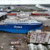
The Bayou Sorrel Lock is located on a 64-mile-long shortcut from the Mississippi River
to Morgan City that avoids a long, indirect trip through New Orleans. The shortcut is the
Morgan City to Port Allen (Baton Rouge) Alternate Route of the Gulf Intracoastal
Waterway.
The Bayou Sorrel Lock is located at the juncture of the Alternate Route and the East
Atchafalaya Basin Protection Levee. The lock is at the town of Bayou Sorrel, which lies
on the protected (east) side of the levee.
Increased flood protection is proposed because the Atchafalaya Basin levee is eight feet
higher than the gates of the Bayou Sorrel Lock. The gates and lock constitute
continuation of the levee across the waterway.
This flood-control system cannot be
modified to pass a project flood safely.
A new, larger lock is proposed because vessels are experiencing delays of 2.4 to 4.1
hours per towboat-barge combination. The new lock’s dimensions would be 1,200 feet
long by 75 ft. wide. The present lock measures 799 by 56 feet. Depth would remain 15
feet. The Corps of Engineers would buy an additional 102 acres of land to accommodate
construction. At present, the Corps holds channel and dredged- material placement
easements on this land.
It is expected that the study will be completed by June. Engineering and design would be
completed in 2005. Then, cons truction would take about three years, weather and funding
permitting. Vessels would continue to use the existing lock while the new one is built in
the dry. Keeping the Alternate Route open would allow towboats and barges to avoid a
234-mile detour through the New Orleans area when operating between Baton Rouge and
Morgan City. This would also make it possible to avoid creating vessel-traffic jams at the
Corps’ navigation locks on the West Bank near New Orleans.
Alternatives considered
Flood-control-only plans would safely pass the project flood in the Atchafalaya Basin,
but not reduce navigation delays. The flood-control only alternatives include (1) an
independent float-in flood gate, located on the floodway (Atchafalaya Basin) side of the
lock, and (2) A new lock with the same dimensions as the existing lock.
Flood control and navigation plans would safely pass the project flood and reduce delays
to navigation. Alternatives for a new lock include 75 by 1,200 feet and 110 by 1,200 feet.