NOAA Fairweather Updates Arctic Charts

As Arctic ice recedes, countries are looking forward to faster, safer and more efficient sea routes across the top of the world. Responding to a request from the U.S. Navy, U.S. Coast Guard, Alaska Maritime Pilots and the commercial shipping industry, NOAA sent one of its premier surveying vessels, NOAA Ship Fairweather, to detect navigational dangers in critical Arctic waters that have not been charted for more than 50 years.
Fairweather, whose homeport is Ketchikan, Alaska, will spend July and August examining seafloor features, measuring ocean depths and supplying data for updating NOAA’s nautical charts spanning 350 square nautical miles in the Bering Straits around Cape Prince of Wales. The data will also support scientific research on essential fish habitat and will establish new tidal datums in the region.
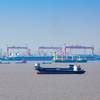
Just as the growing numbers of cars on the road cause traffic “chokepoints,” more ships traversing northern passageways can choke maritime traffic. These maritime traffic snarls occur when nautical charts are outdated, ships do not have sufficient information for navigation or changing maritime conditions – like sea level rise or movements of the seafloor – are not tracked.
“We have seen a substantial increase in activity in the region and ships are operating with woefully outdated charts,” said Sen. Lisa Murkowski of Alaska. “I have introduced legislation that authorizes a significant increase in funding for mapping the Arctic, and I am pleased to see NOAA beginning the process. While this is a good start, we still need more resources to adequately map this region.”
“Commercial shippers aren’t the only ones needing assurances of safety in new trade routes,” noted Captain John Lowell, director of NOAA’s Office of Coast Survey. “The additional potential for passenger cruises, commercial fishing and other economic activities add to pressures for adequate response to navigational risks.”
The U.S. Exclusive Economic Zone includes 568,000 square nautical miles of U.S. Arctic waters. The majority of charted Arctic waters were surveyed with obsolete technology dating back to the 1800s. Most of the shoreline along Alaska’s northern and western coasts has not been mapped since 1960, if ever, and confidence in the region’s nautical charts is extremely low.
“In Alaska we are seeing the effects of climate change more rapidly than anywhere else in the U.S.,” said Sen. Mark Begich of Alaska. “As Arctic sea ice recedes, economic activity in the region is going to expand dramatically. Alaskans rely on NOAA to help us make sure that things like oil and gas development and marine transportation are done safely and responsibly. The 21st century mapping technology the Ketchikan-based Fairweather brings to this important charting mission is a great example of what the federal government needs to do as activity in the Arctic grows.”
About a third of U.S. Arctic waters are considered navigationally significant. Of that area, NOAA’s Office of Coast Survey has identified 38,000 square nautical miles as survey priorities. NOAA estimates that it will take well more than 25 years to map the prioritized areas of the Arctic seafloor.
“President Thomas Jefferson ordered a survey of the East Coast in 1807, when our country was losing more ships to unsafe navigation than to war,” explains Capt. David Neander, commanding officer of the Fairweather. “Today, we have better maps of the moon than of our own oceans. Our 46-person crew is amassing ocean data that directly affects our economy and our ecosystems.”
The vessel is equipped with the latest in hydrographic survey technology – multi-beam survey systems; high-speed, high-resolution side-scan sonar; position and orientation systems; hydrographic survey launches; and an on-board data-processing server.
Updated charts for commercial and recreational navigation are available on Coast Survey’s Web site http://www.nauticalcharts.noaa.gov