Arctic Waters Hydrographic Survey by NOAA

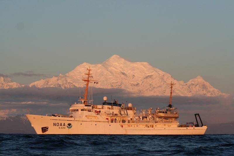
NOAA Ship 'Fairweather' to conduct hydrographic work in the Arctic updating depths measured in the 18th century.
NOAA Ship Fairweather begins a 30-day survey mission in the Arctic, scheduled to check a sparsely measured 1,500-nautical mile coastal corridor from Dutch Harbor, Alaska, north through the Bering Strait and east to the Canadian border.
The mission will collect needed information to determine NOAA’s future charting survey projects in the Arctic and will cover sea lanes that were last measured by Captain James Cook in 1778.
“Much of Alaska’s coastal area has never had full bottom surveys to measure water depths,” said Cmdr. James Crocker, commanding officer of Fairweather, and chief scientist of the party. “A tanker, carrying millions of gallons of oil, should not be asked to rely on measurements gathered in the 19th century. Unfortunately, that’s exactly what navigators have to do, in too many cases. NOAA is changing that.”
“We expect more increases of Arctic maritime traffic due to melting sea ice, which will require accurate and precise navigational data,” said Kathryn Ries, acting director of NOAA’s Office of Coast Survey . “The sheer size of the task -- the coast length of 921 nautical miles is really 2,191 miles of low tidal shoreline once you figure in the bays and inlets --- requires that NOAA increase its charting efforts.”
Before NOAA cartographers can update the charts, however, they need the depth measurements and other data gathered by NOAA’s survey vessels like Fairweather.