

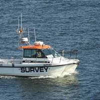
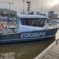
Arctia to Map Offshore Wind Area in Norway
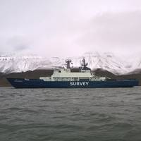
Arctia Meritaito, a subsidiary of Finland's Arctia, announced it has been awarded a contract by the Norwegian Mapping Authority to perform hydrographic seabed surveying as part of the 2024 Mareano program.Under its contract from the Norwegian Mapping Authority's Hydrographic Service (NHS), Arctia Meritaito will survey approximately 1,900 square kilometers with multibeam echosounder and sub bottom profiler in potential offshore wind area Sørvest F in the North Sea.The surveys will be conducted by the multipurpose research vessel Pohjanmeri.
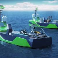
Reach Subsea Partners with Agalas for New IMR/Survey Vessel
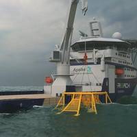
Reach Subsea, a Norwegian subsea services company, has signed a long-term charter contract with Agalas for a modern IMR/Survey vessel to be built in Turkey.According to Reach Subsea, to be hired on three or five-year charter, will has a low emission, smart lifting arrangement and a state of the art equipment package that can be adapted to several market segments, with delivery early 2026.Reach Subsea CEO Jostein Alendal said:"The market for subsea vessels is expected to remain tight for the foreseeable future…
MarTID: 2023 Survey of Maritime Training Practices is Open
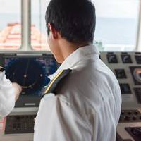
Vessel owners/operators, Maritime Education and Training Institutes and Seafarers are encouraged to participate in the 2023 MarTID survey of maritime training practices.The survey is designed to take only 20 to 30 minutes to complete, but the insights are invaluable in the quest to learn more granular detail on the current focus and future shifts in the way in which seafarer training is delivered, measured and funded globally.Click Here to read the 2021 MarTID ReportThe Maritime…
Remote Survey is the New End-Game

More than remote witnessing, more than remote data analysis, remote survey techniques are now going to aid the shift to full vessel autonomy.The technology that enables a robot to safely navigate an environment it has no prior knowledge of is called Simultaneous Localization and Mapping (SLAM). “It is the key to autonomy for any aspiring can-do inspection robot.” That’s according to ScoutDI, a participant in the REDHUS project led by DNV which is developing a prototype inspection drone.SLAM is not a specific, copyrighted piece of technology.
TDI-Brooks Awarded Contract to Study Seabed Conditions for US Offshore Wind
U.S.-based marine services company TDI-Brooks announced it was awarded geophysical, geotechnical and benthic sampling survey campaigns to study seabed conditions within the project lease area and potential export cable corridors for offshore wind farms off the U.S. East Coast. TDI-Brooks said it expects to begin the program in April and will continue through summer 2023 with two to three vessels in operations. The data collected will help determine safe and responsible project design and engineering along with identifying potential geohazards and benthic habitats.
Vineyard Wind Taps ThayerMahan for Subsea Survey
Vineyard Wind, a joint venture between Avangrid Renewables, a subsidiary of AVANGRID, Inc. and Copenhagen Infrastructure Partners (CIP), announced a partnership with autonomous maritime solutions company ThayerMahan for seabed and infrastructure survey and inspection work in the waters off southern Massachusetts.Based in Groton, Conn., ThayerMahan, specializes in seabed surveys, acoustic mitigation and monitoring, and other maritime related services and has facilities in Connecticut and Massachusetts.
Need a Survey? There’s a USV for That
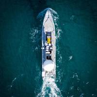
While the adoption of unmanned/uncrewed surfaces vessels (USVs) was initially in defence, use of these low footprint systems has spread into other sectors, not least survey, and now the race is on for greater capability, endurance and autonomy. Elaine Maslin reports.After starting small, in inland waterways, use of USVs for survey operations has moved into coastal and now offshore waters. Given the extensive amount of seabed and rapid growth in offshore wind, there’s plenty of work out there for them to do.With the travel restrictions posed by Covid and increasing awareness of climate change…
VIDEO: New Marine Survey Firm Nicola Offshore Open for Business

A new company called Nicola Offshore specializing in marine survey campaigns and on-demand missions has started operations from its headquarters in Hamburg, Germany on Monday.According to the company's press statement, Nicola Offshore was established to service the more complex and specialist aspects of marine surveying, including underwater object detection, unexploded ordnance (UXO), and subsea cable investigations, as well as pre- and post-dredging reports. The company is a joint venture between Nicola Engineering GmbH…
Ocean Infinity to Buy MMT
US-based seabed survey and ocean exploration company Ocean Infinity on Tuesday said it had agreed to acquire the Sweden-based subsea survey firm MMT."Ocean Infinity and MMT are excited to announce an acquisition that brings together MMT’s deep expertise and established track record as a distinguished marine survey and data analytics provider and Ocean Infinity’s best-in-class robotic technology and operational expertise," the companies said without sharing the financial details…
BMT’s Pentamaran: Next-gen Hull for Autonomous Ops
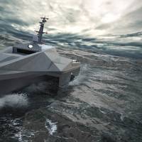
Designed to meet challenges of long range autonomous ops, the ‘Pentamaran’ design has been optimized to reduce fuel consumption and increase flexibilityBMT recently released details of its next generation ‘Pentamaran’ platform for autonomous applications, vessels that can be custom configured for military, patrol, intelligence surveillance and reconnaissance (ISR), anti-submarine warfare (ASW) and hydrographic survey work.The Pentamaran has been designed to reduce drag as much…
ABS Offers IHM Surveys Remotely
ABS has added Inventory of Hazardous Materials (IHM) Survey as remote choices.ABS is delivering IHM remote survey to support clients ahead of the December 31, 2020, introduction of mandatory IHM for all vessels sailing under an EU member states’ flag or any vessel calling at a European port.“In this challenging, time-pressured environment, ABS IHM remote survey is the simplest route to compliance without the inconvenience of arranging for a surveyor to be physically present on board,” said John McDonlad, ABS Senior Vice President, Global Business Development.An IHM initial survey for existing vessels verifies the location of the hazardous materials on board that are listed in the inventory.
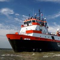
Hydrographic Survey Vessel to be Converted for Unmanned Operations
A hydrographic survey vessel will operate in multiple areas of the Wadden Sea, commanded from shore by personnel in an office in Amersterdam.U.S.-based Sea Machines Robotics, a developer of autonomous command and advanced perception systems, said Thursday that Dutch company Deep BV will equip one of its vessels with a Sea Machines SM300 autonomous control system to enable remote command of the vessel, including navigation and positioning, the control of on-board auxiliaries and sensors, and ship-to-shore data flow.
Fugro Mapping Arctic Waters off Norway
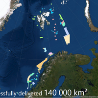
The Norwegian Hydrographic Service has awarded Fugro another hydrographic survey contract as part of the MAREANO seabed mapping program, financed by Norway’s Ministry of Trade, Industry and Fisheries, and the Ministry of Environment.Fugro said it has already completed 10 surveys for the program since 2006 and acquired over 140,000 km2 of data. This latest survey will collect high-resolution, high-density multibeam echosounder and sub-bottom data to produce seamless datasets for the Norwegian mapping program.
SBG Systems' INS Chosen for Shom Fleet
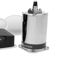
Shom, the French national hydrographic and oceanographic office selected SBG Systems’ inertial navigation sytems to renew their whole fleet of INS. They chose Navsight Apogee INS for their speedboats and survey vessels for both shallow and deep-water real-time bathymetric surveys and Qinertia PPK software for post-processing tasks.Shom has 3 major objectives: national hydrography and cartography, defense support in hydro-oceanographic fields, and support in maritime geospatial products and services for public policies on the sea and the coast.
ClassNK Releases CBM Guidelines
Classifaction society ClassNK released new guidelines that explain the revised rules for using condition based maintenance (CBM) in class surveys to promote the use of CBM technology.Condition based maintenance, a method for monitoring the operating state of equipment, diagnosing the state of said equipment based upon the information obtained from such monitoring, and then performing necessary maintenance and inspections, has been attracting attention in recent years. ClassNK first introduced the concept of the CBM in its class rules in 1994.
BV Performs First Survey by Drone

Bureau Veritas Marine & Offshore (BV) reports it has completed its first ever survey by drone, carried out in the holds of a bulk carrier in an Italian port.The scope was an intermediate survey on a bulk carrier and consisted of close-up inspections and ultrasonic thickness measurements (UTM) conducted by the drone in two cargo hold spaces. The required prior agreement from the flag authority was confirmed – all the more necessary as the ship is subject to the IMO Code for the Enhanced Survey Program (ESP).Remote Inspection Techniques (RIT) were reflected in BV’s rules in 2019.
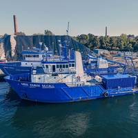
Hybrid Hydrographic Boat Delivered in France
French builder Alumarine Shipyard has delivered a new hydrographic survey boat to the Port of La Rochelle.The eight-meter aluminum vessel, dubbed Cassiopée, is powered by a dual electric/diesel propulsion system. The newbuild is designed to transit at 20-25 knots under diesel power between the home port and the acquisition area, then shift to the electric outboards while performing scans of the seafloor.Electric propulsion and hybrid drives manufacturer Torqeedo said it worked closely with the naval architect and shipyard to specify…
25 More Years for Ocean Surveyor
Damen Oskarshamnsvarvet in Sweden has won the public tender for a contract to undertake a major life extension program on the survey and research vessel S/V Ocean Surveyor, owned by SGU, Sweden’s national geological survey agency.“We are happy to let Damen Oskarshamnsvarvet perform the extensive conversion of the vessel and are confident that she will be ready for another 25 years of marine surveying prior to the field season 2021. Ocean Surveyor is a key platform for many marine surveys conducted in Sweden, not only for SGU, but also for other operators hiring the vessel’s unique surveying facilities,” said Björn Bergman, operations manager at SGU.Ocean Surveyor will undergo the life-time extension over the course of 12 months.
Polarcus Seismic Vessel Refit Completed
Portugal’s Navalrocha shipyard said it has completed a multimillion-euro repair and refit project for Dubai-based marine geophysical company Polarcus.The drydock project which completed in January 2020 involved a broad package of work to the ultra-modern 14 streamer 3D/4D seismic vessel – Polarcus Naila.The vessel is environmentally advanced with diesel-electric propulsion, high specification catalytic converters, a double hull and advanced bilge water cleaning system.“The Polarcus Naila visited Navalrocha shipyard for a total of 33-days running through the Christmas period…
ION to Shoot 2D/3D Programs off Colombia
ION Geophysical Corporation, a provider of geoscience technology, services, and solutions for the oil and gas industry, has entered into a multi-client agreement with Colombia’s National Hydrocarbon Agency (ANH), granting rights to reprocess existing data and acquire new 2D and 3D multi-client programs offshore Colombia’s Caribbean coast.In February, the ANH announced a series of reforms to encourage investment in exploration and production, such as a permanent license round and a more attractive tax regime, to boost declining production and increase reserves.The data is intended to enable better understanding of hydrocarbon potential…
Indian Navy Signs MoU for Offshore Data with GSI
Indian Navy has signed a memorandum of understanding (MoU) with Geological Survey of India (GSI) for ‘sharing of seabed sediments data, products and expertise for Naval application in meteorology and oceanography’.The MoU was signed on 21 January 2020 between Commodore AA Abhyankar, who heads Indian Navy’s Oceanology and Meteorology Directorate and Shri N Maran, Deputy Director General of GSI.GSI’s Marine and Coastal survey Division based at Mangaluru has mapped most of India’s 2.1 Million square km Exclusive Economic Zone and has a vast repository of offshore data.This data collected using GSI’s state-of-the-art oceanic research vessels Samudra Manthan…
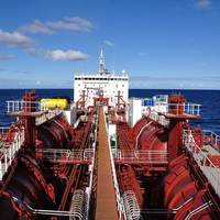
PGS Readies Offshore Sabah Data
Norwegian seismic services provider Petroleum Geo-Services (PGS) said that key areas for the 2020 Malaysia Licensing Round are covered by the PGS Sabah MC3D program.Data is available to evaluate the petroleum potential of the highly prospective offshore Sabah province, said a press note from the geophysical company.Over 47 000 sq. km high-resolution 3D data is available for Sabah, covering new opportunities near established plays in this exciting hydrocarbon province.Block SB-2T on the 2020 bid round is almost entirely covered by Sabah MC3D. SB-2T lies in the proven fold and thrust belt and is surrounded by producing oil and gas fields.
Gazprom Neft Completes Okhotsk Survey
Russian oil and gas exploration company Gazprom Neft has completed ecological monitoring of grey whale populations at the Ayashsky license block, offshore from Sakhalin Island, with expedition members registering more than 550 animals in the course of a five-month survey.According to a press release, the ecological monitoring of grey whales in the Sea of Okhotsk forms part of a joint programme being implemented by oil and gas companies operating in Sakhalin. Gazprom Neft joined the programme in 2017, on starting development of its Ayashsky license block.Researchers conducted 58 sorties on the Siem Sapphire support vessel between June and October…


