

Nautel Expands Maritime Offering with Kenta Acquisition
Canada-headquartered Nautel announced Wednesday that it has acquired France-based technology company Kenta, expanding Nautel’s offerings to customers in the maritime sector.Kenta was established in 1990 and has gained extensive experience in the development of Radio Frequency Communication Systems, mainly in the area of Global Maritime Distress and Safety Systems (GMDSS) for telephony or voice transmission. The company offers complete turnkey transmitter and receiver solutions for MF…
Coast Guard, NOAA to Include Navigation Rules in U.S. Coast Pilot

The U.S. Coast Guard and National Oceanic and Atmospheric Administration (NOAA) have teamed up on a consolidated publication that will help mariners save time and money. The Coast Guard Office of Navigation Systems and NOAA Office of Coast Survey will incorporate the amalgamated International Regulations for the Prevention of Collisions at Sea (72 COLREGS) and the Inland Navigation Rules into NOAA’s U.S. Coast Pilot publications. The U.S. Coast Pilot publications already include the Coast Guard’s Vessel Traffic Service regulations.
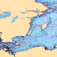
Survey Vessels Hit the Charts
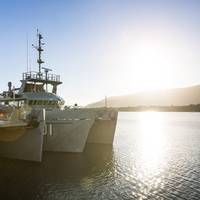
Training to ‘fight and win at sea’ occurs across the Navy every day of the year, but how does that concept map to the hydrographic fleet and their motto ‘diligence and skill’? – step into the world of the Navy’s survey motor launches. HMAS Mermaid, one of four Paluma class vessels, recently completed an intensive five and a half week training program in North Queensland waters in company with her sister ship HMAS Paluma. The ship and her 15-person crew were put through their paces by Navy’s in-house training and assessment team – Minor War Vessel Sea Training Group.
C-MAP Appointed Admiralty Distributor
C-MAP has been appointed by the United Kingdom Hydrographic Office (UKHO) as an official ADMIRALTY Digital Distributor and SENC Service Provider. Following this appointment, C-MAP, will now supply ADMIRALTY Vector Chart Service (AVCS), C-MAP ADMIRALTY ENC Service (CAES), ADMIRALTY Digital Publications (ADP) and Electronic Nautical Publications (e-NPs) through its global network of offices and distributors. AVCS - the world’s leading ENC Service - will be provided by C-MAP in both traditional S-63 format and in the time and cost efficient DNV certified SENC data compression format. Named C-MAP ADMIRALTY ENC Service (CAES), the new service is complementary to other C-MAP services including Weather, Piracy and Professional+ (Pro+) chart data.
P&O Ferries Chooses GNS Solutions
Ferry company P&O Ferries will take advantage of GNS solutions to deliver purchasing cost efficiencies and simplify navigation management and compliance on board. P&O Ferries, the British ferry company that operates ferries from the U.K. to Ireland and Continental Europe, has selected maritime solutions provider GNS to provide navigation products and services for its fleet of 15 vessels. Under the terms of the agreement, GNS will supply digital and paper navigational products as well as its Voyager software to all P&O vessels for a fixed annual price.
Nautisk Appoints Sub-distributor in Spain
Global chart distributor Nautisk has appointed SEAMAPS ES as a sub-distributor, serving Algeciras and the surrounding areas. The Spanish chandler will service local customers with core navigational products and services direct from Nautisk including Admiralty charts and publications in both paper and digital format. SEAMAPS will also offer a number of solutions developed by Nautisk for the maritime market including POD (Print on Demand), Nautisk’s vessel information service - Neptune, and the newly launched digital publications library, NaviTab.
Smulders Appointed CEO of Radio Holland

Paul Smulders has been appointed CEO of Radio Holland, part of the RH Marine Group (formerly Imtech Marine). Smulders returns to Radio Holland where he started his career ashore in 1989 as sales engineer deepsea, after a career at sea as nautical officer. From 1993 on he fulfilled various positions, such as sales manager for the Radio Holland Hong Kong sales activities in China, Taiwan and Hong Kong, and in the Netherlands as Area Sales Manager and Managing Director of Radio Holland Netherlands.
GNS Expands its Voyager Suite
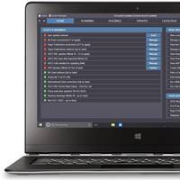
Maritime services group Global Navigation Solutions (GNS) will unveil its new Voyager suite of products that for the first time connects ship and shore through one e-navigation solution. Scheduled to debut at events in London, Singapore and Hamburg on June 17, 18 and 19, GNS’s new web-based Voyager Management Service now enables shore-based ship managers to check that vessels are always carrying required charts and publications, in either digital or paper format, and that all relevant corrections have been received onboard and applied, thereby helping prevent vessels from incurring penalties from chart-related issues arising with port-state control inspections.
Tankers Switch to Digital Navigation
In July 2015 international regulation requires all tankers to be compliant with IMO rules for the use of ECDIS and ENCs. As many shipping companies start planning that changeover Global Navigation Solutions (GNS) has today published a white paper, The Ultimate Guide to Going Digital, a seven-step plan to help managers plan everything from new ways to buy charts, manage inventories, update charts, demonstrate compliance, passage plan, as well as dealing with the increased administration.
ChartWorld Extends Portfolio to Support GIS Customers
ChartWorld now offers OceanWise Marine Themes dataset that combines the fragmented features of traditional nautical charting merged into an almost seamless marine map. The data is more beneficial and overcomes the irregular coverage and multi scale levels of traditional charting products. In particular those users who intend to add third party datasets or other outputs such as Web Services will benefit from Marine Themes. The Digital Elevation Model (DEM) makes Marine Themes an advanced dataset for use in desktop and WebGis.
NOAA Nautical Charts Now Permanently Free

After a three-month trial period, PDF versions of NOAA nautical charts will become a permanent product, free to the public. The free PDFs, which are digital images of traditional nautical charts, are especially valued by recreational boaters who use them to plan sailing routes and fishing trips. The free PDF charts are part of a suite of new and enhanced navigational products designed to make NOAA’s data more accessible to the general public. “Up to date charts help boaters avoid groundings and other dangers to navigation…
ChartCo Fits SeaSpan with Navigation Software
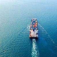
ChartCo announced that SeaSpan Corporation, an independant owner of container ships, has placed an order with ChartCo to fit its navigation data management system across the entire fleet. ChartCo will install its full software suite, including PassageManager, and supplying paper and electronic chart updates to each vessel. PassageManager allows ChartCo subscriber to plot routes, attach navigational products to those routes and then produce comprehensive passage plans combining products, port and route data.
WRSystems Announces Two Key Appointments
W R Systems, Ltd. (WRSystems) announces two key appointments in its Maritime Technologies Division: Mr Arthur Thomas Senior joins as Vice President – Maritime Business and Mr Mike Kellner joins as Director – Maritime Business. WRSystems’ Maritime Technologies Division supplies Radar, ECDIS and Inertial Navigation Technology as part of a full suite of navigational products. Art Thomas leads the expansion of the Maritime Technologies Division within WRSystems. Mr Thomas’ team at WR Systems builds on the company’s extensive experience in design, supply, installation and through-life support of navigational and communications equipment. Mr Thomas has extensive experience in the commercial maritime electronics sector.
Svanes Joins NAVTOR as new Managing Director
E-navigation company NAVTOR said that Tor A. Svanes, the founder of C-MAP Norway, has joined the business in the position of Managing Director. Svanes, who is well known within the maritime industry for his contribution to the development of ECDIS and the electronic chart concept, will now lead and develop the NAVTOR team and proposition. Stavanger-based Smedvig established NAVTOR in June 2011 after the firm spotted an emerging opportunity in the maritime marketplace. As carriage requirements for ENCs moved towards an official IMO mandate, Smedvig saw an opening to build up an e-navigation company that could meet the new demand for digital navigational services.
NOAA Begins Production With Esri

GIS Creates Integrated Data Workflow for More Efficient Chart Production. The National Oceanic and Atmospheric Administration (NOAA) has implemented a new nautical charting system based on Esri GIS technology to produce more navigational products than ever before without increasing its budget or personnel needs. The new system, NCS II, is based on Esri Nautical Solution, and it allows NOAA to centralize the management of hydrographic data for US coastal waters. Since accepting Esri Nautical Solution as part of its production system in 2009…
NOAA’s Newest Chart to Support Puerto Rico Maritime Economy
The Port of San Juan, which is experiencing a tremendous growth of maritime traffic and planning for more, received an additional economic boost today when NOAA debuted a new nautical chart that will make ocean-going vessel traffic safer and more efficient through San Juan Bay and the port area. “There is not only more traffic, but larger vessels are making San Juan their port call,” said Capt. John Lowell, director of NOAA’s Office of Coast Survey. “Mariners asked for NOAA’s help when they started finding themselves too far right of the port entrance,” Lowell said. “The San Juan harbor pilots knew the ship captains were at risk of endangering their vessels.
NOAA’s New Chart Supports Puerto Rico Maritime Economy
The Port of San Juan, which is experiencing a tremendous growth of maritime traffic and planning for more, received an additional economic boost today when NOAA debuted a new nautical chart that will make ocean-going vessel traffic safer and more efficient through San Juan Bay and the port area. “There is not only more traffic, but larger vessels are making San Juan their port call,” said Capt. John Lowell, director of NOAA’s Office of Coast Survey. “Mariners asked for NOAA’s help when they started finding themselves too far right of the port entrance,” Lowell said.
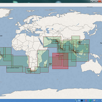
UKHO Opens Doors on the Future of Navigation In Singapore
At Sea Asia, the UKHO announced that it will open its first overseas office in Singapore to provide local support for Admiralty distributors and a rapidly-growing customer base across Asia. The move will enable the UKHO to work more closely with the world’s largest maritime market which has a vital role to play in the shipping industry’s successful transition to digital navigation. The number of vessels throughout Asia using electronic navigation technology is rising quickly as shipping companies take advantage of both the improved safety benefits and operational efficiencies available.
Transas Reports Another Successful Year
According to Transas, the year 2002 was marked by substantial growth in sales all over the world and their updated product line. During the year, Transas completed development of the new-generation 3000 line of navigational products. Now, this product line comprises Navi-Sailor 3000, the enhanced version of the electronic chart system with UAIS transponder interface; Navi-Radar 3000, PC-based radar display system; Navi-Conning 3000; and Navi-Fisher 3000, the ectronic chart system specifically adapted for fishery vessels. The line also includes Navi-Bridge 3000, a smart mini-IBS (Integrated Bridge System) designed to make ship control easier and more efficient.
Kelvin Hughes New Entertainment Service
Kelvin Hughes is offering a new crew entertainment package after signing an exclusive agreement with Headland Media. This agreement authorises Kelvin Hughes to sell Headland Media’s film, book, music, sports, and game service, Walport Entertainment On-Board. This will be a new addition to Kelvin Hughes’ existing navigational products. Walport Entertainment On-Board from Headland Media comprises a choice of the latest international film releases and classics, hit TV shows from UK and US, DVD coverage of major sporting events, CDs and pop videos covering a wide range of music, an unrivalled selection of books and magazines, and popular video games, including PS2, PS3, Xbox and Wii.


