

SevenCs Updates WMS ChartServer
SevenCs has released WMS ChartServer, version 5, which provides enhanced functionality across several fronts.Greater interoperability is the key to WMS ChartServer’s support of spatial queries; this support takes the depth and relevance of information on offer to a new level, using GeoJSON-formatted coordinates.Interoperability and valuable context were also the benefits fueling the development of bounding boxes that cover more than 360° of latitude. These give customers compatibility…
Top Speed For Your Maritime Charts
SevenCs has just released a brand new software tool called TMS ChartServer which is running on a high performance “Tile Map Service” technology. It allows users of maritime web and mobile applications – e.g. Fleet Monitoring, Vessel Tracking, and Surveying – to display maritime charts at top speed: no matter if full global chart coverage is needed or just a smaller area of interest. SevenCs GmbH is located in Hamburg, and for decades has been “the Expert” in developing maritime software applications.
SevenCs Release ChartServer 4.3
SevenCs explains that ChartServer is a WMS server that enables the user to view nautical chart data (e.g. S-63 encrypted ENCs). S-63; ARCS; DNC; VMap; ARINC; DTED. It also includes the newly improved chart loading and installation tool - Chart Handler. ChartServer can be used in combination with or as a backdrop to other geo-spatial data layers (e.g. weather). It is specifically designed for performance oriented applications, generated to display chart data using web technology. ChartServer is developed in accordance with OGC requirements, making it the perfect tool for the integration with your application. Based in Hamburg, SevenCs develops S-57 chart display Kernels for ECDIS…
Transas Adds Paper Chart Functions to Navi-Planner 4000
Navi-Planner 4000 has been known for electronic charts, publications and other data management for several years. Recognizing the fact that a lot of shipping companies continue using paper charts, Transas has added a new functionality to its voyage planning software providing one tool for both, electronic and paper charts management to its customers. Users can import complete vessel's inventory or manually select paper charts held onboard. Navi-Planner 4000 then connects directly to the Transas chart server ashore to gather all outstanding Notices to Mariners within a few seconds.
HYPACK Automatic Download of ENC Charts
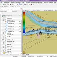
The new HYPACK feature allows U.S.-based users to quickly obtain the most recent charts provided by NOAA and the USACE at no additional charge. U.S.-based users who have an Internet connection will be able to download the charts from the USACE and NOAA web-map servers with the click of a button. Both agencies have made their charts available for download, and HYPACK has made it easy to ensure users have the latest chart data. Step One: Update ENC Catalog: HYPACK downloads the latest chart catalogs over the Internet from the NOAA and USACE map servers.
Transas Launches Pay As You Sail Solution
Transas Marine launches Pay As You Sail solution. Transas Marine launches its 'Pay As You Sail' chart solution for (S)ENC. Transas received approval for the 'Pay As You Sail' service by UKHO, PRIMAR and IC-ENC after succesful sea trials and verification by Det Norske Veritas (DNV). Traditionally the navigator has to select and purchase charts prior to each voyage using what is commonly called pre-licensing method. With Transas PAYS solution the vessel will have a license and access to install, view and pre-plan using official (S)ENC's without additional cost. What's unique with Transas "Pay As You Sail" solution is that recording and reporting of charts used is done with extraction from Transas Navi-Sailor 4000 ECDIS logbook.
Raytheon to Supply T45 with IBS, Nav Package
Raytheon Marine GmbH won the contract with Raytheon Systems Limited U.K., to supply the Navigation suite and Integrated Bridge equipment, for the first batch of the new Type 45 Anti-Air Warfare Destroyers. Raytheon, in close partnership with the U.K. PCO, will develop this opportunity to promote the Navigation and Bridge systems as a leader in state-of-the-art, fully integrated and innovative integration technology. Raytheon Marine, Kiel is responsible for the complete supply (Hard and Software) of all Navigation System equipment, and the development and subsequent supply of major components physically integrated Bridge. Raytheon Systems Ltd. maintains leading tasks in the Program, and ILS Management.


