

Labor Shortages, Climate Change & Technology: They’re All Related

Many problems in our “New World” can be solved more quickly than ever due to the speed at which information now travels. Gone are the countless long days of research, because often our questions can be answered instantaneously at a computer terminal or on a handheld mobile device. Traditional investment, research, science and industry have all attempted to reconfigure their business practices to accept that information speed. Unfortunately, government regulation and bureaucracy have not…
Meet SMARCO, Cloud-based Tech, Sensors for Container Efficiency, Security

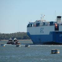
Indonesian shipping company Meratus unveiled SMARCO-Smart Container, a technology that leverages advanced sensors and cloud-based tech for efficient and secure container shipping. Using IoT sensors, GPS tracking, and cloud-based technology, SMARCO is desgined to providefull visibility and control of container shipments, including real-time monitoring of movement, speed, shock, intrusion, and temperature changes.After arrival at the destination, customers receive a comprehensive report on the shipment process.
Interview: Joe Hudspeth, BAE Systems

Joe Hudspeth is the Director of Business Development for Global Marine at BAE Systems in Endicott, N.Y. BAE Systems offers complete, efficient propulsion and auxiliary power systems utilizing electric technology. Hudspeth has been involved with maritime sales, marketing and product development since 2000. He currently serves as a regional co-chairman for the Passenger Vessel Association, is a judge for the Worldwide Ferry Safety Association student design competition, and frequently speaks and writes on maritime and ferry related issues. Hudspeth lives in Bellingham, Wash.
Coast Guard Discontinues Differential GPS Broadcast
On June 30, 2020 the Coast Guard switched off the last Differential Global Positioning System (DGPS) signals after more than 25 years of service.With the improved accuracy and integrity of un-augmented GPS over the last several years, and with the introduction of the U.S. operated satellite-based augmentation system known as Wide Area Augmentation System (WAAS), the maritime community no longer has a mission requirement for DGPS. GPS now provides sufficient positional accuracy…
Coronavirus: Cargo Loss Prevention Measures

The pandemic has brought about sudden changes for cargo transportation, impacting shippers and transport companies around the world and potentially increasing the risk environment, particularly for high-value and temperature-sensitive goods. In a new risk bulletin AGCS highlights steps for cargo owners to consider when developing contingency plans.While in most cases initial government directives have established cargo transportation as an essential activity, permitted during any quarantine period…
Rising from the Ashes

The federal government is now taking steps to reverse its 2010 decision to terminate the nation’s LORAN program. The LORAN program was initiated during World War II, when US and Allied forces fighting in the Pacific Theater needed a good means of navigation in that vast ocean. The US Coast Guard was charged with establishing and operating chains of Loran-A stations throughout the Pacific. With war’s end, the program was extended to coastal areas of the United States and elsewhere. Over time, Loran-A was replaced by Loran-C, which provided both greater coverage and improved accuracy.
Marine Terminal Operators Launch Initiative
PierPass Inc. has announced an initiative to reduce the number of transaction problems experienced when trucks pick up or deliver containers at the marine terminals at the Ports of Los Angeles and Long Beach. These problems – exceptions from normal processes that result in the issuance of "trouble tickets" -- lead to substantial delays in container movement through the terminals. About 5% of all transactions at terminals in the United States result in trouble tickets, which on average add about an hour to the "turn time," the amount of time a truck spends at a terminal, according to a 2011 report by the National Cooperative Freight Research Program (NCFRP). The report found that "exceptions from normal processes [are] a major source of delay and cost.
Inventing the iBoat
It all started back in the mid 1990’s when the seemingly new fangled internet became a tangible information portal for home computer users. As the prohibitive costs started to dissipate, the so called ‘e’-volution took off, thus making access to email, blogs, and personalized web pages more tangible and popular, even to the point of being expected. Today, the internet has nearly become lifeblood and people are all but helpless without some form of streaming connection to the information superhighway.
New McMurdo Smartfind S10 AIS Beacon
When manually activated, the Smartfind S10 uses AIS and GPS technology to give precise location information to aid the recovery of people in difficulty at sea. Waterproof to 60 meters, buoyant and compact, this unique device can make all the difference in a localized search situation. The chances of being rescued are greatly increased thanks to its ability to transmit both AIS and GPS data to the vessel the individual has come from and to other AIS equipped vessels within a four mile radius.
KVH Receives $1m Order far Nav System
KVH Industries, Inc., (Nasdaq: KVHI) announced that it has received a new $1m order for its CNS-5000, a self-contained navigation system that combines fiber optic gyro (FOG)-based inertial measurement technology from KVH with global positioning system (GPS) technology from NovAtel. This navigation solution provides the precise position and orientation of a host platform on a continuous basis, even during periods where GPS signals are blocked by natural or man-made obstructions or conditions. “This latest order, following on the heels of another $900,000 order a month ago, is evidence of the rapid acceptance of the CNS-5000 and the demand for a self-contained, commercial navigation solution,” said Dan Conway, KVH’s vice president of business development.
Manukai’s Delivery Voyage – In Real Time
Matson Navigation Company’s new MV Manukai has commenced with its delivery voyage and is currently traveling from the U.S. East Coast to the West Coast, via the Panama Canal. The ship will then enter Matson’s Hawaii Service, with the inaugural voyage scheduled for October 1 from Los Angeles to Honolulu. The ship is the first to be built by Kvaerner Philadelphia Shipyard, Inc. and the first new Matson ship of the 21st century. Utilizing today’s GPS technology, the ship’s voyage can be tracked on Matson’s “Birth of a Ship” Web site at www.matson.com/bos. By clicking on the “Track the Manukai” link below, detailed info on the vessel’s geographic position can be accessed.
News: NY DOT Announces Ferry Safety Improvements
New York City Department of Transportation Commissioner Iris Weinshall outlined several interim initiatives designed to enhance safety at the Staten Island Ferry. The Commissioner said "we are continuing to cooperate with the National Transportation Safety Board's investigation. While many questions remain unanswered, we must act now to improve safety. The riders of the Staten Island Ferry deserve no less." Commissioner Weinshall outlined initiatives that were developed in consultation with the United States Coast Guard. • Ensure a permanent presence in pilot house. Effective immediately, a deckhand assigned to the operational (inshore) pilot house will be positioned in that pilot house at all times.
Global 2-Way Introduces Global T-Fleet
Global 2-Way, today announced the signing of an agreement with Terion, Inc. of Melbourne, Fla., to buy the assets of their DHF network. Management Systems (MCAMS) product line, called Global T-Fleet. A combination of patented digital high frequency technologies originally developed as a nationwide backup communication system, and present day GPS technology, using it to form a unique communications network. allows for nationwide two-way text messaging and location on demand through a web-based platform. such as hazard material haulers are, can be of tremendous value and importance to both the transporting company and concerned customers," said Russell Weaver, Marketing Communications Director for Global 2-Way.
CSI-made MX 575 is Type-Approved as DGPS for SOLAS
Brunswick Corporation. MX 535 Transponder -- with all three linked to a junction box. Hemisphere GPS division. carriage requirements, according to standards established by the IMO. half-meter long, together with CSI's MBL-3 beacon antenna. Marine for some time. Trinity Solution. Hemisphere GPS has been producing for MX since 2003. customers include the U.S. Coast Guard. Hemisphere GPS President Rick Heiniger. be called the next wave in navigation," said MX Marine President Greg Konig. corrections. global customer base that includes both the U.S. and Canadian Coast Guards. multipath-resistant antennas in a single enclosure a half meter long. unexpected DGPS signal outages. multipath-resistant antennas in two separate enclosures. accuracy. being much more affordable.
Seaway Corporations Open Waterway to Mandatory AIS
The U.S. Department of Transportation’s Saint Lawrence Seaway Development Corporation (SLSDC) and the Canadian St. Lawrence Seaway Management Corporation (SLSMC) opened the binational waterway’s 45th navigation season. This season marks the beginning of mandatory Automatic Identification System (AIS) use on commercial vessels entering waterway in North America to employ this technology as a requirement for transit. “AIS represents a significant improvement in marine transportation navigation, integrating vital navigation data long available through our Vessel Traffic Control Centers (VTCCs) with electronic chart display technology at the fingertips of officers on the bridge,” said SLSDC Administrator Albert Jacquez.
Comments Requested on GPS Interference
The USCG is requesting information from vessel operators on problems with, and potential solutions to, GPS system interference. The USCG states mobile telephones and other electronic devices employing Mobile Satellite Services (MSS) can interfere with GPS systems. This interference has the potential to adversely affect the safe navigation and operation of vessels using GPS technology. These problems resulted from the assignment of adjacent radio frequencies to MSS and GPS systems. Because of the proximity of their radio frequencies, the relatively high powered MSS transmissions can interfere with GPS receivers. One possible solution being considerd would be the limitation or restriction of MSS on certain maritime vessels…
Noble Corp. Reports Rig Damage
prior to the storm's arrival and that all the company's units in the U.S. of Mexico have been secured. from their mooring lines as Hurricane Rita passed. system (GPS) technology installed onboard each of the units. their original locations. for preliminary evaluations of condition. Noble Joe Alford moved approximately 8 miles off its original location. winch. technology onboard. members below the hull. repairs, of the other units without taking them to a shipyard. Texas, and Pascagoula, Mississippi. to conduct further surveys. in delays in returning units to operational status. schedules to return the units to operational status. will be released after further survey of the condition of the units.


