

NAVTOR Eyes Expansion in Singapore

E-navigation specialist NAVTOR said it is continuing to build its business footprint beyond Europe, with the news that the Norwegian firm is expanding its new Singapore office. The base, which opened in December 2014, has given the firm an important foothold in the Southeast Asian market, driving new business with shipowners and managers such as NEOM, SeaTeam, Waruna Shipping, Samudera Shipping, and Sattech International. NAVTOR launched its ENC service in 2012, followed by its move into Singapore, and then by another office opening in Japan in September 2015.
UKHO ‘Living with ECDIS’ Seminars at Nor-Shipping

The United Kingdom Hydrographic Office (UKHO) has announced the details of its free-to-attend ECDIS Seminars at Nor-Shipping, which have been updated to include the implications for shipowners and operators of the updated IHO ENC (Electronic Nautical Charts) Standards. The UKHO’s ‘Living with ECDIS’ Seminars will take place on Wednesday, June 3 and Thursday, June 4 at Nor-Shipping and will be presented by Captain Paul Hailwood, a renowned expert on ECDIS and integrated bridge operations, and Tom Mellor.
NAVTOR Expands into Asia
E-navigation specialist NAVTOR has set course for Asia, with the news that the Egersund, Norway-based business has opened an office in Singapore. The move comes in response to growing regional demand for simple, efficient and cost effective ENC distribution solutions, as the IMO’s ECDIS Mandate continues its gradual roll out. In Europe, NAVTOR is already a recognised leader in ENC distribution and an e-navigation pioneer, holding a preferred supplier position with companies such as Hurtigruten, Teekay, DOF and RCL Cruises. Its ENC service, which is used by owners controlling more than 70% of the entire Norwegian offshore fleet, launched in 2012…
NOAA Nautical Charts Now Permanently Free

After a three-month trial period, PDF versions of NOAA nautical charts will become a permanent product, free to the public. The free PDFs, which are digital images of traditional nautical charts, are especially valued by recreational boaters who use them to plan sailing routes and fishing trips. The free PDF charts are part of a suite of new and enhanced navigational products designed to make NOAA’s data more accessible to the general public. “Up to date charts help boaters avoid groundings and other dangers to navigation…
Navigation Safety: New Edition of Admiralty Digital Publications
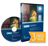
The United Kingdom Hydrographic Office (UKHO) has launched its latest edition of ADMIRALTY Digital Publications (ADP), Version 14. Free as an upgrade to existing users and available as a 3 month free trial to new customers. UKHO inform that 75% of the world's fleet of vessels over 2,000 gross tonnes has now been approved to use digital publications in place of their paper equivalent. ADP's suite of digital navigation publications, includes: ADMIRALTY Digital List of Lights, ADMIRALTY TotalTide…
NOAA Begins Production With Esri
GIS Creates Integrated Data Workflow for More Efficient Chart Production. The National Oceanic and Atmospheric Administration (NOAA) has implemented a new nautical charting system based on Esri GIS technology to produce more navigational products than ever before without increasing its budget or personnel needs. The new system, NCS II, is based on Esri Nautical Solution, and it allows NOAA to centralize the management of hydrographic data for US coastal waters. Since accepting Esri Nautical Solution as part of its production system in 2009…
P&O Nedlloyd Changes Chart Supplier
P&O Nedlloyd has decided to further expand the relationship with chart agent Marine Press of Canada. All charts, publications and electronic charts for the fleet of over 40 container vessels will now be supplied by the new chart agent. P&O Nedlloyd already use the chart correction system Digitrace from Marine Press onboard all vessels. “Digitrace is working very well onboard, so this move was natural for us. We will now achieve a much more streamlined process by getting both the physical product and the corrections/updates from one single source” confirms the P&O Nedlloyd Manager Nautical & Audits. “We were looking for a reliable system for the chart supply and we are certain we will now receive exactly this from Marine Press of Canada.


