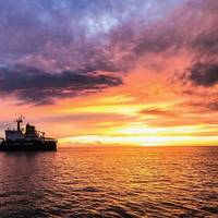
USCG Navigation Center: Steering a steady course for safe, secure, efficient waterways

The U.S. Coast Guard’s Navigation Center (NAVCEN) is involved in a number of activities that have an impact on all Americans, even if they don’t realize it.From motorists checking directions with their Global Positioning System (GPS) to boaters to ships coming and going to U.S. ports, the NAVCEN plays an unseen but vital role.With a staff of19 officers, 17 enlisted personnel and 19 civilians, NAVCEN falls under the Director of Marine Transportation Systems (CG-5PW) at USCG Headquarters…
Ships Collide in the Dover Strait
The UK Coastguard report that a bulk carrier and an oil tanker collided in the Dover Strait. Although both vessels have been damaged, there is no water ingress and no pollution. A French tug is on scene with the vessels. There are no injuries and all of the crew are accounted for. The tanker, ‘Seafrontier’, which is loaded with 37953mt of gasoline, has 27 people on board. The bulk carrier ‘Huayang Endeavour’ is in ballast and has 22 people on board. The Coastguard helicopter was sent to the scene, along with Dover and Ramsgate RNLI Lifeboats, in case evacuation was required. The helicopter remained with the vessels for a short while, reporting information back to the Coastguard, before returning to base. The lifeboats have also now left and the tug has arrived on scene.
USCG – GPS testing off North Carolina
The USCG Navigation Center (NAVCEN) has issued a special notice stating that, from 3 through 10 February daily from 1600 EST to 2145 EST, the GPS navigation signal in waters off Wilmington, North Carolina may be unreliable due to testing of GPS signals used by shipboard, aviation, and handheld navigation devices. From Feb 03 through Feb 10, 2012, daily from 1600 EST to 2145 EST, the GPS navigation signal may be unreliable due to testing on GPS frequencies used by shipboard navigation, aviation and handheld systems. Systems that rely on GPS, such as E-911, AIS and DSC may be affected at an approximate testing center point of 33 45.00N, 77 00.00W, with an impact radius of approximately 75 NM from center point.
Master Prosecuted for Illegal Crossing
At a hearing at Aberdeen Sheriff’s court, the Master of a general cargo ship pleaded guilty to a Merchant Shipping offence following an incident while transiting the Dover Strait Traffic Separation Scheme. Captain Andriy Naumenko, the Ukranian Master of the 10,100 tonne, Maltese registered vessel, SAFMARINE BATA, pleaded guilty to a breach of Rule 10(c) of the International Regulations for Preventing Collisions at Sea 1972, for which he was fined £2,000. This prosecution follows an investigation by the Maritime and Coastguard Agency into the circumstances surrounding an incident involving the SAFMARINE BATA on the 12th April 2005 as it crossed the Southwest lane of the Dover Strait Traffic Separation Scheme whilst en route from Portugal to Aberdeen in the UK.
Master Prosecuted for Wrong Crossing
The UK Maritime and Coastguard Agency (MCA) said that the master of a cargo vessel was fined £500 and ordered to pay costs of £500 for violation of the Collision Regulations. When the master crossed the southwest lane of the Dover Straits TSS, he failed to cross at approximately right angle, even when reminded of the obligation by the Channel Navigation Information Service. (HK Law)
News:Marine Television Antennas May Interfere with Nav Systems
The U.S. Coast Guard warns all mariners that certain marine television antennas may interfere with the performance of Global Positioning System receivers. The interference can result in inaccurate position information or a complete loss of GPS signals. This is a potential hazard to navigation, for both the operator of the vessel with the television antenna and for nearby boaters as the interference is not limited to the GPS equipment onboard the vessel with the antenna. In some cases, vessels up to 2000 feet away from an active antenna have reported interference. If mariners experience outages or degradation of their GPS receiver operation, they should perform an on-off test of their marine TV antenna.
Marine Television May Interfere with Navigation Systems
The U.S. Coast Guard warns all mariners that certain marine television antennas may interfere with the performance of Global Positioning System receivers. The interference can result in inaccurate position information or a complete loss of GPS signals. This is a potential hazard to navigation, for both the operator of the vessel with the television antenna and for nearby boaters as the interference is not limited to the GPS equipment onboard the vessel with the antenna. In some cases, vessels up to 2000 feet away from an active antenna have reported interference. If mariners experience outages or degradation of their GPS receiver operation, they should perform an on-off test of their marine TV antenna.


