

Novaco Upgrades Its NovacoBridge Navigation Management Solution
Navigation services provider Novaco Limited is set to release a major update to its integrated navigation management solution, NovacoBridge. The update will be launched this month at Expomaritt Exposhipping Istanbul 2021.Used by mariners and businesses across the commercial and leisure markets, NovacoBridge provides a comprehensive all-in-one suite of navigation tools as well as individual modules for vessels and shore-based offices.Costas Zervas, Director EMEA at Novaco said…
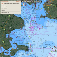
Electronic Navigational Charts: An Update and Some Issues
In November 2019, the Office of Coast Survey (OCS), part of the National Oceanic and Atmospheric Administration (NOAA), announced the start of a five-year program to “sunset” all raster and paper nautical charts.NOAA has produced electronic navigational charts (ENCs) since 1993. In the 2019 notice, NOAA writes that “ENC sales increased 425% since 2008, while sales of paper charts are now half of 2008 levels.”For NOAA and mariners, a focus on electronic charts and publications promises many advantages. With a singular focus, NOAA can use its resources more efficiently.
OneOcean Adds Electronic LogBooks to Its Platform

Maritime compliance and navigation services firm OneOcean announced the launch of LogCentral, a secure, easy-to-apply digital tool that aims to make collecting and sharing vessel data quick and simple.“LogCentral is a genuine breakthrough, not just for optimizing the usage of electronic logbooks but also for driving fleet-wide efficiencies,” says Martin Taylor, Chief Executive Officer of OneOcean. “Data goes through comprehensive validation at point of entry to massively improve accuracy.
World's First: Drone Brings Cargo to Offshore Production Platform
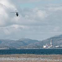
Norwegian oil company Equinor has successfully sent a drone carrying a 3D-printed cargo from shore to an offshore production platform in the North Sea in what the company says is a world's first.In a flight spanning around 80 kilometers from the Mongstad base onshore to the Troll field in the North Sea offshore Norway, the drone carried a 3D-printed part for the lifeboat system. The flight took one hour, at an altitude of approx. 5000 feet, or 1524 meters."The flight was a test…
Ice Chart Data Satellite Network to Launch in 2022
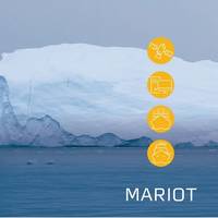
A newly established consortium is going to develop a network for low Earth orbit satellites delivering ice chart data to ships at sea. A new research project called MARIOT (Maritime IoT) is going to develop a low Earth orbit satellite network based on the new VDES (VHF Data Exchange System) technology. The consortium behind the project is headed by the Danish satellite operator Sternula. The satcom developers GateHouse, Space Inventor, and Satlab as well as Aalborg University…
Navelink Readies Sea Traffic Management
Navelink is a newly formed sea traffic management industry consortium initiated by the industrial companies Kongsberg Gruppen, Saab and Wärtsilä, three influential and significant maritime equipment manufacturers and service providers.The aim of the consortium is to reach a new global standard enabling scalable maritime information exchange. The consortium already has the Swedish Maritime Authority (SMA) boarded and has commissioned Combitech to deliver the infrastructure needed."Ship owners and operators, as well as coastal and port authorities and their service providers can benefit from the open infrastructure we are establishing.
ChartCo Opens New Office in Greece
ChartCo, the global provider of digital navigation and compliance solutions, has expanded its global network of offices to Piraeus, Greece to help provide dedicated support for customers in this region for the shipping industries.The global leader in digital navigation services is currently supplying and supporting customers in commercial shipping, offshore, cruising and superyachts all around the world and has a prominent presence of offices in the UK, Europe and Southeast Asia.Over the past decade, ChartCo has established its footprint within the shipping industry in Greece and Cyprus, and now serves more than 100 companies and over 1…
World’s First Purpose-Built Krill Harvesting Vessel Choose NAVTOR
Norwegian maritime industry completed the project of the world’s first purpose-built krill harvesting vessel that has taken two years and included 40 Norwegian vendors.A press release claimed that Antarctic Endurance, the custom designed new-build is a one of a kind, energy efficient krill harvesting vessel that showcases the very best of Norwegian maritime engineering expertise and innovation.E-navigation specialist NAVTOR said that its NavBox solution was chosen by Antarctic Endurance for e-Navigation services."The NAVTOR team are both proud and humbled that our NavBox solution was chosen to make sure she always have latest charts and publications available as it embarks on the 2019 harvesting season…
New Catamaran “Unicat” in Argentina
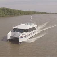
In September 2018, a 17 x 5 meter catamaran completed its final tests in the Tigre Delta of theTigre on the Parana River near Buenos Aires, Argentina prior to its delivery to her Chilean owners.The cat was designed by Eng. Emilio Noel and built by Astilleros Unidelta SA. which has a well-established reputation in a wide range of steel and aluminum workboats. The yard has a plant located in Buenos Aires with 10,000 cubic meters of open and 4,000 cu.m. of covered work space. The…
ChartCo Announces New Integrated Platform

Digital navigation services and voyage compliance company ChartCo announced a completely new e-navigation and compliance platform at this year’s SMM in Hamburg. The launch provides an insight into the future direction of the company, following a period of high investment in product development.ChartCo OneOcean is a unitary platform that will make life simpler for both mariners at sea and management teams ashore. It will play an important role in how shoreside operations and shipping fleets are managed…
ChartCo to Announce New Integrated Platform at SMM
ChartCo, a leader in digital navigation services and voyage compliance, will announce a completely new e-navigation and compliance platform at this year’s SMM in Hamburg. ChartCo OneOcean will play an important role in how shoreside operations and shipping fleets are managed whilst offering significant benefits to onboard crew. The new product announcement will provide visitors with an insight into the future direction of the company following a period of high investment in its…
ChartCo to Unveil New Integrated Platform at SMM
Digital navigation services and voyage compliance solutions provider ChartCo said it will launch a completely new e-navigation and compliance platform at this September’s SMM in Hamburg. ChartCo OneOcean will play an important role in how shoreside operations and shipping fleets are managed while offering significant benefits to onboard crew. A notable new feature within the OneOcean platform is the incorporation of data from ChartCo’s environmental solution, EnviroManager, which helps crews comply with both MARPOL, regional and national regulations.
Coast Guard, NOAA to Include Navigation Rules in U.S. Coast Pilot
The U.S. Coast Guard and National Oceanic and Atmospheric Administration (NOAA) have teamed up on a consolidated publication that will help mariners save time and money. The Coast Guard Office of Navigation Systems and NOAA Office of Coast Survey will incorporate the amalgamated International Regulations for the Prevention of Collisions at Sea (72 COLREGS) and the Inland Navigation Rules into NOAA’s U.S. Coast Pilot publications. The U.S. Coast Pilot publications already include the Coast Guard’s Vessel Traffic Service regulations.
Nautisk Names Martinsen Commercial Director

Global maritime navigation expert Nautisk said it has appointed a new Commercial Director, strengthening its team as it prepares to expand its digital navigation services. Espen Martinsen brings over 10 years’ experience in sales, and has spent the last seven years at the Danish toy group, LEGO, most recently as Nordic Field Sales Director. Prior to this he was Partner Manager at Norwegian CRM software vendor SuperOffice. Specializing in the development and implementation of reporting and management systems…
IMO to Promote e-Navigation
Reliable, user-friendly and integrated navigation and communications systems can help with decision making on a ship. That is where e-Navigation comes in. International Maritime Organization (IMO) attended the e-Navigation Underway International Conference which takes place every year on board a ship travelling between Copenhagen and Oslo (24-26 January 2018). IMO's Sascha Pristrom gave a presentation on IMO's plan to lead shipping into a new digital era. He updated participants on IMO's e-Navigation Strategy Implementation Plan (SIP) as well as its work with the International Hydrographic Organization (IHO) to develop guidance on definition and harmonization of the format and structure of Maritime Service Portfolios (MSPs).
Taking the Plunge into Digital
It’s a matter of when – not if. Digital is with us, and while many industries have embraced its potential, there is still some reticence in the shipping sector to take the plunge. Norwegian navigation expert Nautisk has rethought its entire product offering to embrace digital, so what have they learned? Nautisk’s head of marketing, John Dawson, explains. Nautisk has been a specialist chart agent for more than 100 years, and our core product base has been paper charts and printed publications for the shipping sector.
Chinese Lighthouse Operational in South China Sea
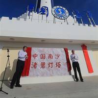
Another Chinese lighthouse has become operational on Zhubi Reef, a reef in the disputed Spratly Islands of the South China Sea. China’s Ministry of Transport held ceremony on April 5, 2016 signaling the lighthouse’s completion and start of operation. Construction of the 55-meter-high lighthouse, which has a lantern of 4.5 meters in diameter on top and rotating lights inside, began in October, 2015. The lighthouse is monitored via a remote control terminal, emitting white light in the nighttime, with a range of 22 nautical miles and a glow cycle of five seconds.
China Switches on Lighthouse on South China Sea Island
China has begun operating a lighthouse on one of its artificial islands in the South China Sea near where a U.S. warship sailed last year to challenge China's territorial claims. China claims most of the energy-rich waters of the South China Sea, through which about $5 trillion in ship-borne trade passes every year. But neighbours Brunei, Malaysia, the Philippines, Taiwan and Vietnam also have claims. China's transport ministry held a "completion ceremony", marking the start of operations of the 55-metre (180-ft) high lighthouse on Subi Reef, where construction began in October, state news agency Xinhua said late on Tuesday. The U.S.
Cuba, US Sign Memorandum on Maritime Navigation
Representatives of Cuba and the United States signed in Havana a memorandum of understanding (MoU) on cooperation in areas of hydrography and geodesy to improve the safety of maritime navigation. Ambassador Jeffrey DeLaurentis, the Chief of Mission at the U.S. Embassy in Havana, and Col. Candido Alfredo Regalado Gomez, Chief of Cuba’s National Office of Hydrography and Geodesy (ONHG), have signed the MoU. “NOAA (National Oceanic and Atmospheric Administration) has a strong interest in both improving navigational safety and in protecting the marine environment in the heavily travelled and vibrant waters between our two countries in the Straits of Florida,” said Russell Callender, Ph.D., assistant NOAA administrator for the National Ocean Service.
Global Marine Port and Service Industry to Grow at a CAGR of 4.7%
According to a new industry report published by Lucintel, the future of the global marine port and service industry looks good, with opportunities in the marine freight transportation industry. As per a Lucintel study, the global marine port and service industry is forecast to grow at a CAGR of 4.7% from 2015 to 2020. The major drivers of growth for this industry are high growth of the marine freight transportation industry and surging demand of containerized and bulk cargo. Increasing global exports, rising customer (Shipping companies) demand, and expansion of new regional trade hubs are the additional factors contributing to accelerated growth.
SUNY Maritime to Host e-Navigation Conference
It is likely that regions like the Baltic, the North Sea, the Strait of Malacca, Torres Strait and other areas will implement e-Navigation services that modern ships transiting these areas will be required to subscribe to. This will have the effect of requiring such ships to implement e-Navigation even without a formal IMO carriage requirement. Ships transiting the St Lawrence Seaway are already using e-Navigation services. The U.S., too, is making plans to implement certain e-Navigation Services in its coastal and inland waters. The maritime insurance industry is starting to realize that proper implementation of e-Navigation will improve their general average and is considering avenues to encourage their customers to implement e-Navigation.
GNS Announces Senior Appointments
Maritime navigation services group Global Navigation Solutions (GNS) announced the appointments of Phil Stothard as Chief Information Officer and Kieron Abernethy as Chief Revenue Officer. Both assume their roles with immediate effect. Phil Stothard joins GNS from banking and payment solutions provider ACI. Phil has over 25 years’ experience of IT development, leading teams and delivering global solutions for organizations such as HSBC and Accenture. Phil has particular expertise in data and information systems and has a track record of delivering value to internal and external clients from the solutions he has designed and delivered.
New Lineup for NOAA Hydrographic Services Panel
NOAA administrator Kathryn Sullivan, Ph.D., has appointed six members to the Hydrographic Services Review Panel, a federal advisory committee that gives NOAA independent advice for improving a range of services and products that support navigation and coastal resilience. Capt. “Providing coastal communities, boaters, and the commercial maritime industry with timely, reliable, accurate, and authoritative information is essential as we strive to keep commerce flowing through our nation’s ports,” Sullivan said. Rear Admiral Ken Barbor (ret.), U.S. Lawson W. Capt. Gary A. Scott R.


