

Jeppesen Simplifies Routing, Chart Management
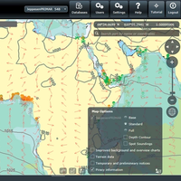
NauticalManager from Jeppesen allows mariners to easily plan, generate and document routes using an ECDIS and onboard PC. It also makes it simple to create the reports required by port state control and class auditors for checking a vessel’s ECDIS compliance. NauticalManager eases the bridge-side burden of ENC management by making it simple to order Official ENCs, review the chart portfolio and integrate temporary and preliminary Notices to Mariners. NauticalManager was developed…
'Boat Smart' White Paper Updated
Jeppesen and Alliance for Safe Navigation partners announce updated 'Boat Smart' white paper emphasizing importance of updated charts for navigation. Jeppesen and its Alliance for Safe Navigation (ASN) partners have released an updated version of the educational white paper 'Boat Smart, Update Your Charts', and are making this informative document available to the public, boating journalists, boating organizations and the marine industry through a variety of channels. First produced in 2010, this new version ofBoat Smart, Update Your Charts incorporates the latest published boating accident statistics and contributing factors from the U.S. Coast Guard.
NOAA Fairweather Updates Arctic Charts
As Arctic ice recedes, countries are looking forward to faster, safer and more efficient sea routes across the top of the world. Responding to a request from the U.S. Navy, U.S. Coast Guard, Alaska Maritime Pilots and the commercial shipping industry, NOAA sent one of its premier surveying vessels, NOAA Ship Fairweather, to detect navigational dangers in critical Arctic waters that have not been charted for more than 50 years. Fairweather, whose homeport is Ketchikan, Alaska, will spend July and August examining seafloor features, measuring ocean depths and supplying data for updating NOAA’s nautical charts spanning 350 square nautical miles in the Bering Straits around Cape Prince of Wales.


