NZ's “Sound framework” for Managing Coastal Navigation

A review of coastal navigation safety by Maritime NZ has found that there is a sound framework in place to manage the movement of ships around the New Zealand coast, with procedures in place to assess risk and adjust safety measures if required.
The NZ Coastal Navigation Safety Review report can be read here:http://www.maritimenz.govt.nz/Consultation/Coastal-navigation/Coastal-navigational-safety-review-2015.pdf
Maritime NZ Director Keith Manch said the review, begun in April last year, was prompted by an anticipated increase in the number of ship visits to New Zealand, a trend toward larger ships, and technology changes in navigational aids.
Consideration was also give to a Transport Accident Investigation Commission (TAIC) recommendation following the grounding of the Rena that Maritime NZ collect data on shipping movements around the New Zealand coast, and monitor and control the use of virtual aids to navigation around the New Zealand coast.
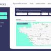
Recent access to ship tracking data based on ships’ Automatic Identification System (AIS) enabled Maritime NZ to examine the routes taken by ships, Mr Manch said.
“Previous studies have indicated that ship volumes and other existing hazards around New Zealand do not meet international criteria for imposing shipping lanes or mandatory routes and the review indicates that this is still the case,” he said.
“Incidents like the Rena grounding would not necessarily be prevented if shipping lanes were in place – in the case of the Rena, poor watch-keeping and navigation were identified as key contributing factors.”
Following the review, work will now be done to improve management of aids to navigation, including virtual aids, which use electronic systems – rather than physical marks or beacons – to alert ships to navigation hazards through their AIS systems.
“This is a fast-moving area of technology and it’s proving challenging to manage internationally. We will look to develop a strategy to plan how to lead management of virtual aids to navigation around New Zealand.”
The review identified two areas of potentially higher risk relative to other locations – the Hauraki Gulf and Colville Channel, and Cook Strait – when passenger vessels and other hazards were considered in combination.
“This review does not indicate an immediate risk to vessels or water users in these areas, but we will be working with harbourmasters, pilots, ferry operators, and the coastal shipping industry to look at how risks are managed in these areas, and whether there are any gaps,” Mr Manch said.
“Around 120 ships’ masters, harbourmasters, pilots and other water users provided expert input into the review and we’re delighted with that response.”
Other review recommendations include linking with Australia to improve the approach to port State control inspections carried out on foreign-flagged vessels with more than 60 percent of ships arriving or leaving New Zealand waters also travelling to or from Australia.
“Australia uses a sophisticated data collection and risk profiling tool to manage port State control inspections and we will be discussing with the Australian Maritime Safety Authority (AMSA) what can be done to join up our two systems,” Mr Manch said.