

Missing Titanic Submersible Update: Searchers Detect Subsea Sounds
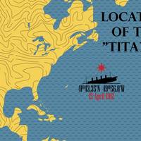
Search teams detected underwater sounds while scanning the North Atlantic for a tourist submersible that vanished with five people aboard during a deep-sea voyage to the century-old wreck of the Titanic, the U.S. Coast Guard said early on Wednesday.The detection of the sounds by Canadian aircraft on Tuesday, day three of the search, was reported by the Coast Guard as the clock ticked down to the last 24 hours of the missing craft's presumed oxygen supply.Robotic undersea search operations were diverted to the area where the sounds seemed to originate…
El Faro’s Voyage Data Recorder Located
The voyage data recorder (VDR) belonging to sunken cargo ship El Faro was found early Tuesday morning in 15,000 feet of water, about 41 miles northeast of Acklins and Crooked Islands, Bahamas, the National Transportation Safety Board (NTSB) announced. A specialist team comprised of investigators and scientists from the NTSB, the U.S. Coast Guard, Woods Hole Oceanographic Institution and Tote Services, the owner and operator of El Faro, located the VDR using remotely operated undersea search equipment. Video footage showing El Faro's VDR is available here. At about 1 a.m.
Submarine Begins Underwater Search for Missing Dornier Aircraft
The search for the missing Dornier aircraft of Indian Coast Guard and its three crew members is being augmented with underwater search by naval submarine, reports All India Radio. After six days of efforts to trace the missing Coast Guard Dornier aircraft, all eyes are now on the Navy submarine that started the undersea search operation for the plane. There were reports that wreckage of the Dornier aircraft was found but Coast Guard Eastern region Inspector General Commander S P Sharma later denied the reports. “We are awaiting communication from the submarine. At this point, we can’t come to any conclusion,” said Sharma in a statement.
Dutch Survey Vessel Joins Search for MH370
Dutch engineers this week started a months-long survey to map unchartered deep-sea terrain at the bottom of the Indian Ocean, the next step in the search for the wreck of Malaysian Airlines flight MH370, a company official told Reuters. A survey ship from Dutch engineering company Fugro , carrying 40 crew and technicians, began mapping out an area larger than the Netherlands, some 1000 miles (1,600 km) east of the northwest coast of Australia. The search for the lost plane is…
Search for MH370 Enters New Phase
The search for missing Malaysia Airlines flight MH370 is commencing a new phase and will transition over the coming weeks to an intensified undersea search, informs the Joint Agency Coordination Centre. In the meantime Bluefin-21, which has completed its search of the 314 square kilometre area around the detections made by the Towed Pinger Locator, will continue to search adjacent areas. Mission 17 will commence when weather conditions improve allowing Bluefin-21 to be safely launched from Australian Defence Vessel Ocean Shield. Ocean Shield will remain on station supporting Bluefin-21 search activity. Over the coming days the vessels that remain on standby for the search will transition to and from the search area. A Royal Australian Air Force AP-3C Orion also remains on standby in Perth.
Undersea Search Team Locates Missing Submarine
A team of underwater search experts from the U.S. has located the wreckage of Israeli submarine Dakar in 9,600 fsw in the Eastern Mediterranean. The search team, headed by Nauticos Corporation of Hanover, Md., consisted of Williamson and Associates of Seattle, and Phoenix Marine, Inc. of Arlington, Va. Initial detection of the wreck was accomplished using a side scan sonar system. After detecting a strong target on two sonar passes, the search team deployed a Remotely Operated Vehicle (ROV) to perform a detailed video inspection of the wreck. Video images from the ROV enabled topside naval experts to positively identify the wreck as Dakar. Dakar and its 69 member crew disappeared mysteriously on January 25, 1968.
New Navy UUV Master Plan Published
The U.S. Navy has published a new Unmanned Undersea Vehicle (UUV) Master Plan, the first since 2000. The new plan will serve as a guide for the continued evolution of UUV technologies, increasingly critical components of the 21st century fleet. The plan, completed late in 2004 and approved for publication in January, holds steady on course to develop UUVs' "signature" capabilities-maritime reconnaissance, undersea search and survey, oceanography, communication and navigation aid, and submarine track and trail. At the same time, the plan pushes back the technological boundaries to define a new set of capabilities that will be important going forward. The Navy's new UUV Master Plan depicts four basic classes of tactical UUVs, which are to be developed over the next 10-15 years.


