TeamSurv Ocean Survey Project Boosted

TeamSurv, the crowd sourcing project to create better nautical charts, has won support and endorsement from the European Space Agency (ESA) and the European Satellite Navigation Competition (ESNC).
TeamSurv has won a call by ESA to enter their Business Incubation Centre (BIC) at Harwell, Oxford. This provides TeamSurv with finance, with business and technical support, and with office space for the next year to enable a plan for a sustainable future, and to grow with the number of vessels and the amount of data produced.
ESA’s Technology Transfer Programme Office has seven BICs across Europe, supporting entrepreneurs using space technology in a non-space environment. The UK BIC is run by the Science & Technology Facilities Council (STFC) on their Harwell campus.
TeamSurv has also come 2nd in the UK arm of the European Satellite Navigation Challenge (ESNC). The ESNC is a competition aimed at stimulating new innovations in satellite navigation for use in technologies like smart phone apps and location-based services. 93 business ideas were put before the UK judging panel. The UK winners, ManagePlaces, produce a smartphone application for geotagging documents and other pieces of information in project management and workflow applications.
TeamSurv say that these two wins show the increasing awareness of the poor quality of data on the depths of our seas – we know the surface of the moon in more detail than our seabed – and the increasing realisation and acceptance that TeamSurv’s crowd sourcing approach is the best route for filling this data gap.
Crowdsourcing was dismissed by the hydrographic community when TeamSurv started in 2009, but now key figures such as Robert Ward, President of the IHO, and Tom Karstner, the UK National Hydrographer, are publicly stating that crowd sourcing is the way to go for filling the data gap, with higher precision commercial surveys being reserved for critical areas.
Having accurate depth data is important for a wide range of applications in addition to that of safe navigation. These include scientific and environmental measuring and monitoring of the maritime environment, ensuring the sustainability of fishing, providing sea bed data for offshore oil, gas and renewables, and monitoring erosion and movements in the sea bed for planning and managing ports and harbours, dredging and sea defences.
Many areas of our seas are almost totally unsurveyed, for example over 80% of the Pacific islands, and even in developed countries such as the United Kingdom over 50% of our coastal waters are reported by the UKHO as being inadequately surveyed. Professional surveys are very expensive (at about £1500 per square kilometre), and governments’ expenditure on surveying is shrinking in most countries.
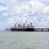
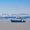
TeamSurv will use these new resources first of all to establish a sustainable future for the project. It will also upgrade its servers, recruit more participating vessels (with commercial shipping and fishing fleets now joining as well as leisure craft), and provide its data to a wider range of users.
Ends