Kongsberg Seatex Technology on AIS Satellite

The Norwegian satellite, AISSat-1 will be launched from India on 9 May. The satellite will be used by maritime authorities as an additional means of ensuring safety at sea in the High North. The satellite is equipped with technology developed in a joint effort by the Norwegian Defence Research Establishment (FFI), Kongsberg Seatex AS, the Norwegian Coastal Administration and the Norwegian Space Centre. The project is funded by the Ministry of Trade and Industry.
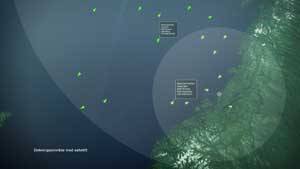
All passenger ships and large vessels in international traffic are required to carry the Automatic Identification System (AIS) onboard. AIS is primarily a ship collision avoidance system and is based on a range of onshore base stations with an offshore range of about 40 nautical miles. 35 base stations are deployed along the Norwegian coast and all IMO nations have deployed, or are in the process of deploying, a similar chain of base stations.
AISSat-1 is a demonstrator and experimental satellite carrying equipment for reception and relaying AIS signals, thus expanding the AIS coverage area from coastal waters to all maritime zones controlled by Norwegian Authorities.
The exploitation of this technology in a fully deployed system will improve the safety for ocean-going vessels in the High North and around Spitzbergen. Such a system will also simplify the identification and coordination of vessels in a search and rescue situation as well as being used for monitoring of vessels carrying hazardous cargo and other environmental risk assessment situations.