

Wisconsin Awards $5.3 Million in Harbor Maintenance Grants
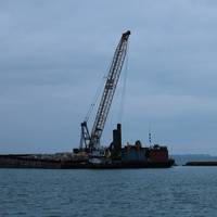
Wisconsin Gov. Tony Evers, together with the state's Department of Transportation (WisDOT), announced grants totaling $5.3 million for seven harbor maintenance and improvement projects to promote waterborne freight and economic development.“From the Great Lakes to the Mississippi River, Wisconsin’s unique geography provides our state opportunities to grow our economy and help our businesses reach markets worldwide,” said Gov. Evers. “These grants will help maintain our harbors and ensure our ports are secure and reliable…
Van Oord Wins Coastal Protection Work in the UK
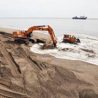
Dutch-based dredging contractor Van Oord said it has signed a contract with the U.K.'s Environment Agency to continue to protect the Lincolnshire coast for the next four years.The deal, which continues on the work Van Oord has been undertaking there since 2015, encompasses beach nourishment over the length of 20 kilometers and requires around 400,000 cubic meters of sand each year.Van Oord said it will also be providing technical advice to the Environment Agency in relation to the implementation of their flood risk management strategy.
U.S. Support for Ghana Fisheries
U.S. Agency for International Development (USAID) Ghana’s Acting Deputy Mission Director, Janean Davis said that United States is taking steps to improve fisheries in Ghana.Ms. Janean Davis, told the attendees in a conference in Ghana that “Together, we can help put in place the necessary structures and processes to consolidate the gains we’ve made in the fisheries sector over the past five years.”The Ministry of Fisheries and Aquaculture Development and the Fisheries Commission with support from the United States Government, through the USAID, organized a three-day conference, from August 19-21, 2019, in Accra to highlight and discuss successes…
Study Calls to Reduce Ship Speed for Arctic
In the Arctic, marine mammals such as belugas and bowhead whales rely on a quiet environment to communicate and forage. But as Arctic sea ice shrinks and shipping traffic increases, vessel disturbance could very likely impact their social behaviours, distribution and long-term survival, warns a new study led by University of Victoria marine biologist Lauren McWhinnie. Published in the peer-reviewed journal Ocean and Coastal Management, the study calls for precautionary measures to minimize the negative impacts of increased vessel traffic in the Arctic—such as noise and ship strikes—as climate change brings a longer ice-free season. “We…
Op/Ed: AIWA - A National Asset Worth Funding
What does the future hold for infrastructure investment on the Atlantic Intracoastal Waterway in 2018? The Atlantic Intracoastal Waterway Association (AIWA) is a nonprofit, membership organization for one of the nation’s longest water infrastructure projects stretching over 1,100 miles: the Atlantic Intracoastal Waterway (AIWW). We are grateful to serve as the one unified Voice of the Waterway and below is our outlook for 2018. In the President’s Budget for 2017, the AIWW began the appropriations process with only $6.911 million for the entire waterway.
Global Markets Ripe for US Marine Technologies

The growing worldwide demand for marine technologies, port construction and shipbuilding is generating new export opportunities for U.S. companies. As more firms look to boost their bottom line by maximizing their reach to the more than 95 percent of world consumers who live outside of the United States, many are taking advantage of numerous export resources along the way. At the same time, many other businesses have yet to export. International Trade Specialist Maryanne Burke leads the U.S. Commercial Service’s Marine Technology Team, and is based at the Boston U.S.
US Ocean Economy Sees Large Growth -NOAA

In 2012, U.S. The U.S. ocean economy outpaced the domestic economy between 2011 and 2012, with an increase of $22 billion in gross domestic product, from $321 billion to $343 billion, according to a new National Oceanic and Atmospheric Administration (NOAA) analysis. Adjusting the figures to remove the effects of inflation, this increase equates to a 10.5 percent rate of growth—more than four times as fast as the U.S. economy as a whole. The report is based on 2012 U.S. national economic statistics released in August 2014.
BMT Awarded Port Geographe Coastal Engineering Contract
BMT JFA Consultants (BMT), a subsidiary of BMT Group, has been awarded a contract by the Western Australian Department of Transport (DoT) to provide services as Coastal Engineering Advisor for the Management of Beaches, Structures and Waterways at Port Geographe, Busselton. The contract will initially run for two years with options to extend annually up to a total five year period. Port Geographe harbor is a coastal marina and residential canal estate developed in 1996 near the town of Busselton, Western Australia.
Winners of Walter B. Jones Memorial Awards Named
Eleven individuals and organizations have been named as winners of the 2014 Walter B. Jones Memorial Awards for Excellence in Coastal Ocean Resource Management, an award given by NOAA’sOffice for Coastal Management for exemplary leadership and a commitment to balancing the human use of coastal and ocean resources with the needs of the environment. These national awards, given every two years, honor individuals and organizations that have dedicated countless hours to conserve, protect, and improve the U.S. coasts. They recognize the application of innovative approaches, tools, or technology to advance the field. “This year’s award winners represent a wide range of uniquely driven people and activities in the pursuit of wise coastal resource management,” said Jeffrey L.
Coastal Zone Management: ABA Publish New Book
With oceans considered by many as one of the last frontiers, the American Bar Association's new book “Zoning the Oceans: The Next Big Step in Coastal Zone Management’’ is intended to help experts and government planners use zoning as a vehicle for ocean development and management. It is claimed to be the first book to focus on new and emerging state ocean zoning programs in the context of recent developments in offshore coastal zone regulation at the state and federal levels, say the publishers.
ABA Book Explores Ocean Zoning Management
With oceans considered by many as one of the last frontiers, a new American Bar Association book will help experts and government planners use zoning as a vehicle for ocean development and management. “Zoning the Oceans: The Next Big Step in Coastal Zone Management’’ is the first book to focus on new and emerging state ocean zoning programs in the context of recent developments in offshore coastal zone regulation at the state and federal levels. The timely and relevant book delves into a wide range of coastal zone management issues…
Nixon Named Director of R.I. Sea Grant

Earlier this month, Dennis Nixon was named director of the Rhode Island Sea Grant, one of 32 programs that make up the National Sea Grant College Program, which is administered by the National Oceanic and Atmospheric Administration. Nixon spends much of his life near the ocean. As a longtime Jamestown resident, Nixon is never more than minutes away from Narragansett Bay. As associate dean of the University of Rhode Island’s Graduate School of Oceanography, he is just as close to the waves when he’s in his office. Nixon has been teaching at the University of Rhode Island for 37 years.
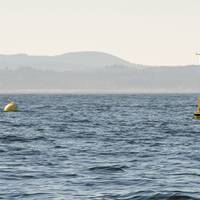
Sea Forecasting Project Aims for Commercial Service
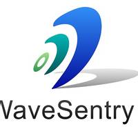
WaveSentry, a Technology Strategy Board funded project backed by a consortium of industry and academic experts, successfully concluded at the end of April with an event to present the key outcomes of the project explore technologies and opportunities for further development of wave measurement and maritime forecasting. The WaveSentry project consortium aimed to develop a new information and forecasting tool for managing the risks of marine operations in adverse sea states. Delegates…
EU Supports 'Blue Growth': Sustainable Management of Sea & Coasts
The European Commission launch a proposal to improve the planning of maritime activities at sea and the management of coastal areas. The proposal – which takes the form of a draft directive – aims to establish a common European framework for maritime spatial planning and integrated coastal management in EU Member States, with a view to ensuring that the growth of maritime and coastal activities and the use of resources at sea and on coasts remain sustainable. Human and economic activities such as offshore wind energy, submarine cable and pipeline routes, shipping, fishing and aquaculture are increasing in marine waters and coastal areas, but too little coordination can lead to competition for space and pressure on valuable resources.
Oregon Offers Wave Energy Development Opportunites
State of Oregon has amended its Territorial Sea Plan to allow for siting of marine renewable energy development projects in state waters. The amendment identifies four "Renewable Energy Suitability Study Areas" along the Oregon coast where initial development of wave energy will be encouraged and pose the least conflict with existing ocean uses and natural resources. The four areas are located off the coasts of Lakeside, Reedsport, Nestucca, and Camp Rilea, and total about 22 square miles or two percent of Oregon’s territorial sea.
NOAA Panel to Discuss GOM Maritime Issues
NOAA’s Hydrographic Services Review Panel will meet Nov. 27-29 in New Orleans to discuss hydrographic surveying, nautical charting, tides and current measurements, as well as geodetic and geospatial measurements for the Gulf of Mexico region. The three-day meeting is open to the public, and public comment periods are scheduled in the afternoons. The panel will hear from representatives of the regional maritime community, including port authority officials and marine pilots, the geospatial community, and users of NOAA’s tides and currents information.
CH2M HILL Announces Two Key NE Leadership Appointments

CH2M HILL (www.ch2mhill.com), a global full-service consulting, design, construction, and operations firm, announces two key leadership appointments in the Northeast. With the 2011 acquisitions of Halcrow and Booz Allen Hamilton’s (BAH) State and Local Transit Consulting business, CH2M HILL has five times more people-power and expert capabilities to service the New York transportation infrastructure market and the entire Northeast region, stretching from Maine to Virginia. To support the firm’s growth plans, Thomas P. Klin, has been promoted to Vice President and Northeast Geographic Manager.
U.S. Coast Guard Academy Establishes Center for Maritime Policy & Strategy
The new center aims to promote education, research and policy innovation on contemporary challenges to America’s maritime interests. The center’s primary mission is to promote interdisciplinary research and scholarship across maritime policy communities and academic disciplines. The center’s initial research focus encompasses the Arctic, governance of marine resource frontiers, coastal management and marine spatial planning and holistic approaches to maritime security. “The Center for Maritime Policy & Strategy is an important organization for the academy and the U.S. Coast Guard,” said Rear Adm. Sandra L. Stosz, U.S. Coast Guard Academy Superintendent. For more information click here.
Esri Introduce ArcGIS for Maritime Charting, Bathymetry Data
Esri has released a new solution to support users in port management, maritime transport, coastal management, offshore energy, nautical chart production, and maritime defense. ArcGIS for Maritime: Charting, and ArcGIS for Maritime: Bathymetry, are part of the ArcGIS system and enable users to create, manage, and share maritime-related data and metadata. Together, these solutions provide a comprehensive geospatial platform for nautical chart production and bathymetric data management. "ArcGIS for Maritime will save time and money for organizations that use bathymetric and nautical data," said Timothy Kearns, maritime program manager, Esri.
BOEM Calls for Public Input on Proposed 2012-2017 Eastern GOM Lease Sales
The Bureau of Ocean Energy Management (BOEM) is seeking information from interested parties regarding proposed oil and gas lease sales in the Gulf of Mexico Eastern Planning Areas. These sales are included in the Proposed Outer Continental Shelf (OCS) Oil and Gas Leasing Program for 2012-2017, announced earlier this month. BOEM has published a Call for Information and Nominations/Notice of Intent (Call/NOI) to prepare an Environmental Impact Statement (EIS) for two Eastern Gulf sales currently scheduled for 2014 and 2016. BOEM will collect and analyze information to identify and evaluate areas with potential for oil and gas development, as well as to determine possible environmental effects and potential conflicts in the Call area.
Hydrographic Services Review Panel, May 4-6
The NOAA Hydrographic Services Review Panel will meet May 4-6 in Honolulu to discuss operations, research and development, hydrographic surveying, nautical charting, and geodetic and geospatial measurements. The panel is a Federal Advisory Committee that advises the NOAA Administrator on carrying out NOAA’s navigation services mission, which is to ensure the safe, efficient, and environmentally sound movement of commerce along America’s marine transportation system. The panel will hear from representatives from the maritime community, including port authority officials and marine pilots, as well as non-traditional users of navigation data like coastal planners and emergency responders.
BOEMRE, Oregon Form Offshore Renewable Energy Task Force
The Bureau of Ocean Energy Management, Regulation and Enforcement (BOEMRE) is holding its first offshore renewable energy task force meeting with the state of Oregon. This inter-governmental task force was established to facilitate communication between BOEMRE and state, local, tribal and federal stakeholders concerning commercial renewable energy leasing and development on the Outer Continental Shelf (OCS) off the coast of Oregon. The task force includes state government officials designated by the governor and officials from affected federal agencies, elected local government officials, and tribal leaders. “BOEMRE created this task force to coordinate and consult with the State of Oregon and others on potential renewable energy activities on the OCS off Oregon…
BOEMRE Calls for Public Input on Proposed 2012-2017 Gulf of Mexico Lease Sales

NEW ORLEANS – The Bureau of Ocean Energy Management, Regulation and Enforcement (BOEMRE) today announced it is seeking information and nominations from all interested parties regarding proposed oil and gas lease sales in the Gulf of Mexico Western and Central Planning Areas for the 2012-2017 Outer Continental Shelf (OCS) Oil and Natural Gas Leasing Program. BOEMRE will analyze information received in response to this Call for Information and Nominations (Call), which will primarily identify and evaluate areas with potential for oil and gas development…


