

Cuba, US Sign Memorandum on Maritime Navigation
Representatives of Cuba and the United States signed in Havana a memorandum of understanding (MoU) on cooperation in areas of hydrography and geodesy to improve the safety of maritime navigation. Ambassador Jeffrey DeLaurentis, the Chief of Mission at the U.S. Embassy in Havana, and Col. Candido Alfredo Regalado Gomez, Chief of Cuba’s National Office of Hydrography and Geodesy (ONHG), have signed the MoU. “NOAA (National Oceanic and Atmospheric Administration) has a strong interest in both improving navigational safety and in protecting the marine environment in the heavily travelled and vibrant waters between our two countries in the Straits of Florida,” said Russell Callender, Ph.D., assistant NOAA administrator for the National Ocean Service.
OceanGrafix to Print NOAA's New POD Coast Pilots
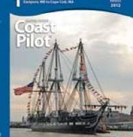
OceanGrafix, now approved as Print-on-Demand (POD) printer/distrubutor for NOAA's US Coast Pilot Series. In conjunction with NOAA’s new process of making weekly online updates to the U.S. Coast Pilot books, OceanGrafix will print the books that reflect all updates and corrections. “NOAA is making fundamental improvements in our publishing processes so our commercial partners, like OceanGrafix, can make the U.S. Coast Pilot available to mariners as quickly as possible,” says Kathryn Ries, NOAA Coast Survey’s acting director.
Arctic Waters Hydrographic Survey by NOAA
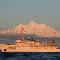
NOAA Ship 'Fairweather' to conduct hydrographic work in the Arctic updating depths measured in the 18th century. NOAA Ship Fairweather begins a 30-day survey mission in the Arctic, scheduled to check a sparsely measured 1,500-nautical mile coastal corridor from Dutch Harbor, Alaska, north through the Bering Strait and east to the Canadian border. The mission will collect needed information to determine NOAA’s future charting survey projects in the Arctic and will cover sea lanes that were last measured by Captain James Cook in 1778.


