

Sperry Marine, DNV GL Strike Deal on Digitalization

Sperry Marine and DNV GL signed a strategic agreement to enable vessels to securely share their navigation data for use in DNV GL's digital classification services and obtain real-time class status of the navigation systems.The agreement seeks to improve process efficiency for class surveys covering the core elements of vessel navigation, through co-operation on new digital solutions. It will help to streamline the class survey inspection process by giving DNV GL access to data from the ship’s bridge…
SevenCs Releases ORCA Pilot X Software
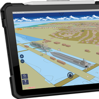
SevenCs, part of the ChartWorld Group, announced the release of ORCA Pilot X software. Originally designed as a primary navigation aid for Pilots, ORCA Pilot X is a tool for professional navigators. ORCA Pilot X is being offered as a free download on the Apple AppStore for iOS tablets.SevenCs has a long tradition of developing bespoke navigation applications for pilots around the world. Following the feedback and input from many users, SevenCs began the development of ORCA Pilot X as the natural evolution from ORCA Pilot G2.Ralf Lehnert…
Smart Navigation System
The research project Prepare Ships, led by RISE Research Institutes of Sweden, will develop a navigation system that foresees the positions of other vessels through machine learning. This reduces the risk of collisions and enables more efficient navigation. The project has recently been granted funding through the “European GNSS Agency”, GSA.A consortium of Swedish, Norwegian and German partners has now been given the go-ahead for their research and innovation project that will increase safety and efficiency in shipping.
Academic Cooperation Addresses Maritime Ice Operations

A group of industry stakeholders have signed a Memorandum of Understanding (MoU) for academic exchange and cooperation within the framework of the Kalmar Ice Academy, with a focus on collaboratively helping the offshore and shipping industries to increase operational safety and efficiency while reducing environmental impact, through furthering understanding of maritime operations in ice. The parties, which included Kongsberg Digital, Viking Supply Ships, the Swedish Maritime Administration and the Kalmar Maritime Academy at the Faculty of Technology…
Reederei NSB Opts for Marlink VSAT
NSB Niederelbe Schiffahrtsgesellschaft mbH & Co. KG (REEDEREI NSB) has chosen Marlink to supply fully managed VSAT services including connectivity and an extensive business critical solutions roll-out for its entire fleet of 50+ vessels. The contract, signed early in July, positions Marlink as NSB’s primary provider of voice and connectivity services, supporting the leading German shipping company to continue improving its crew welfare and operational communication facilities with fully integrated services and solutions. In addition to the management of containerships, tankers, bulkers and offshore jack-up vessels, REEDEREI NSB, Member of NSB GROUP, is active in crewing of its own ships as well as vessels of other parties.
Fugro Launches Seastar XP2
Fugro Satellite Positioning released its Seastar XP2 PPP GNSS augmentation service on July 1, 2014, which provides increased redundancy for mission-critical offshore GNSS position and navigation applications. Like Fugro’s flagship Seastar G2 service, XP2 is an L1/L2, phase-based, Orbit and Clock PPP service. Similar to the 24+ American GPS satellites, XP2 incorporates a number of Russian GLONASS satellites to generate corrections that permit the calculation of a real-time position solution. The new XP2 service mimics Fugro’s flagship G2 and offers accuracies approaching it.
Raymarine Debuts New MFDs with WiFi
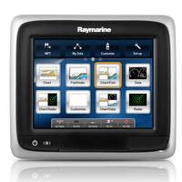
Following the launch of the a-Series multifunction displays (MFDs), Raymarine has expanded the a-Series line with the addition of two versions of the a65 and a67 complete with built-in Wi-Fi. The compact a‐Series multifunction displays offer access via Raymarine’s LightHouse user interface to navigation applications like GPS, sonar, radar and data. The expansion into Wi-Fi means that, as with Raymarine’s e‐Series and c-Series MFDs, new a-Series Wi-Fi owners will be able to use RayRemote and RayControl apps to control their a-Series Wi-Fi MFD directly from their smartphone or tablet.
Raymarine’s New a-Series Multifunction Displays
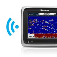
New a65/a67 WiFi versions support RayControl and RayRemote apps. Following the launch of the new a-Series multifunction displays (MFDs), Raymarine has taken steps to expand a-Series functionality further with the addition of two new versions of the a65 and a67 complete with built-in Wi-Fi. The compact a‐Series multifunction displays are already extremely versatile, offering boaters simple and quick access via Raymarine’s intuitive LightHouse user interface to navigation applications like GPS, sonar, radar and data.
Fugawi Swedish Marine Charts
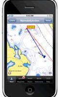
Software manufacturer Northport Systems Inc. announced the addition of Swedish Marine Charts to its online Fugawi Touratel Map collection for use with Fugawi navigation software and the Apple iPhone. The X-Traverse chart and map data distribution system is also now available for integration by third-party developers who wish to easily add marine charts and land maps to their mobile applications. Compatible with Fugawi Marine ENC and Fugawi Global Navigator navigation software for PC…
L-3 Enters Agreement With KMSS
L-3 Communications' Aviation Recorders division has entered into an agreement with Kongsberg Maritime Ship Systems (KMSS) as the sole source supplier of Hardened Voyage Recorders (HVR) for its new Maritime Black Box (MBB). The agreement provides L-3 Communications with the opportunity to provide its HVR to KMSS for installations on both new builds and existing vessels. Under this contract, L-3 will provide its 12-hour, solid state HVR for inclusion into KMSS's MBB system. The MBB and HVR meet the requirements specified in the International Maritime Organization's (IMO) SOLAS Chapter V, according to the standard set out in the International Electrotechnical Commission's (IEC) specification 61996, for a fully IMO compliant Voyage Data Recorder (VDR) System.


