

NOAA Certifies 11Printers for Paper Charts
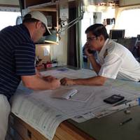
Mariners and the boating public have a wider choice of options and special services when they purchase NOAA paper nautical charts, thanks to NOAA's expanded "print-on-demand" chart production and distribution system. Coast Survey has certified eleven chart printing agents who have the flexibility to offer different color palettes, various papers, a cleaner margin, and a range of services. Under the program, NOAA's paper nautical charts are printed when the customer orders them - or "on demand." NOAA creates and maintains the charts…
NOAA Certifies More Printing Agents

The availability of paper "print-on-demand" nautical charts continues to expand, as NOAA's Office of Coast Survey has added three more printing companies to its roster of certified agents for paper charts. "The most recent printers to join the NOAA paper chart program represent the enduring connections between maritime tradition and progress," said Capt. Shep Smith, chief of Coast Survey's Marine Chart Division. "Companies with histories going back decades, and even centuries, support a firm foundation for the continuing production and delivery of U.S. Iver C. Weilbach & Co.
NOAA's Paper Charts are here to Stay
It won't be long before mariners and the boating public will have a wider choice of options and special services when they purchase NOAA paper nautical charts, thanks to NOAA's expanded "print-on-demand" chart production and distribution system, Coast Survey officials announced today. This week, Coast Survey certified new print-on-demand chart printing agents, and gave them the flexibility to offer different color palettes, various papers, a cleaner margin, and a range of services.
No Fear, NOAA Paper Charts Still Near
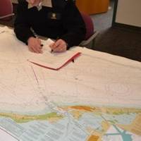
The announcement that the federal government will stop bulk lithographic printing of nautical charts brought some understandable angst, however NOAA say they may be changing the chart production process but they will NOT stop the production of paper charts. The Agency explain they are working with private companies to make them better: printed in brighter colors and available for fast delivery to the door. Most importantly, they are up-to-date to the moment ordered. These improved paper charts are NOAA-certified print-on-demand (POD) nautical charts created by NOAA Coast Survey cartographers.
Shipping Lanes Re-routed off California Coast
Effective June 1, 2013, West Coast shipping lanes are being adjusted to protect endangered whales, & OceanGrafix's new charts incorporate those changes. OceanGrafix, the first and only company to offer NOAA print-on-demand nautical charts, today announced the availability of updated nautical charts that reflect imminent changes to shipping lanes. Effective June 1, 2013, the International Maritime Organization (IMO) is amending vessel traffic separation schemes in an effort to enhance navigational safety and to protect endangered whales. The IMO adjustments to shipping lanes, which are backed by National Oceanic & Atmospheric Administration (NOAA) research…
Waterproof Charts Available from OceanGrafix
Nearly all nautical charts in stock are now available from OceanGrafix in new 100% waterproof format. Printed on a high-grade synthetic material, OceanGrafix’ s new waterproof charts are completely impervious to water. “Mariners face a variety of conditions onboard that can make it challenging to keep paper charts dry,” says OceanGrafix President Ron Walz. “While our standard, water-resistant charts meet the needs of many of our clients, some environments do call for a truly waterproof chart,” adds Walz. “This new format gives our mariners another option. St. Paul, Minnesota–based OceanGrafix is the first and only company to offer NOAA print-on-demand nautical charts for recreational and commercial boaters.
OceanGrafix to Print NOAA's New POD Coast Pilots
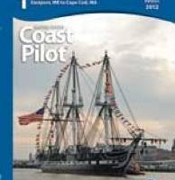
OceanGrafix, now approved as Print-on-Demand (POD) printer/distrubutor for NOAA's US Coast Pilot Series. In conjunction with NOAA’s new process of making weekly online updates to the U.S. Coast Pilot books, OceanGrafix will print the books that reflect all updates and corrections. “NOAA is making fundamental improvements in our publishing processes so our commercial partners, like OceanGrafix, can make the U.S. Coast Pilot available to mariners as quickly as possible,” says Kathryn Ries, NOAA Coast Survey’s acting director.
Nautical Chart Updating – White Paper by OceanGrafix
OceanGrafix, the exclusive provider of NOAA print-on-demand (POD) nautical charts for U.S. waters, announces the availability of “The Creation of Accurate, Precise Charts: Understanding U.S. Nautical Chart Updates and Their Distribution.” This new white paper highlights why nautical charts are so important to mariners—including recreational boaters—and explains how a mariner can easily access chart updates. “Recreational boaters, unlike commercial mariners, are not required to carry nautical charts. But as more demands are put on our waterways, busy coasts mean more risk for accidents,” says Capt. John Lowell, director of NOAA’s Office of Coast Survey.
NOAA: New AK Chart Makes Arctic Safer
NOAA: New Alaska navigational chart makes increased Arctic shipping safer; Kotzebue Harbor chart replaces measurements last taken in 19th century. NOAA formally presented today to Alaska officials a new nautical chart for Kotzebue Sound in the Alaskan Arctic, a sparsely charted region that is seeing increased vessel traffic because of the significant loss of summer sea ice. The new chart depicts the full range of depth measurements and object detection acquired during a full ocean bottom survey last summer by the NOAA hydrographic survey ship Fairweather.
Nautical Charts – NOAA Testing QR Code Effectiveness
OceanGrafix, the exclusive provider of NOAA print-on-demand (POD) nautical charts for U.S. waters, announce that QR codes are now available on eight NOAA charts for the Tampa Bay, Fla., area. The National Oceanic and Atmospheric Administration (NOAA) added the QR codes in an effort to test their effectiveness in providing valuable and timely information to mariners. Quick Response Codes, or QR codes, are two-dimensional bar codes that can be scanned by a smart phone to direct users to digital content online. In this instance, boaters can scan the QR codes on select NOAA nautical charts to access real-time data sites for important information such as tides, currents, and marine weather.
OceanGrafix Begins Test Phase
OceanGrafix begun the beta test phase for remote printing locations of the Charts-on-Demand nautical charts. Using digital print technology, OceanGrafix has begun the testing in Louisiana at two of their chart agent’s locations, McCurnin Nautical and Baker Lyman, with expectations to soon have many remote printing sites throughout the United States. By utilizing the remote printing capability, OceanGrafix is able to further their mission of providing the maritime industry with the most current information in the least amount of time. OceanGrafix, in cooperation with the National Oceanic and Atmospheric Administration (NOAA), produces fully corrected and up-to-date nautical charts of all US waterways.


