

Tymor Marine Gets Grant Funding to Refine Draft Survey Tech
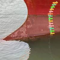
A maritime technology company based in Aberdeen has been awarded funding from Scottish Enterprise to support the development of an app-based version of its breakthrough draft survey technology. Tymor Marine’s DRFT MRKS software uses artificial intelligence with deep learning applied to video capture to provide an accurate measurement of the weight and load of a vessel.The grant funding from Scottish Enterprise will allow Tymor’s team to build on the operational capabilities of the software…
BOEM and NOAA Announce Joint Strategy for Fisheries Surveys
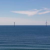
The Bureau of Ocean Energy Management (BOEM) and the National Oceanic and Atmospheric Administration (NOAA) Fisheries will work together to address potential impacts of offshore wind energy development on NOAA Fisheries’ scientific surveys, which help to manage the United States’s fisheries.For 150 years, the NOAA’s scientists have collected survey data that form the basis of the science-based management of America’s federal fisheries, support the protection and recovery of marine mammals and endangered and threatened species…
Neptune Energy Hires Fugro for Cygnus Subsea Work
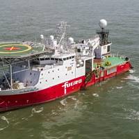
Dutch seabed survey services firm Fugro has won a subsea inspection contract with the oil and gas company Neptune Energy at the Cygnus gas field in the UK North Sea.As part of the contract, Fugro will employ its specialized survey technology to inspect the subsea infrastructure, including pipelines and structures, and to undertake survey activities in advance of future drilling campaigns on the Cygnus field. It will use the Atlantis Dweller vessel as part of the operations."Traditionally…
Remote Surveys Becoming Business as Usual
Remote vessel and equipment surveys have been available in the maritime world for years, but classification societies are seeing increased demand for these services as more firms turn to digital solutions to continue business during the coronavirus outbreak.Using real-time video communication tools, and even drones and robotics when applicable, surveyors are able to work with stakeholders to perform inspections without having to be on site, which is especially beneficial amid current COVID-19 travel restrictions.ABS…
Humber Surveyor Joins Survey Fleet
Associated British Ports (ABP)' Humber Estuary Services (HES) has has purchased a new survey vessel, Humber Surveyor, which joined the survey fleet that includes the Humber Sounder and the Humber Charter. According to a press release from ABP, Humber Surveyor is equipped with survey technology including a multi-beam sonar, two single beam sonars, side scan and forward scan sonar."The kit is capable of three dimensionally mapping the ever-shifting sediment within the Humber Estuary. The vessel is also able to digitally model marine structures such as quaysides, buildings, bridges and even shorelines utilising a laser scanner mounted to the roof…
ClassNK Issues Guidelines for Drone Surveys

Because drone-related technologies are improving at an extremely rapid pace, application in diverse fields is increasingly expected. In the maritime industry as well, efforts aimed at utilization in the field of inspections and surveys are being carried out. At the International Association of Classification Societies (IACS), discussions on the use of Remote Inspection Techniques (RIT) including drones in class surveys are already underway, and IACS Rec. 42 (Guidelines for Use of Remote Inspection Technics for Surveys) was revised in June of 2016.
MMT Contract for Stril Explorer
Swedish marine support services company MMT AB has awarded a contract of 18 months to Simon Møkster Shipping for charter of the Stril Explorer. The Multi Purpose Support Vessel (MPSV) has been on contract to MMT since April 2014 and Møkster is proud to strengthen its relationship with MMT moving forward. The vessel will be used in various survey related projects by MMT. Stril Explorer is a DP2 MPSV with a large open deck and is very suitable for launch and recovery operation, for example with ROV´s, ROTV´s AUV and geotechnical equipment. Stril Explorer has one main ROV hangar, suitable for 2 x WROV, launching through hangar port/stb side doors. The vessel is on a long term charter agreement and is equipped with the latest marine survey technology.
UTEC Develops Bespoke FPSO Virtual Management Tool
UTEC has delivered a bespoke Virtual Asset Management tool to an offshore Operator in Eastern Canada to allow its team to remotely access its floating, production storage and offloading unit (FPSO) from their desktop. The field, located offshore approximately 350 kilometers southeast of Newfoundland and Labrador contains one of the largest FPSO vessels ever built. At approximately the size of three football fields laid end to end the FPSO is over 290 meters long, more than 40 meters wide and more than 18 stories high. UTEC’s iSite tool is a web-based system which provides the Operators supply chain with the ability to tour the FPSO with 360° visualization…
DNV GL: The Drone Squad for Ship Surveys
With four drone types in its arsenal, DNV GL has adapted its survey technology to various ship structures. Recently DNV GL reached a new milestone with its first offshore drone survey. It's a gusty day in Gdynia, Poland, and outside the DNV GL station Leszek Alba is waiting for the wind to change. Alba is one of DNV GL’s 16 drone surveyors. Today, he is testing the Custom drone’s stability in different wind conditions and the stability of the video transmission – an important factor during the inspection of remote structural components in tanks and cargo holds. Since DNV GL carried out its first production drone survey in June 2016, it has become the leading provider in this field.
Ørbeck-Nilssen Sets Out Transformation of IACS at CMA
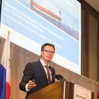
Speaking at Shipping 2018, the Connecticut Maritime Association’s (CMA) annual conference, Knut Ørbeck-Nilssen, CEO of DNV GL – Maritime and IACS Chairman, looked at some of the initiatives taken at the International Association of Classification Societies (IACS) that were changing the organization. “It is my duty and honor to encourage the world’s biggest classification societies to pull together to adapt to this rapid pace of change and create a strong foundation for IACS as the leading maritime technical association,” Ørbeck-Nilssen said.
ClassNK Lays Out R&D Roadmap
Classification society ClassNK has mapped out the details of its vision and goals for research and development projects over the next five years. ClassNK’s R&D Roadmap outlines the two activities as the foundation of its R&D, and details investigations and research associated with core technologies which will also contribute to the development of human resources for contributing maritime technology and engineering as a classification society and utilization of damage information to contribute to damage prevention. Utilizing these foundational technologies as a base, ClassNK said it intends to carry out R&D in the mid-long term on the four focus areas of rule development…
Hydroacoustic Package for Norwegian Icebreaker
The new RV Kronprins Haakon, the first Norwegian Icebreaker built for Polar research, and the first purpose built polar research vessel since Roald Amundsen’s Maud launched in 1917, will start regular science cruises in 2017 with a complete hydroacoustic systems package from Kongsberg Maritime. Builder Fincantieri has selected a combined delivery of Kongsberg Maritime survey technology, including a wide range of Simrad scientific research systems for the Kronprins Haakon. Kongsberg Maritime will also supply an extensive K-Bridge system…
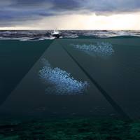
America's Top Fishing Port Addresses Groundfish Crisis
The Port of New Bedford says it has released its 6-pronged plan to revive its historic groundfishery and modernize the port. According to the New Bedford Harbor Development Commission’s (HDC) "Groundfish Port Recovery and Revitalization Plan for the Port of New Bedford and Fairhaven," the region’s groundfish fishery stands to improve if fisheries scientists and managers apply similar video survey technology as that which helped revive the region’s now-successful scallop fishery. Along with soliciting grant funds to develop video surveys for groundfish, as the nation’s number one fishing port, the city has released its recommendations for modifications to the Magnuson-Stevens Act (MSA), the Federal law governing all domestic fisheries management.
BOEM and BSEE: Guidance for Offshore Protection
The Bureau of Ocean Energy Management (BOEM) and the Bureau of Safety and Environmental Enforcement (BSEE) has issued guidance to oil and gas companies operating in the Gulf of Mexico Outer Continental Shelf (OCS) extending existing guidance on how to conduct archaeological resources surveys and prepare archaeological reports, and adding certain additional areas for examination based on new information about the likely location of historical resources. “There are more than 2,100 historic shipwrecks in the Federal waters of the Gulf of Mexico…
Loop Current Eddy Halts Work at GoM Projects
The most recent Loop Current eddy to halt operations in the Gulf of Mexico with 4.0+ knot currents shows no sign of letting up any time soon. In support of multiple projects, Horizon Marine has mobilized three of its ocean current monitoring systems to provide fine-scale monitoring of Eddy Hadal*, the latest eddy to shed from the Loop. This large, vigorous oceanographic feature has impacted operators in Mississippi Canyon, Green Canyon, and Walker Ridge since June. Over the years, the Loop Current and associated eddies have cost the offshore industry millions of dollars with operators reporting downtime as 'Waiting on Currents'. The Fast Automated Survey Technology (FAST) Eddy survey systems…
NOAA Fairweather Updates Arctic Charts
As Arctic ice recedes, countries are looking forward to faster, safer and more efficient sea routes across the top of the world. Responding to a request from the U.S. Navy, U.S. Coast Guard, Alaska Maritime Pilots and the commercial shipping industry, NOAA sent one of its premier surveying vessels, NOAA Ship Fairweather, to detect navigational dangers in critical Arctic waters that have not been charted for more than 50 years. Fairweather, whose homeport is Ketchikan, Alaska, will spend July and August examining seafloor features, measuring ocean depths and supplying data for updating NOAA’s nautical charts spanning 350 square nautical miles in the Bering Straits around Cape Prince of Wales.


