

Simrad Intros HALO20+ Radar
Simrad Yachting, a member of the Navico family, has introduced SIMRAD HALO20+ and HALO20 Radars, a pair of compact, pulse compression radar units, designed for smaller sport-fishing and cruising vessels.Already available in a 24-inch dome, the new HALO20+ radar is its smallest Pulse Compression Dome Radar yet, said the global manufacturer of Marine Chartplotters, Autopilots & Entertainment for sports fishing boats, motor boats & luxury cruisers.The new 20-inch dome packs in the same features. Delivering a full 360-degree sweep every second, at ranges up to 1.5 nautical miles, these updates give boaters an almost real-time view at close range…
Lowrance Debuts High Powered HDS Multifunction Displays
Lowrance announced today the release of a high-performance addition to the HDS series of fishfinders/chartplotters – Lowrance HDS Carbon. The new Lowrance HDS Carbon adds a high-performance dual core processor, multi-touch SolarMAX HD screen, dual channel CHIRP and Network Dual Sounder to the proven features that have made HDS multifunction displays the choice of anglers at all levels. The HDS Carbon series includes 12-, 9- and 7-inch models. Anglers in the market for a want-it-all integrated system need a processor that can smoothly drive the high-tech capabilities of HDS Carbon like StructureScan 3D with SideScan and DownScan Imaging, dual channel CHIRP sonar, StructureMap, Broadband Radar and SiriusXM Weather Chart Overlay.
European Debuts for Garmin at METS Trade 2016
Garmin, the global leader in satellite navigation, is set to premiere a range of its new 2017 marine products to the European market, at METS Trade 2016. Experience Garmin’s strengthened marine product portfolio in Amsterdam this year – featuring the compact GPSMAP 722/922 and 1022/1222 series’ and the powerful VHF 110i/210i AIS radios, to mention but a few. With a wide variety of products on show, from GPS mapping devices, to solid-state pulse compression radars, to transducers; the Garmin stand is certainly not one to be missed this year. Experience an advanced navigation solution with the compact GPSMAP 722/922 series, available as 7 and 9-inch sunlight-readable touchscreen chartplotters or combo units (xs series).
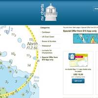
nv Charts Updates Florida, Bahamas, Caribbean Charts
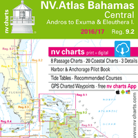
nv charts has announced the release of their newly updated chart sets for Florida, the Bahamas and the Caribbean for 2016/17 in paper and digital format. In addition to being updated, the new NV.Atlas format brings a modern, handy design to the charts that’s practical and easy to use. The chart set includes a download of digital charts, including free navigation software, plus the free nv charts Mobile App for iOS and Android mobile devices. The App includes free digital updates for this chart set for 2016/17.
B&G Software Upgrade for Zeus2 and Vulcan Chartplotter
B&G, the world’s leading sailing navigation and instrument specialist has upgraded its latest software for the full range of Zeus2 and Vulcan chartplotters. The new software upgrade enhances B&G chartplotters, allowing users to wirelessly download high-resolution weather information using PredictWind* GRIB files to store meteorological forecasts. This new functionality helps in trip planning or developing strategy for top-level competition. PredictWind is recognized as the leading global supplier of weather data for inshore and offshore sailing, with forecasts ranging from low-bandwidth offshore route planning to specialized, highly detailed local area forecasts of 1km resolution.
Navico Under New Ownership

Navico – a provider of marine electronics and parent company to the Lowrance, Simrad, B&G and GoFree brands – announced that Goldman Sachs Merchant Banking Division and Altor Fund IV have partnered and signed an agreement to acquire Navico from the Altor 2003 Fund. Navico is an innovative force within the recreational and commercial marine electronics market and has a rich history of investment in research and development. In the last two years, the company developed such technologies as the HALOTM Pulse Compression Radar technology…
Lowrance Debuts Elite Ti Series Fishfinder/Chartplotters
Lowrance, a world-leading brand in fishing electronics since 1957, announced today the release of a new, premium Elite Ti standalone series of fishfinder/chartplotters. The Lowrance Elite-5 and Elite-7 Ti touchscreen fishfinder/chartplotters offer anglers high-performance at an incredible value. With an easy-to-use touchscreen interface, Bluetooth and wireless connectivity, proven Lowrance navigation technology and high-performance sonar – including CHIRP sonar, StructureScan HD and DownScan Imaging – the Elite Ti Series is a robust, feature-rich, yet compact solution – all at an affordable price. The Lowrance Elite Ti is designed for anglers who want a complete view of the area beneath their boat.
Vesper Marine Debuts New AIS Transponder
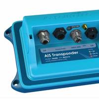
Marine safety products manufacturer Vesper Marine has released a new Class B Automatic Identification System (AIS), the XB-6000. The black box transponder includes a built-in NMEA 2000 gateway and GPS antenna that integrates AIS, GPS and NMEA instrument data to display vital safety information on any AIS-compatible chartplotter, multifunction display (MFD) or personal computer. The Vesper Marine XB-6000 offers convenient access to AIS safety information instantaneously while on the water.
Silver Ships Delivers Survey Vessel to USACE
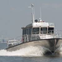
Silver Ships delivered a 48-ft. Endeavor Survey boat to the U.S. Army Corps of Engineers, New Orleans District. The vessel will be tasked with surveying the waters in both the Gulf of Mexico and rivers of the New Orleans District. The all-welded aluminum vessel is designed and engineered by Naval Architect Lou Codega, PE of Smithfield, VA and features a hull form designed to handle the short choppy seas of the Gulf Coast regions. The vessel is powered by twin Caterpillar C18 diesel engines at 803 hp each coupled to Twin Disc v-drive gears.
Navionics SonarChart Compatible With Sounder
Navionics, the leader in content and location-based services for the recreational boating and outdoor markets, announced today the latest details of its award-winning SonarChart Live. Now offering compatibility with Raymarine Dragonfly PRO and Wi-Fish systems, boaters can connect GPS chartplotters, sounders and fishfinders with their mobile devices using Wi-Fi to view an HD bathymetry map in real time while navigating. Raymarine Dragonfly PRO and Wi-Fish users can also take advantage of the unique split-screen view within the Navionics Boating app, enabling them to display both charts and DownVision sonar in the palm of their hands. SonarChart Live is also now available for use with any sounder or plotter connected to a compatible Wi-Fi router, such as Digital Yacht’s Sonar Server.
Seapilot Class B AIS Available in North America
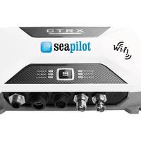
True Heading, a manufacturer of Automatic Identification System (AIS) solutions, GPS compasses and app navigation, announced its complete line of Graphene Class B AIS transponders have received type approval and are now shipping in the North American market. The Seapilot Class B AIS is offered in four different versions, the CTRX Graphene, WiFi-AIS CTRX Graphene, CTRX Graphene+ and WiFi-AIS CTRX Graphene+. Compact and easy to install, the Seapilot Class B transmitter sends vessel information including heading and speed…
GoFree Debuts Lake Insight & Nautic Insight Cartography
GoFree – the provider of digital content and services, and part of the Navico family of marine electronics brands including Lowrance, Simrad Yachting and B&G – announced today the release of six updated mapping products for use in both inland and coastal U.S. waters. Greatly improved for 2015, Lake Insight® and Nautic Insight® cartography packages are each available in three versions: PRO, HD East and HD West. Delivering high-quality maps for the lower 48 United States including the Great Lakes, GoFree’s Lake Insight v15 now features an updated database of 9,000 lakes with depth contours, including 2,300 detailed charts with contours at 1- to 3-foot intervals.
Navionics Debuts SonarCharts
Navionics, the leader in location-based content for the recreational boating and outdoor markets, announced today the release of a new SonarCharts chart card for use with several Garmin GPS chartplotters. Featuring extraordinary bottom contour detail of up to 1 foot in the US and Canada, the new version of SonarCharts HD bathymetry map for use with several Garmin GPS chartplotters offers the most detail available anywhere, and is great for increasing awareness of shallow waters and locating fishing areas at any depth level. The SonarCharts card also includes navigational aids, providing a complete resource for all boating activities.
New Bahamas Northwest Chart Set Upgrade
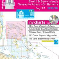
nv charts announces the release of its newly updated chart set for Region 9.1, Bahamas Northwest, including Bimini and Berry Islands, Nassau to Abaco, and Grand Bahama, for 2015/2016 in paper and digital format. The chart set includes a CD of digital charts, including free navigation software, plus the free nv charts Mobile App for iOS and Android mobile devices, for real-time navigation with tablet devices. The App includes free digital updates for this chart set for 2015/2016. Nv charts are relied on for accuracy and dependability by recreational boaters, professional mariners, and the U.S.
New HTML5 Version of Insight Genesis
Insight Genesis™,the custom map-generation tool for Lowrance, Simrad NS and B&G Zeus series chartplotters,announced today the latest update to its premium map-making service— Apple Mac and mobile device compatibility. Significantly expanding access to Insight Genesis, the service’s new HTML5 architecture creates exciting ways for boaters and anglers around the world to access and enjoy the map-making experience. The online serviceleverages the multi-platform capabilities of HTML5 to offer compatibility with Microsoft™ Windows®, Apple OSX and iOS, Android and Windows Mobile devices.Sonar logs can now be analyzed and reviewed on PC or Mac computers, as well as Apple, Windows and Android mobile phones and tablets*.
Fugawi Aboard Combines US, Canada Raster Charts
Fugawi Aboard, a newly launched product from Northport Systems Inc., combines U.S. and Canadian raster charts, based on National Oceanic Atmospheric Administration (NOAA) and Canadian Hydrographic Service (CHS) nautical charts, into quilted regions for use on compatible chartplotters. Fugawi Aboard combines more than 2,000 NOAA and 600 CHS raster navigation charts on one quilted product. Packed with coastline detail for the entire United States and Canada, Fugawi Aboard delivers the look and feel of vector charts with the unmatched detail and familiarity of paper charts.
Northport Systems Upgrades Navigation Softwre
Software developer Northport Systems Inc. has announced the latest enhancement to its innovative Fugawi Marine 5 marine navigation software, Theyr Weather. Fugawi Marine 5 allows for simple download, management, and display of high-resolution weather data from the X-Traverse web service, eliminating the need to sift through low quality GRIB files from multiple, hard-to-find sources. Whether planning a multiday journey or trying to spot the biggest wave, Theyr’s GRIB data keeps boaters informed of the weather conditions most relevant to their on-the-water excursions.
nv charts Debuts New Cuba Southwest, Puerto Rico Chart Sets
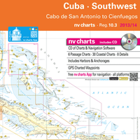
nv charts announced the release of their new chart set for Region 10.3 Cuba Southwest, covering the southwestern coast of Cuba. This new, updated, meticulously surveyed chart set has been much anticipated by sailors in the Caribbean who have wanted to visit the southwestern coastal area but have been reluctant due to the unavailability of reliable charts. Region 10.3 sets, as well as nv charts’ new 2014 edition of Reg. 11.1, Puerto Rico, will be available at the nv charts booth at the U.S. Powerboat Show in Annapolis, MD., October 3 – 6, in Tent C, booth C31; and at the U.S.
Nv Charts Launches New ‘Virtual Chart Shop’ Web Site
Nv Charts announced the launch of nvcharts.com, a new interactive web site and e-commerce site for all of the company’s charting and navigation products, customer service, and all things Nv. The new website features an improved homepage design, cleaner layout of page content, and an intuitive and consistent site-wide navigation system. It is also accessible through a wider range of web browsers and devices, including mobiles and tablets. “Our new site is a virtual chart shop online…
NV Charts Release Free Mobile Navigation App
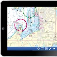
Motor boaters, sailors, and cruisers who want to ride the cutting‐edge crest of navigation with mobile devices can now take advantage of NV charts App, a new, simple‐to‐use free app now available from NV charts, a global leader in highly accurate, detailed maritime chart products. The new NV charts App is free and makes it a simple matter to download NV charts’ superior chart regions to iPads, iPhones and all iOS platforms as well as Android operating devices. For years, NV charts has offered paper charts, as well as digital versions for download onto a laptop or notebook PC for navigation.
NV Charts Debuts New Northeast Regional Chart
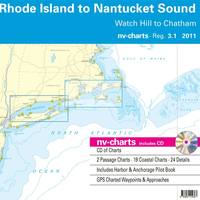
One of the most popular boating and cruising areas on the U.S. East Coast, the region from Long Island, New York to Nantucket, is now available in improved format and readability from NV Charts. Region 3.1: Rhode Island to Nantucket Sound, including the waters from Watch Hill, R.I. to Chatham, Mass., on the lower end of Cape Cod, includes Nantucket, the Elizabeth Islands and Buzzard’s Bay, Block Island, Block Island Sound and all of Narragansett Bay. The nv charts Region 3.1 set is provided in paper and digital format for sailors…
New Vessel AIS Trasceiver by Koden
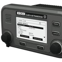
New for 2012, Koden has introduced the KAT-100 Class A Automatic Identification System (AIS) transceiver, combining an AIS transponder unit with a high-contrast LCD display featuring rotary control knobs for quick data selection and entry via the keypad. Koden say its new IMO Wheelmarked KAT-100 Class A AIS is an ideal solution for SOLAS and sub-SOLAS class vessels, workboats and high-end private yachts. The KAT-100 transmits and exchanges the full range of required dynamic information with AIS equipped vessels…
Cartography Enhanced for North American Boaters
Jeppesen has announced the Spring 2012 Release of its popular C-MAP MAX and C-MAP 4D cartography, bringing a variety of significant enhancements and exclusive new data to recreational boaters across North America. C-MAP's 4D cartography provides the newest and most innovative navigation experience available, combining the three traditional dimensions with a fourth dimension of time in the form of consistent, periodic updates. Jeppesen updates its electronic charts three times per year, and makes these updates and upgrades available to boaters through a variety of channels. The Spring 2012 Release includes a new 3D model with a brighter sun-viewable color palette for C-MAP 4D delivering a unique…

