Jeppesen, Brazil Forge Marine Data Agreement

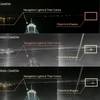
Jeppesen and ’s Directorate of Hydrography and Navigation (DHN) have reached an agreement giving Jeppesen access to all of the nautical charts and data published by DHN for ’s sovereign waters. The agreement, signed through Empresa Gerencial de Projetos Navais (EMGEPRON), will allow Jeppesen to use DHN’s high quality nautical charts and data in its industry leading marine navigation products for both commercial and light marine users. With direct access to sovereign data, Jeppesen is able to ensure the highest levels of quality and integrity, thereby increasing the safety of maritime navigation. The agreement also makes possible new chart and data coverage areas for Brazilian waters.
In addition, Jeppesen and DHN have a letter of intent, under which the two are discussing the use of Jeppesen dKart tools and software by DHN to digitize and automate the production of Notices to Mariners, List of Lights and other aids to navigation.
“Jeppesen is committed to supporting sovereign organizations, such as DHN, in their mission of ensuring safe and efficient navigation within their waters,” says Michael Bergmann, director, Maritime Industry Affairs and Services for Jeppesen. “We look forward to a long and mutually beneficial cooperation between our organizations.”