NOAA Site Helps Users Prepare for Big Storms

As the coastal population continues to grow, so do the hazards when big storms approach. Now, an on-line tool, Historical Hurricane Tracks, helps users get a quick picture of coastal areas with the greatest frequency of hurricanes and tropical storms—and that historical “snapshot” can help community members and local emergency managers develop better plans for storm preparation and recovery.
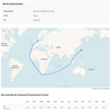
NOAA’s Historical Hurricane Tracks Web site, includes data on storm strikes through 2007. Current hurricane activity can be followed at http://www.nhc.noaa.gov.
The Web site allows users to generate customized maps showing the path of storms that have made landfall in the United States in years past. Users can search by U.S. ZIP code, state or county, latitude and longitude, or a storm’s name or year. Searches can be narrowed to specific storm categories.
Developed by NOAA’s Coastal Services Center in partnership with NOAA’s National Hurricane Center, the site contains more than 150 years of Atlantic hurricane data and nearly 60 years of eastern north Pacific Ocean data, which may be downloaded for use in geographic information system applications. The site also links to detailed reports on the life history and effects of U.S. tropical cyclones since 1958.