World’s Largest Iceberg Continues to Break Apart


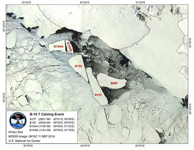 Image courtesy of NIC
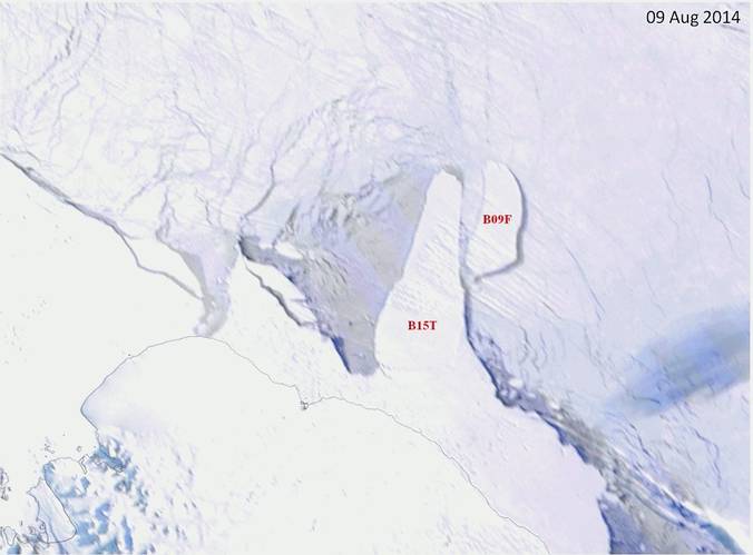 Image courtesy of NIC
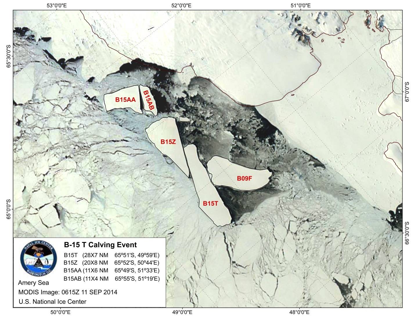

The United States National Ice Center (NIC) named three new icebergs after a previous iceberg B15T broke into four pieces. B15T remains, while the resultant icebergs are named B15Z, B15AA and B15AB.
B15T is the largest surviving remnant of the largest ever recorded iceberg B15, which calved from the Ross Ice Shelf in March of 2000 and was roughly the size of Jamaica when it originally separated from Antarctica.
As B15 broke apart, all pieces over 10 nautical miles long received their own designation and were tracked. Over the past 14 years, pieces of B15 began to exit the Ross Sea and travel westward around Antarctica, traveling hundreds of miles and going as far as the Antarctic Peninsula in the Weddell Sea. Some of these smaller icebergs broke apart, others drifted north to melt, and several are still being tracked.
B15T has such a deep keel that it has run aground several times over the years. While it was grounded, many other icebergs have passed by, and sometimes made contact with it. During its most recent grounding, B15T was stuck in a north to south orientation forming a blocking pattern near the Antarctic coast in the Amery Sea. After a couple of months, another large iceberg, B09F (21 x 8 nautical miles), seemed to hit B15T and then drift north and around it. At first, nothing seemed to happen; then several days later B15T broke apart and calved into four separate icebergs. The new icebergs from this calving event are the 26th, 27th and 28th tracked icebergs (B15Z, B15AA, and B15AB) originating from B15. Even after calving, B15T at 28x7 nautical miles is the largest of the eight remaining icebergs still being tracked from B15.
Behnjamin Zib, an analyst at the NIC, confirmed that iceberg B15T split up, and the resultant icebergs were at least 10NM using the MODIS image shown below. B15T is located at 65°51’ South, 49°59’ East, in the Amery Sea and has been reduced in size to measure 28 nautical miles on its longest axis and 7 nautical miles on its widest axis.
B15Z is located at 65°52’ South, 50°44’ East, in the Amery Sea and measures 20 nautical miles on its longest axis and 8 nautical miles on its widest axis. B15AA is located at 65°49’ South, 51°33’ East, in the Amery Sea and measures 11 nautical miles on its longest axis and 6 nautical miles on its widest axis. B15AB is located at 65º55’ South, 51º19’ East, in the Amery Sea and measures 11 nautical miles on its longest axis and 4 nautical miles on its widest axis.
Iceberg names are derived from the Antarctic quadrant in which they were originally sighted. The quadrants are divided counter-clockwise in the following manner:
A = 0-90W (Bellingshausen/Weddell Sea)
B = 90W-180 (Amundsen/Eastern Ross Sea)
C = 180-90E (Western Ross Sea/Wilkesland)
D = 90E-0 (Amery/Eastern Weddell Sea)
When first sighted, an iceberg’s point of origin is documented by the NIC. The letter of the quadrant, along with a sequential number, is assigned to the iceberg. For example, C-19 is sequentially the 19th iceberg tracked by the NIC in Antarctica that originated between 180-90E (Quadrant C).