

Shell Shipping, Orca AI Aim to Drive Navigation Innovation

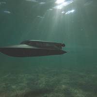
Shell Shipping & Maritime and Orca AI kicked off with a pilot project trialing Tel Aviv-based start-up Orca AI’s maritime navigation platform on a Shell-managed gas tanker. But it has now morphed into a long-term development collaboration resulting in new features that can significantly enhance safety at sea. Here Saurabh Kumar, Project Engineer at Shell Shipping & Maritime, and Dor Raviv, CTO at Orca AI, reflect on outcomes and benefits of the partnership so far.Navigational error resulting in collision or grounding is one of the highest safety risks associated with maritime transport.
AI is Pivotal for the Future of the Autonomous Shipping

The shipping industry is responsible for around 90% of the world’s trade distribution, carrying the likes of machinery, motors, food and vehicles around the globe. However, despite being around for nearly 5,000 years, the industry has been incredibly slow to innovate. All you have to do is look at how the automotive industry has gone from the original car through to self-driving vehicles in less than 200 years to fully appreciate how behind the curve the maritime world is.There…
Staying Vigilant On and Beneath the Waterline
The ocean is a very large and increasingly congested place. More and more shipping and industry is using it. But the risks hidden below the waterline, that established navigational tools don’t always detect, remain.But what if the trend for new surface-based sensor technology, the likes of which enable cars to detect potential collision hazards, could be available for shipping to detect underwater obstacles?That’s just what Sonardyne International Ltd. has developed with its new Vigilant forward looking sonar (FLS).
Ship Design: Evolving for Efficiency, Compliance
The evolution of marine design is increasingly influenced by three drivers: New three-dimensional design tools, the increasing complexity of power systems, and new access to high-latitude shipping routes. While new digital design tools are a natural progression of the current Information Age, new propulsion energy requirements and Polar shipping routes are reactions to the legacy of the ebbing Industrial Age. Three-Dimensional Design WorkflowsA young naval architect recently stated…
Shipping’s ‘Perfect Storm’ is Brewing -Allianz
Large shipping losses have declined by 50 percent over the past decade, mostly driven by the development of a more robust safety environment by ship owners, according to Allianz Global Corporate & Specialty SE’s (AGCS) fifth annual Safety & Shipping Review 2017. In 2016 there were 85 total shipping losses reported, down 16 percent from 101 a year earlier. The number of shipping incidents declined slightly year-on-year by 4 percent with 2,611 reported, according to the review, which analyzes reported shipping losses over 100 gross tons.
ECDIS Basics: New Book Published
Geomares Publishing has introduced a new training book ECDIS Basics, written by Professor Ralph Becker-Heins, which aims to give practical hands-on knowledge to all those who will be trained in the operational use of Electronic Chart Display and Information systems (ECDIS). The publishers explain that ECDIS is one of the most complex and sophisticated navigational tools on board a ship today. High quality training and instructions are therefore essential requirements and this is where this book can play an important role. For less experienced users, the book will help to gain an overview of the principles of ECDIS navigation and the related challenges. However, it is likely that advanced ECDIS operators will also be able to find new answers and helpful suggestions in this book.
Northern Australia Waters: Emergency Towage Service
The Australian Maritime Safety Authority (AMSA) has awarded two substantial new contracts to Brisbane-based company Australian Maritime Systems Limited to provide emergency towage services in Far North Queensland as well as to maintain its aids to navigation network. AMSA Chief Executive Officer Graham Peachey said the Level 1 emergency capability operates out of Cairns and provides a dedicated 24/7 vessel and crew to provide emergency towage and first strike emergency response on behalf of AMSA.
Standardization for Safer Shipping of e-Navigation & Training

e-Navigation aims to harmonize navigation systems and ultimately make the mariners’ job easier, but its implementation will necessitate extensive changes to maritime training. Dr. Michael Baldauf of the World Maritime University, discusses the reasons for change, progress made so far, and further changes that will need to be made to reap the benefits of e-Navigation. In recent years, bridges have become increasingly ‘smart’ with a plethora of new equipment, systems and interfaces.
The Russian Federation Confirms Flag State Approval for Admiralty Digital Publications

Over 75% of the world's vessels over 2,000 gross tonnes now permitted to carry digital nautical publications. The United Kingdom Hydrographic Office (UKHO) can confirm that vessels flying the flag of the Russian Federation are now able to use ADP to meet carriage requirements for nautical publications. The Russian Federation is the world's eighth largest flag state, as measured by the number of vessels, and this decision allows the 2,322 vessels flagged by the Russian Federation…
Canada Commissions Maritime Pollution Risk Study

Harper government announces pan-Canadian risk assessment study on marine safety. The Honourable Denis Lebel, Minister of Transport, Infrastructure and Communities, today announced that Transport Canada, in collaboration with the Canadian Coast Guard and Environment Canada, is commissioning a pan-Canadian risk assessment study on readiness to respond to ship-source spills in Canadian waters. “Our government is working to protect the safety of Canadians and the environment,” said Minister Lebel. “Canada depends on marine shipping for jobs, economic growth and long-term prosperity.
Underwater Metal Detectors Assist in Artifact Recovery
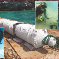
Underwater metal detector is successfully used for the African Slave Wrecks Project. In October 1619 the naval warship Warwick sailed into the King’s Castle Harbour in Bermuda with an important cargo from England; the colony’s new governor, Captain Nathaniel Butler. After taking on provisions the Warwick was to travel onto the struggling colony at Jamestown, Virginia, but it never made the voyage. Before the ship could sail, Bermuda was hit by a fierce hurricane. Battered by strong winds the Warwick broke free from her anchors…
Safer Navigation with International Standards for Electronic Systems

Carrying an estimated 90% of world trade and billions of passengers every year, international shipping represents the life blood of the global economy. Safety, always a major concern for seafarers, has made huge advances in the last century. However, the massive increase in traffic in recent decades requires, among other things, new or better global communication and navigation solutions resting on internationally-agreed standards to maintain and improve safety levels. Shipping was among the very first industries to adopt widely implemented international safety standards.
Boat Owners Urged to 'Spring-clean' Navigational Charts
The Alliance for Safe Navigation, whose mission is to raise awareness about the importance of up-to-date navigational information, today released a list of resources recreational boaters should turn to as part of their spring commissioning. The list stresses the importance of having accurate navigational tools onboard and reminds the boating public that getting chart updates is critical and a very real component of boating safety. The alliance points to its annual survey as evidence of the fact that boaters do get themselves into trouble. Its 2011 survey found that over 25 percent of respondents experienced a grounding within the last five years, with some damage as high as $10,000. One proactive measure boaters can take is to carry accurate and up-to-date navigational tools.
The eNav Strategy and its Implications
Virtually everyone is, by now, familiar with the concept of electronic navigation, also called eNavigation or eNav. The problem is that the term means different things to different people. Historically, it started with radio beacons. Radar, loran, and GPS have been added over time. Now we have AIS and electronic charting. Most mariners view this as an increasingly sophisticated set of tools installed on the ship to improve the ability to avoid collisions, groundings, and related casualties. That is only part of the story.
UKHO at Nor-Shipping 2011
The UKHO today announced its attendance at Nor-Shipping 2011 will offer shipping managers both practical guidance and strategic insight to help them effectively plan for the successful adoption of digital navigation. In addition to the main Admiralty stand (Hall B, B0-14) the UKHO is hosting a series of unique daily seminars and workshops which explore the immediate operational challenges and future strategic decisions faced by shipping managers. From Tuesday to Thursday, the seminar programme leads with an inspirational presentation from futurologist Dean van Leeuwen, entitled ‘TIDES of Change.’ ‘TIDES of Change’ – which debuted at Sea Asia in April 2011 – provides some thought-provoking material on the evolving world of technology and business…
Cunard’s New Sub Website is Fit for A “Queen”
Cunard Line has just launched a completely new sub-website dedicated to its magnificent Queen Mary 2, the world's largest, longest, tallest, widest and – at $780 million – the most expensive passenger liner ever built. The site features the latest in navigational tools and substantially new interactive content; it is now possible to take a tour of the vessel that won't even be launched until January 2004. The site, which has been completely redesigned and enhanced, features virtual imagery that enables users to tour the grand liner, get a panoramic view of public rooms and cabins and even watch a movie of the grand vessel’s construction milestones.
Coast Guard Issues Mississippi River Safety Advisory
The U.S. Coast Guard Captain of the Port (COTP), St. Louis, opened the Mississippi River to vessel traffic following the completion of dredging at mile marker 161.0, near the mouth of the Meramec River. The river had been closed to commercial vessel traffic since Dec. 14. However, low river levels have prompted the COTP St. Louis, and the COTP Paducah, Ky., to establish a joint Safety Advisory on the Upper Mississippi River between Cairo, Ill., (mile marker 0.0) and St. Louis (mile marker 184.0). Northbound tows entering the advisory area may not have more than 30 barges in their tow, of which only 15 may be loaded. Southbound tows are limited to no more than 20 barges. All barges within the advisory area may not draft more than 9 feet, except for those barges loaded prior to noon on Dec.
Great Ship - Endeavour
Though not scheduled for delivery until the summer of 2000, Arco's Endeavour, which is under construction at Litton Avondale Industries in New Orleans, is such an achievement that review of the ship's progress is necessitated in this year's grouping of Great Ships. When the Arco Millennium tanker project was announced in 1997, it was recognized as one which would require exceptional adherence to technical excellence in the design, construction and outfitting of what could arguably be described one of the more advanced oil tankers in the world. With its operation in and around the environmentally super-sensitive U.S. West coast (it was designed primarily for the 2…
AIS - Panacea or Pandora's Box
According to Greek legend, Zeus had the messenger god Mercury leave a mysterious box with Pandora. Mercury told Pandora to hold the box for safe-keeping, but under no circumstances was she to open it. Not long after Mercury departed, curiosity got the better of Pandora and she opened the box to examine its contents. Unfortunately, the box contained all the ills and misfortunes of the world. They promptly escaped and have been loose in the world since that time. The word 'panacea' is derived from the Greek terms "pan" (meaning all) and "akos" (meaning remedy). The question is which term applies to AIS? What is AIS? AIS is an electronic transceiver unit intended to be integrated with a ship's radar, gyrocompass, global positioning system (GPS), and other operational and navigational systems.
Furuno Releases New Navigator
Furuno has introduced the new GP37 DGPS/WAAS receiver. Replacing the GP36, the GP37 combines a 12 parallel channel GPS receiver with WAAS technology and proven Differential GPS correction for the ultimate in marine GPS accuracy. Designed for coastal ships, fishing boats and pleasure craft, the GP37 includes many of the same features that made its predecessor so powerful. It provides an incredibly accurate position fix of 1-3 meters while taking up a minimum amount of space. The GP37's highly sensitive combined GPS/H-Field DGPS “Loop” antenna is protected by a compact, waterproof housing built to withstand the harshest of marine environments and requires no external ground connection.


