Navigational Errors Caused Cruise Ship to Strike Pier in Alaska

Overreliance on an electronic chart, miscommunication and an outdated navigational chart were among factors that led to a cruise ship striking a pier last year near Sitka, Alaska, the National Transportation Safety Board (NTSB) said Tuesday.
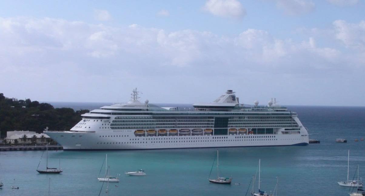
The Royal Caribbean cruise ship Radiance of the Seas was docking at the Sitka Sound Cruise Terminal on May 9, 2022, when it struck and damaged a mooring dolphin. The cruise ship sustained a minor hull indentation. The mooring dolphin sustained damage to three of the four pilings supporting it. There were no reported injuries to the 1,375 passengers, 782 crew and four pilots on board. The contact resulted in $2.1 million in damages to the pier and impacted cruise ship traffic to the Sitka Sound Cruise Terminal for the remainder of the 2022 season.
In April 2021, the Sitka Sound Cruise Terminal pier was extended by 395 feet, including adding two mooring dolphins connected by a walkway and a 410-foot-long floating dock next to the existing dolphins. The Sitka Sound Cruise Terminal did not inform the National Ocean and Atmospheric Administration (NOAA), the agency in charge of updating U.S. coastal nautical charts, of the extension. NOAA had no record of the construction until NTSB investigators informed them of the pier’s extension after the contact. At the time of the contact, the electronic navigation chart (ENC) the cruise ship was using did not show the extended pier or added dolphins.
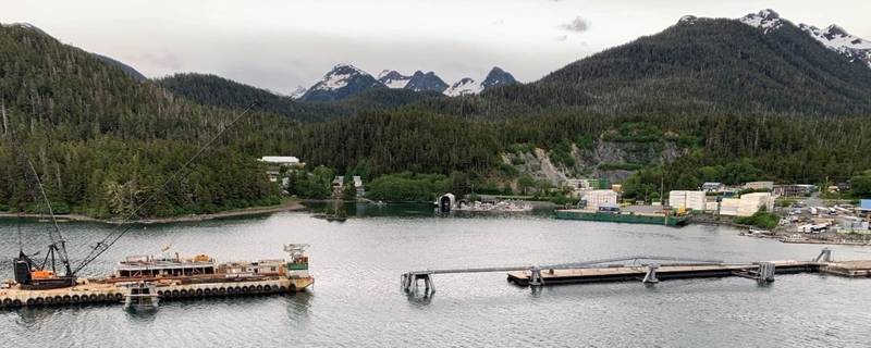 The Sitka Sound Cruise Terminal pier is shown on June 9, 2022, with barge alongside the damaged dolphin for repairing (with catwalk removed). (Source: NTSB)The crew of the Radiance of the Seas relied heavily on the vessel’s electronic chart and information system (ECDIS) to plan and execute their docking. The master and bridge team had other navigational technologies, including radars and cameras, available to assist them with the approach to the terminal. Even with these tools available, the crew relied solely on the ECDIS, which showed an inaccurate ENC.
While docking, the bosun and master did not confirm the type of distances that were being communicated during the docking. The bosun was relaying accurate distances to the pier’s northernmost dolphin, but the master incorrectly assumed the bosun was calling out how much clearance the ship would have as the stern passed the dolphin.
The NTSB determined the probable cause of the contact was the master and bridge team’s overreliance on an electronic chart to identify the pier’s position relative to their planned rotation location, and the master’s misunderstanding of the clearance distances to the pier being called by the crewmember on the stern while the vessel was rotating. Contributing was the Sitka Sound Cruise Terminal not reporting the extension of the pier into the waterway to the appropriate hydrographic authority in order to update the relevant navigational chart.
NTSB investigators cited two lessons learned as a result of the investigation, voyage planning and reporting port or terminal modifications.
“Proper voyage planning includes developing a complete plan for every phase of the voyage—from the vessel’s starting port to its end port (berth to berth), including leaving the dock and mooring,” the report said. “Reference points for maneuvering should be identified, measured precisely, and reported clearly. Vessel bridge teams should also ensure that they have the most up-to-date data before getting underway and consult with the local pilot(s) on the accuracy of navigation charts to ensure depictions of ports and/or terminals are correct.”
“Ports and terminals should immediately report significant modifications to port or terminal configurations to the appropriate hydrographic authority (for example, the National Oceanic and Atmospheric Administration) so that charts can be updated and the changes made readily available to vessel owners, operators, and crews/bridge teams,” the report said.