Offshore Oil & Gas: Brazil’s Northern Frontier

In an effort to spread out oil and gas production to other parts of the country and increase overall oil production, Brazil has finally intensified hydrocarbon exploration along its northeastern and northern coasts. These are some of the poorest regions in the country and infrastructure for oil and gas exploration is minimal, yet significant discoveries and seismic indicators of large reservoirs are tantalizing and have attracted major local and foreign investors. Potential for oil discoveries in the area is proven, yet players will be faced by many challenges offshore and on land in order to uncork reservoirs at the Northern Frontier.
The Northern Frontier
Brazil’s Northern Frontier is divided between five states; Amapá, Pará and Maranhão, Piauí and Rio Grande do Norte and has five offshore sedimentary basins; Foz do Amazonas Basin, Pará-Maranhão Basin, Barreirinhas Basin, Ceará Basin and Potiguar Basin. The ANP’s (National Petroleum Agency) 11th round of bidding, which took place in May 2013, finally opened up the Northern Frontier, also known as the Equatorial Margin (EM), to intensive exploration, although Petrobras (Brazil’s National Operator) and partners have been drilling and producing on a limited scale in these regions for more than a decade. Magda Chambriard, ANP Director, explained that, “The Brazilian equatorial margin basins are classified by the ANP as exploration frontiers and have promising potential for discoveries of turbidite sandstones (formations that form oil reservoirs post-salt) from the Upper Cretaceous, especially in deep water.”
Spectrum ASA has been leading seismic surveys in the region for some years now and analysis of the seismic data confirms that prospectivity potential is high because the source rock, the migration to a reservoir rock, and the trapping have been identified in key areas. Petrobras’ President, Maria das Graças Foster and Petrobras’ E&P Director, José Formigli have both indicated that the equatorial margin will be the next great challenge for Brazil’s oil and gas industry after the pre-salt, mainly due to the fact that there have been significant analogous oil and gas discoveries in West Africa, and there is much geological similarity between the equatorial margins on both sides of the Atlantic. The seismic data, including the re-processed data indicates that robust reservoirs are present in all the basins along the EM. Recently, there has been exploratory success by Petrobras at an unnamed deepwater play around 200km offshore of the coast of the state of Pará, in the Pará-Maranhão Basin and also off Rio Grande do Norte, in the Potiguar Basin, where the Pitú exploration well, 1,731 meters deep and 55km from the coast, struck oil.
Spectrum Seismic Survey Campaign
In 2013 Spectrum ASA acquired 38,588km of new long offset 2D seismic data covering the Foz do Amazonas, Barreirinhas, Ceará and Potiguar Basins in the EM. In addition, a re-processing effort is underway on a seismic dataset tying the Foz do Amazonas, Pará-Maranhão and Barreirinhas Basins. This re-processing effort is indicating that some of these basins may be linked. Spectrum has accumulated more than 48,000km of Multi-Client seismic in this area of extremely high potential. This data, along with final PSTM (Pre-Stack Time Migration), PSDM (Pre-Stack Depth Migration) was made available for Brazil’s 11th round of bidding.
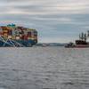
In December 2013, Spectrum and CGG announced that it would launch, as equal partners, a large, high-end BroadSeis 3D multi-client survey program offshore Brazil focusing on a large area of the Foz do Amazonas Basin. Rune Eng, CEO of Spectrum said, “This opportunity for us to join forces with CGG in our project development and employ CGG’s top-notch technology in our next phase in this area is a milestone for Spectrum.” Rune also highlighted that “the Northern Margins of Brazil have been a core area for our investment campaigns over recent years.” The project has received high prefunding from a number of major industry players and covers an area of 11,330 sq. km. The Foz do Amazonas Basin survey is being acquired by the MV Oceanic Endeavour deploying Sercel’s next-generation Sentinel RD solid streamer and started in January 2014. The Sentinel RD has a reduced diameter and a 15% weight reduction, compared to the original Sentinel, providing reduced cable drag and increased storage capacity aboard the seismic vessel. Pascal Rouiller, CEO of Sercel, and Senior Executive Vice President of CGGVeritas said, “Offering the best signal-to-noise ratio, Sentinel is the most operationally efficient system available in the industry today.” While the CEO of CGGVeritas, Jean-Georges Malcor said, “Sentinel RD can be deployed for a wider range of layout options including denser or longer configurations to meet growing demand for high-end marine seismic techniques such as broadband, high-density and long-offset acquisition.”
The seismic streamer vessel, MV Oceanic Endeavour, was launched in 2008 and is equipped to tow up to 16 streamers, and 8 gunstrings. She is one of the most powerful and high-capacity vessels of her class in the world, and has a crew of 70. The high-end BroadSeis data set will be processed in CGG’s state-of-the-art subsurface imaging center in downtown Rio de Janeiro using CGG’s proprietary geovation software for seismic data processing, imaging and reservoir characterization, including a new generation of massive high-density wide-azimuth datasets, true 3D wide-azimuth algorithms and anisotropic depth imaging along with the latest compute-intensive imaging algorithms. “There is an unsurprising high level of industry interest in the Brazilian equatorial margin given the recent Zaedyus discovery to the northwest of Foz do Amazonas as well as analogous discoveries in the West African equatorial margin. Our joint program with Spectrum will capitalize on CGG’s high-end BroadSeis technology and Spectrum’s recent 2D program experience in the Fóz do Amazonas Basin to bring unique insight to this high-potential area,” said Malcor.
Exploration Challenges
Petrobras geologist have stated that the EM’s geology is more complex that at other Brazilian basin essentially due to interpretation difficulties caused by shear faults that resulted in a far more complex model for these sedimentary basins and that when separating from the African continent, the movements at the South Atlantic coast were more of distention and not of dragging of one over the other. This created a very complex situation and is still interfering in the definition of the dynamics of the region’s petroleum system. With speeds of up to 1 meter per second (1.94 knots), currents in the region are another major hurdle operator need to overcome during E&P. In some areas along the EM the operator needs to place the rig dozens of kilometers against the current, before starting to lower a BOP or other subsea equipment to land it at the planned location on the seabed. There have already been a significant number of incidents where rigs have been pushed out of position by the powerful currents, on average, this occurs much more frequently at the EM than at any other oil basin off Brazil. Tide and wind dynamics have a stronger influence on sea conditions at the shallow continental shelf than in deepwater, while deepwater locations are affected by strong surface and deepwater currents that can run hundreds of meters deep and potentially up to 100 km wide, capable of creating shifting vortices that can affect localized current direction and speed causing cross-currents, which can be even stronger than the normal currents, significantly increasing the forces placed on risers, flowlines and other subsea equipment.
There is only very limited infrastructure, such as ports and port equipment, refineries, equipment transportation, offshore aviation, environmental services and labor. Operators will need to invest in building up support centers and training centers in the area, as qualified local content in North Brazil is hardly abundant. Oil spill response infrastructure will also need to be large and robust to be capable of dealing with the strong deepwater currents, as these remote seas and shores will be affected by any oil spill and are home to the largest mangrove coast in the world, Coastal Conservation Areas, Marine National Parks, and major river-mouths. Primary environmental studies will also need to be made along most of the northern coast and offshore and this will increase field development costs and may also delay exploratory drilling operations. In some instances Brazil’s Environmental Agency (Ibama) may not grant environmental licenses to some exploration blocks acquired during the 11th bidding round after environmental studies are analyzed.
(As published in the April 2014 edition of Marine Technology Reporter - www.seadiscovery.com)