U.S., Arctic Coastal States Improve Nautical Charts


The United States joined other Arctic Coastal States in a mutual effort to develop nautical charts that will improve the safety of mariners transiting the Arctic. At a meeting in Ottawa, representatives from Canada, Denmark, Norway, Russia and the United States established a new Arctic Regional Hydrographic Commission.
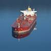
According to U.S. representatives at the meeting, there have been increases in ice-diminished conditions that are seen over longer periods, resulting in a doubling of vessel traffic in the Arctic since 2005. Mounting cargo demands, emerging resource development and the growing popularity of ecotourism add to burgeoning interest in the region.
“As vessel traffic increases, inexperience with navigating in the challenging conditions of the Arctic can create real dangers,” said Capt. John Lowell, director of NOAA’s Office of Coast Survey and U.S. national hydrographer. “Currently, charting data in much of the Arctic is woefully out of date or nonexistent. Inadequate charts pose a significant risk for marine safety, potentially leading to loss of life or environmental disaster, as evidenced by recent vessel groundings.”
Making ocean transport safe through and within the Arctic is important to the U.S. economy, environment and national security. Alaska’s Arctic coast is 921 nautical miles and the mostly low tidal shoreline totals 2,191 miles. This treasure contains considerable species and habitat in addition to economic resources including oil, natural gas and minerals. A new northern shipping route would significantly reduce the time and energy used in transit between the Pacific and Atlantic oceans.
“The establishment of the Arctic Regional Hydrographic Commission will help build synergy among the Arctic Coastal States to ensure safety of life at sea, assist in protecting the increasingly fragile Arctic ecosystem and support the maritime economy,” Lowell said.
Regional hydrographic commissions are formed through the International Hydrographic Organization (IHO), an intergovernmental consultative and technical organization with membership from 82 countries. The Arctic is the only part of the globe not covered by an IHO regional commission.