New Orleans Braces for TS Barry
Some residents and visitors prepared to flee New Orleans on Thursday as Tropical Storm Barry closed in and city officials warned of severe flooding if it makes landfall by early Saturday as the first Atlantic hurricane of the 2019 season.
The storm had maximum sustained winds of 40 miles per hour (64 kph) as of 10 a.m. CDT (1500 GMT) on Thursday, the National Weather Service said.
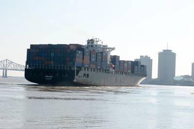
Forecasters issued a storm-surge warning for a stretch of Louisiana coastline south of already-sodden New Orleans stretching from the mouth of the Atchafalaya River to Shell Beach. Rain was an equal danger, given that the lower Mississippi River, which runs through New Orleans, has been above flood stage for six months.
The lower Mississippi is forecast to peak at 19 feet (5.9 m) on Saturday, the highest it has been since 1950 when it almost reached 20 feet, according to the National Weather Service.
The slow-moving storm was located about 95 miles (150 km) south-southeast of the mouth of the Mississippi River at 10 a.m., the National Hurricane Center said.
Meteorologists predicted between 10 and 20 inches (25 and 50 cm) of rain would fall on the Gulf Coast on Friday and Saturday from East Texas through New Orleans and the Louisiana coast.
New Orleans Mayor LaToya Cantrell warned that 48 hours of heavy rainfall could overwhelm the pumps the city uses to fight floodwater, leading to flooding as early as Friday morning.
"We cannot pump our way out of the water levels that are expected to hit the city of New Orleans," Cantrell said. "We need you to understand this."
Water pumps were already working at capacity after heavy rains, she said.
Oil companies have shut a third of offshore Gulf of Mexico production ahead and a coastal refinery was set to shutdown due to an evacuation order prompted by the storm, pushing oil and gasoline prices higher.
'DON'T WANT TO TAKE ANY CHANCES'
Cantrell said no official evacuation orders were being issued but urged people to gather supplies, secure their property and shelter in place.
But some in New Orleans, where Hurricane Katrina killed hundreds when it swamped the city in 2005, were leaving town.
In the city's Bywater neighborhood a block from the Mississippi River, Betsey and Jack Hazard were preparing to repair a fence around their house and flee with their two small children to Mississippi.
"It's really the river that has us worried," said Betsey Hazard, saying she feared it could overtop the nearby levee. "They say that the river won't flood in New Orleans but we have a 5-year-old and a 10-month-old, and we don't want to take any chances."
In the normally bustling French Quarter, popular with tourists, only a couple of tables were occupied at the coffee-and-beignet restaurant Café du Monde.
Kate Clayson of Northhampton, England, and her boyfriend Maxx Lipman of Nashville, Tennessee, said they had arrived on Wednesday for a vacation but were planning to depart on Thursday.
"The woman at our Airbnb said the water came up to the first step of our house yesterday so we've just decided we’d better get out," Clayson said.
The storm will become Hurricane Barry if it reaches wind speeds of 74 mph (119 km) as expected when it makes landfall near the mouth of the Mississippi River and just west of New Orleans.
Louisiana Governor John Bel Edwards declared a state of emergency on Wednesday.
National Guard troops were in place across the state, the governor said.
The National Weather Service said the city had received 6 to 9 inches (15 to 23 cm) of rain by Thursday morning, causing dramatic flooding in the area, including on Bourbon Street in the city's historic French Quarter.
By Kathy Finn


