ORRV Discovers Two Shipwrecks In The Philippines


PEORIA, IL -- (PR Newswire) -- April 29, 2011 -- Oceanic Research and Recovery Inc. (PINKSHEETS: ORRV), a marine salvage and exploration company, today announced that team members have discovered two shipwrecks in the Philippines.
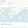
Preliminary investigations indicate that at least one of the ships located is believed to be a Manila Galleon that was outbound from Manila to Acapulco, Mexico. The second wreck is believed to be an inbound Manila galleon which would be carrying silver and gold to be traded for oriental goods, a local guide presented team members with a silver coin dated 1786 (king Carlos III) reported to be from this site.
"The objective of the Tradewinds Project has been to locate one of the fabled Mania Galleons, it looks like we might have been successful", said Scott Heimdal, CEO of ORRV. "One ballast pile is located where research said the ship sank and the dimensions are correct. The pile is estimated at over 50 meters long and 15 meters wide. It also lies at depths which made it impossible for any type of salvage operation at the time of loss."
"The other site shows a perfect side scan image of the hull of a sailing ship with a long bowsprit sitting on the bottom minus the masts; the amount of structural preservation is astounding", continued Mr. Heimdal. "This wreck was located where historical records indicate a Manila galleon was lost. Hundreds of porcelain shards were collected from a reef close to this site which led to the discovery of the wreck. Both wrecks are also of extraordinary size for sailing vessels and Manila Galleons were some of the largest sailing ships ever built."
The Tradewinds Project is the culmination of almost 4 years of development efforts. It is a long term effort planned and organized to locate and recover multiple shipwrecks in the Philippines over the next 5 years. The next phase of operations, planned to start in the next few weeks, will be conducted while working in cooperation with the National Museum of the Philippines and other governmental agencies. Currently ORRV is organizing legal, logistical and operational requirements to proceed with the next phase.
Scheduled work involves additional non-invasive studies the sites, including; high resolution side scan imagery, creation of overall photo mosaics and setting survey points. This data will then be utilized as baseline data in the marine archaeology GIS system regularly used by ORRV on all its projects. This will provide the baseline data used to begin excavation of the wrecks by the team of archaeologists. More information on this sophisticated archaeological tool is available on the ORRV website.
Source: ORRV