Automated Skill Erosion


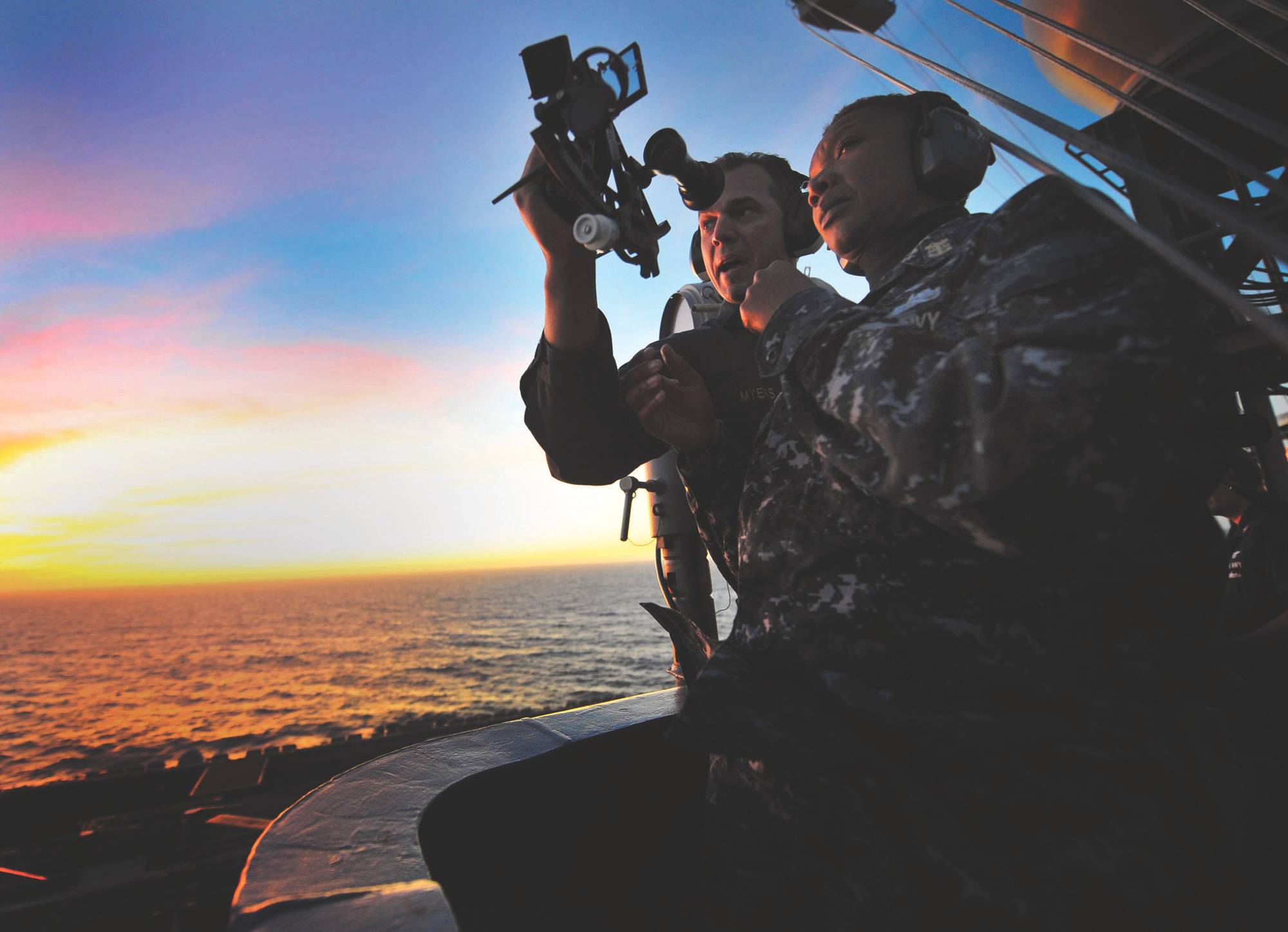
 The U.S. Naval Academy at Annapolis in 2015 reinstituted a course of instruction in celestial navigation after abandoning it a number of years ago. Senior Chief Quarter Master Jonathan Myers teaches Command Master Chief April Beldo how to use a marine sextant during a demonstration of celestial navigation aboard the aircraft carrier USS Carl Vinson (CVN 70). (U.S. Navy photo by Travis K. Mendoza)
 Dennis Bryant

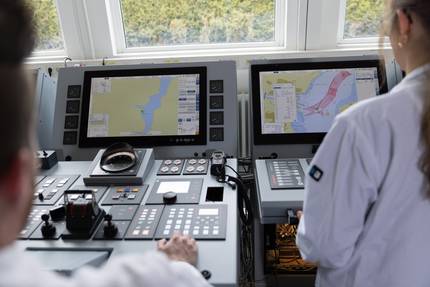
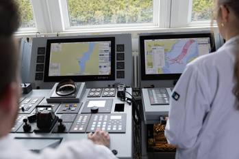
The increasing automation of vessels is causing some mariners to lose basic maritime skills.
Cruise ship Royal Majesty Grounding
During dinner on June 10, 1995, the last night before the cruise ship Royal Majesty was due to arrive in Boston from its voyage to Bermuda, the master bragged to the passengers at his table that his ship could never run aground because it had all the latest electronic equipment, including a navigation system that integrated the GPS signals and other information. At 2225 that night the ship grounded on the Rose and Crown Shoal near Nantucket. It was 17 miles west of its planned trackline. There were no deaths or injuries as a result of this grounding on a charted and marked shoal, but the ship incurred about $7 million in damages. The cause of the casualty was overreliance by the deck watch officers on the automated features of the ship’s integrated navigation system, located on the bridge. The GPS receiver with its warning light to show when signal reception was interrupted, was located in the chart room, which was seldom visited when the ship was at sea. The wire connecting the antenna to the GPS receiver had come loose, ending reception of the signal. The warning light continuously flashed, showing that system had defaulted to its dead-reckoning mode (which did not account for current and winds). The ship was gradually pushed west of its intended track due to the current and winds, but this was not reflected by the integrated navigation system.
The ship’s fathometer was operating properly, but not monitored. The fathometer alarm was not switched from its in-port mode of zero-fathoms to its at-sea mode of three-fathoms. As a result, the fathometer alarm did not sound prior to the grounding.
The ship was equipped with a Loran-C receiver, which was operating properly and would have warned the watch officer that they were off course and headed into shoal water. The watch officers’ practice, though, was to check the Loran-C only if they knew that the GPS receiver was inoperable. Thus, no one read the position on the Loran-C receiver from the Bermuda departure until the grounding.
A buoy was seen on radar and assumed to be one that marked the entrance to the traffic lanes, but never identified. A second buoy marking the traffic lanes that should have been seen if the ship were on course was not seen, but its absence was ignored. Lookouts reported several high red lights (subsequently determined to be on Nantucket Island) and, later, white water ahead, but the watch officer took no action.
The radar, set for six miles, would have detected Nantucket Island if set on the twelve mile range, but this was not done. There is also no evidence that celestial navigation was used at any time during this voyage.
In other words, the watch officers relied solely on one source of position information for navigation, even though multiple sources were readily available. GPS had become so good and so convenient that everything else, including the warning of white water ahead, was ignored.
Other Technology-Assisted Casualties
One would have thought that lessons learned from the Royal Majesty casualty would have been fully absorbed by the marine industry, thus avoiding similar incidents in the future. Not so! Following are just a few incidents where modern maritime technology has led mariners astray.
On March 16, 2011, the bulk carrier MS Oliva grounded at full sea speed on Nightingale Island (a small island off Tristan da Cunha) in the South Atlantic. The ship was enroute from Brazil to China with a cargo of 65,000 tons of soya beans. The ship also had on board about 1,700 tons of fuel oil. An error was made during the passage planning as a result of which the trackline set in the integrated navigation system ran through the small island. No one checked the passage plan in detail. The watch officer saw clouds ahead, but assumed that it was typical weather. It turned out to be clouds around the mountain on the island. The radar showed a target dead ahead, but the watch officer assumed that it was clouds. Unfortunately, the target was Nightingale Island. The grounding broke the ship in two, spilling the cargo and the bunkers. Fortunately, there were no deaths or serious injuries, but the island is a designated important bird area, with many endemic species. The local Rockhopper penguin population and numerous seabirds were adversely affected by the oil spill. The passage plan had, unfortunately, worked perfectly.
On October 4, 2011, the containership Rena grounded at full sea speed on the charted Astrolabe Reef while en route Tauranga, New Zealand. The ship was running late and the second mate intentionally set a course within one mile of the reef so as to shorten the voyage. Neither the second mate nor the master, who had taken over the conning of the ship, was monitoring the ship’s actual position. Both radar and depth sounder were installed and operational, but not relied upon during the time leading up to the grounding. The ship’s routine practice was to chart the position once each hour on the hour. At 0200, shortly prior to the grounding, the AB obtained the ship’s position from the GPS receiver, but was unable to transfer it to the chart because the master and the second mate were standing in front of the chart table. The ship’s radar was equipped with automatic radar plotting aid (ARPA) capability, which would have allowed the reef to be added as a navigation hazard, but this was not done. The GPS information was not integrated into the ship’s radar, the two systems operating independently. The second mate did not use GPS or parallel indexing to monitor the progress of the ship as it neared the reef. The compass error of the ship’s gyrocompass was not checked at any time during the voyage. The reef was not marked by a beacon or buoy, but it was near land and well charted. The navigating officer intentionally sailed the ship to pass close aboard the reef, but did not account for wind, current and compass error, relying almost completely on the ship’s autopilot.
On February 26, 2013, the general cargo ship Douwent grounded on Haisborough Sand in the North Sea. Investigation revealed that the ship was following the navigation track displayed on the GPS receiver and on the radar. An undetected passage planning error had resulted in an erroneous waypoint to be entered in the trackline. Although the ship’s other systems, including radar, fathometer, and paper charts, were in order, sole reliance for navigation was placed on the electronic passage plan.
The US Naval Academy at Annapolis in 2015 reinstituted a course of instruction in celestial navigation after abandoning it a number of years ago.
Aviation
A recent study of the impact of automation on aviation safety reached some disturbing conclusions. While increased automation was expected to reduce workload, freeing the crew to perform more complex tasks, it found that most workload reductions occur when workloads are already low, as in mid-flight. The reduced workload seems to create a trend toward lack of vigilance and even boredom among the crews of highly automated aircraft. Automated systems can actually increase crew activity during higher crew workload phases, such as takeoff and landing, distracting the pilots from critical vigilance for outside traffic and situational awareness.
Aircraft automation has also caused a degradation of basic piloting skills. A recent airline crash in Southeast Asia was blamed in part on the inability of the pilots to effectively fly the plane manually after failure of the automated system. On June 1, 2009, Air France Flight 447 crashed into the South Atlantic off Brazil killing all 228 persons on board. Investigation concluded that there had been temporary inconsistencies between airspeed measurements (likely due to the pitot tubes being obstructed by ice) causing the autopilot to disconnect. The pilots reacted incorrectly, putting the aircraft into an aerodynamic stall from which it did not recover.
In April 2015, dozens of American Airlines flights were grounded when a glitch caused the iPad software used by pilots and co-pilots to view their flight plans to stop working. At least one pilot, though, went back into the terminal, printed out paper copies of the flight plan and route, and then flew his aircraft the old-fashioned way to its destination. The other pilots waited with their planes and passengers on the tarmac several hours until the software glitch had been resolved. I, for one, would be more comfortable flying with a pilot who still knows how to fly without computer assistance.
Conclusion
The master of a ship, and consequently, the owner of that ship, is required to utilize all available means of navigation that will provide useful information. Just because satellite navigation is the most convenient means (and, in many circumstances, the most accurate) the master may be found negligent, and the vessel possibly unseaworthy, if that master does not require the deck watch officers to routinely check the radar, fathometer, and other means of navigation, as well as maintaining a good lookout. As a federal appellate judge ruled in 1960: “A master has no more discretion to disregard this [means of] navigation than he has to disregard the use of charts, current tables and soundings where the circumstances require the use thereof.” Along the same lines, a noted British admiralty judge opined: “[T]he primary instruments for safe navigation must remain an alert and systematic visual and radar lookout.”
The only way by which a deck officer can be expected to be proficient at the use of radar, piloting, celestial navigation, and other means of navigation is for those skills to be routinely practiced. Over-reliance on satellite navigation will inevitably lead to deterioration of the other skills and, more importantly, may result in a failure to become aware when the satellite navigation system is not working properly.
Use it or lose it!
(As published in the May 2016 edition of Maritime Reporter & Engineering News)
The Author
Dennis L. Bryant is with Maritime Regulatory Consulting, and a regular contributor to Maritime Reporter & Engineering News as well as online at MaritimeProfessional.com.
(As published in the May 2016 edition of Maritime Reporter & Engineering News)