C-MAP Updates Its Integrated Maritime Suite


 (Image: C-MAP)
 (Image: C-MAP)
 (Image: C-MAP)

C-MAP has announced a new version of its Integrated Maritime Suite (IMS) 2.0 – a flexible, streamlined tool for navigational planning and voyage execution.
Significant customer collaboration was included in the development of IMS 2.0, integrating C-MAP’s chart and publication management to further enhance bridge planning capability and drive efficient workflows.
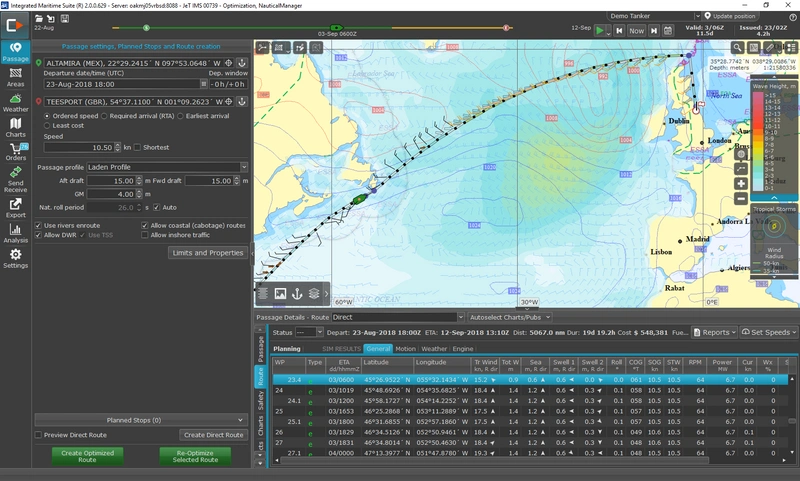
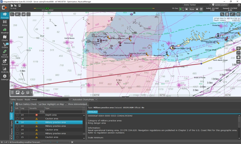
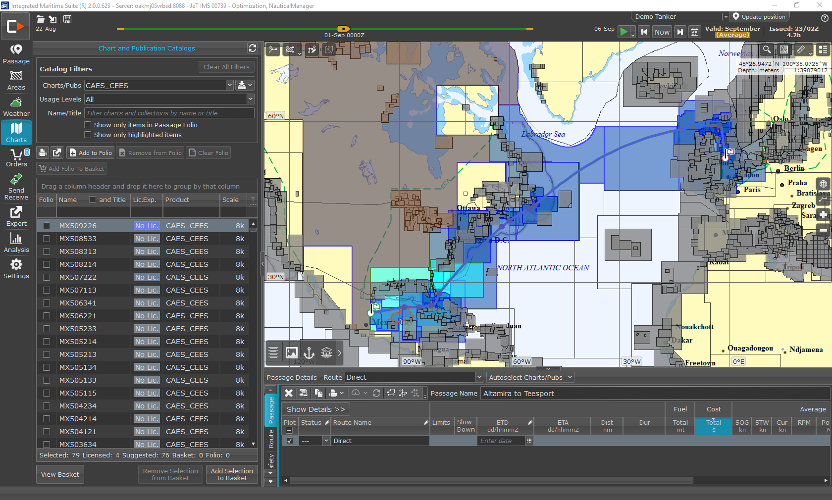
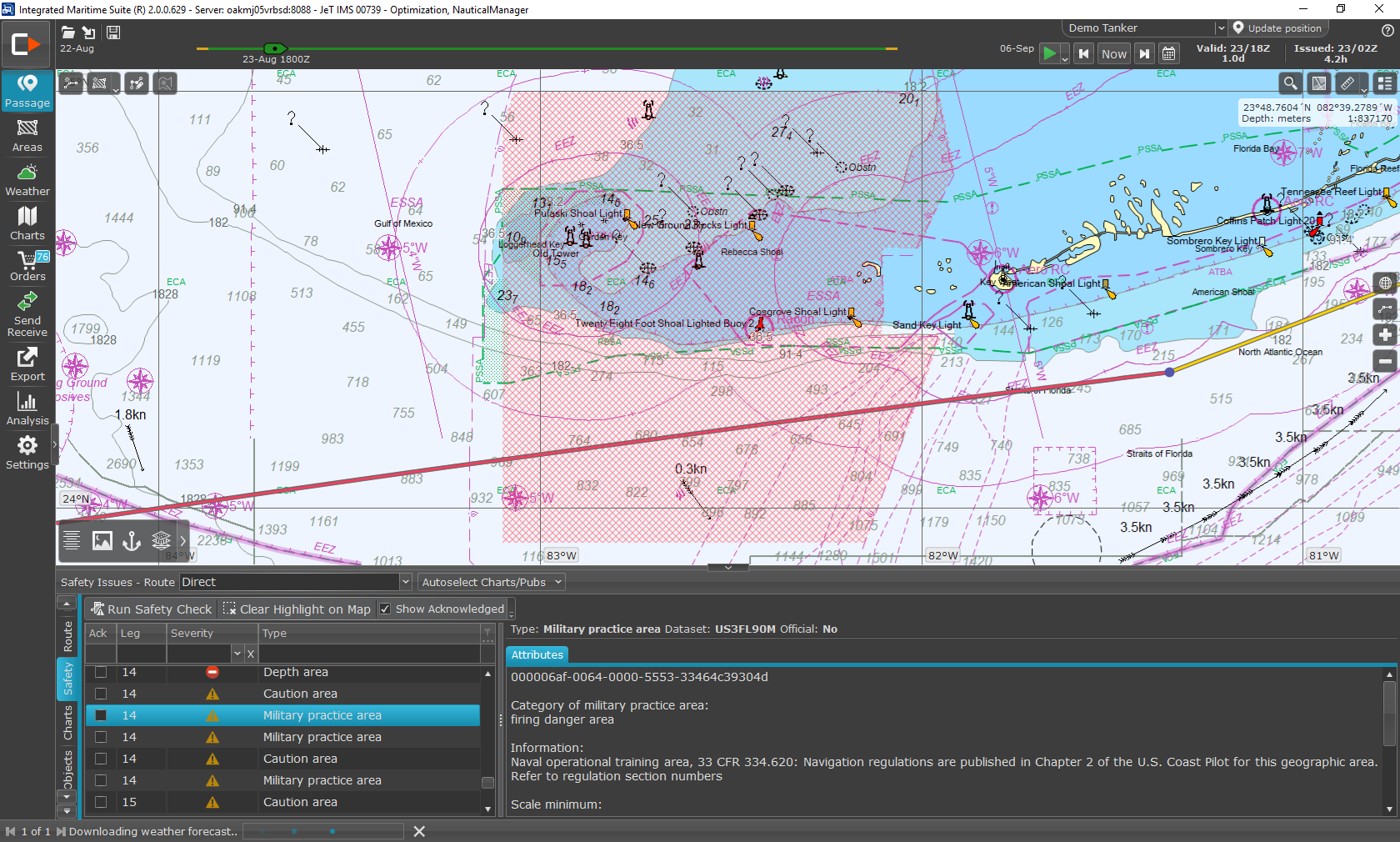
IMS 2.0 brings a new level of integrated tools to the onboard planning station by combining modules for chart and publication management, weather, route planning, and route optimization into a single, powerful package.
“C-MAP has long assisted bridge teams during all stages of the passage, from appraisal and planning to execution and monitoring to ensure safe and cost-efficient transit while supporting the ship master with compliance,” said Captain Sujit Padhye, Routing Team Operations Manager for C-MAP. “This new release of IMS enhances these characteristics by integrating our chart and publication management tools so voyage optimization and navigation are available in a single application. C-MAP IMS 2.0 is mission ready for new era of back-of-bridge efficiency.”
The modular design of IMS 2.0 allows customers to subscribe to only the functionality they need, including:
- •Digital and paper chart and publication management (including support for UKHO’s ADMIRALTY products such as AVCS, e-NP and other ADMIRALTY Digital Publications);
- •Portfolio and data update management, ENC & portfolio updates and generation of voyage and passage reports;
- •Route planning and weather viewing, with automatic ‘one-click’ weather routing;
- •Full voyage optimization based on the owner’s or operator’s commercial objectives such as on-time or earliest arrival, least cost or ordered speed, using a customized ship seakeeping and propulsion model.
This functionality is combined with multiple data layers, including weather layers, voyage planning and ports databases, C-Routes, ECA and risk zones to qualify decisions and control processes. Subscribers to C-MAP digital charts and publications will have the option to access more planning functionality within IMS 2.0.