NV Charts Release Free Mobile Navigation App

Motor boaters, sailors, and cruisers who want to ride the cutting‐edge crest of navigation with mobile devices can now take advantage of NV charts App, a new, simple‐to‐use free app now available from NV charts, a global leader in highly accurate, detailed maritime chart products.
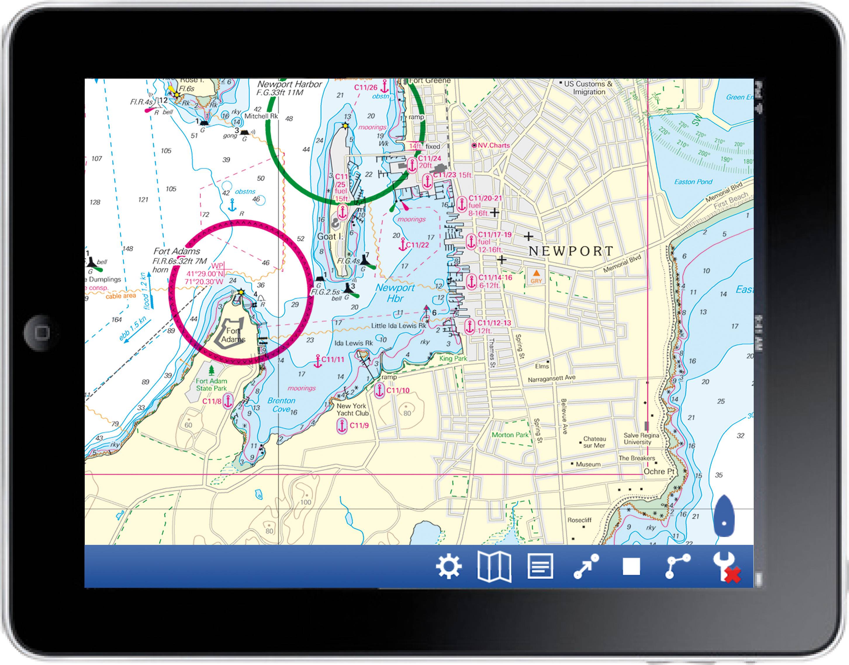
The new NV charts App is free and makes it a simple matter to download NV charts’ superior chart regions to iPads, iPhones and all iOS platforms as well as Android operating devices. For years, NV charts has offered paper charts, as well as digital versions for download onto a laptop or notebook PC for navigation. NV charts recently announced the availability of the company’s digital format products on SIM cards for use in chartplotters.
According to NV, prior to this release, mobile device users had to purchase, download and use third‐party software to enable their iOS‐based products to read digital charts from a single supplier, and these were unimproved NOAA charts. But the free NV charts App can be downloaded directly from the Apple iTunes Store (search for ‘NV charts’) and used right away. “It’s a whole navigation and plotting system in one,” said Hasko Scheidt, NV charts’ president and CEO.
“Not only can you load and use your NV charts, downloaded wirelessly from the NV cloud, but then, with GPS input, you can navigate. The NV charts App provides a complete toolkit for navigation, including a route menu, range and bearing measurement tool, ‘man overboard’ (MOB) marking and return tool, a logbook, and more.”
The charting program lets users follow their vessel across the chart region in real time, plot waypoints, update charts, and more. The App is in its beta version currently; more features will be added in time. Mobile devices equipped with internal GPS receivers can work with the app immediately and without any changes of settings. Non‐equipped can easily pair with a portable Bluetooth‐equipped GPS receiver for offshore navigation.
“Every chart set that we sell is accompanied by a CD so that the digital version can be used on a notebook PC,” Scheidt added. “This CD is labeled with a unique product code for installation. That same code can be entered in the app to enable download of the charts to the mobile device.”
Currently, supported regions include the U.S. East Coast, Bahamas and Caribbean, Bermuda, the Balearic Islands in the Mediterranean, and the North Sea regions in Europe. As the app continues to develop, users will be able to update, and benefit from more chart regions and a greater range of features. In the meantime, answers and feedback can be found on the app’s new blog at www.NVcharts.com/blog.