Presentations Illustrate Dimensions of Accurate Marine Mapping

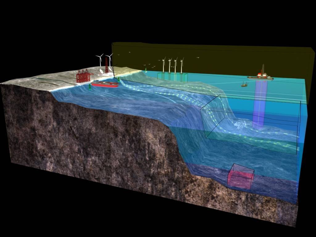
Two new products—the Ocean Dimensions animation and Crowded Ocean Spaces: A 3D View visualization—explain why two-dimensional marine maps cannot tell the whole story. Understanding this fact helps viewers gain a more accurate picture of marine-siting conflicts and compatibilities, including those related to offshore wind energy development.
Traditional maps can give the false impression that the marine space is very crowded. In reality, marine uses are spread out among many dimensions: the sea surface, seafloor, water column, air column and even the dimension of time. Marine planners and managers who take into account these many dimensions are better able to consider specific uses for specific locations.
The animation and visualization are included on MarineCadastre.gov, an integrated information system that features 170-plus authoritative ocean data layers as well as offshore planning tools and technical support. MarineCadastre.gov allows users to create and customize marine maps, share maps and data, and address critical planning details with partners.
MarineCadastre.gov was co-developed by the U.S. Department of the Interior (DOI) Bureau of Ocean Energy Management (BOEM) and the National Oceanic and Atmospheric Administration (NOAA) Coastal Services Center.
noaa.gov