MSRC Announces Ocean Imaging Remote Sensing Contract

The Marine Spill Response Corporation (MSRC) has entered an exclusive contract with Ocean Imaging Corporation for cutting edge remote sensing capability. Ocean Imaging will provide its proprietary aerial surveillance technology as part of MSRC's overall strategy for enhancing the ability to tactically position response resources in the optimal areas of oil migration for responding to spills.
The announcement was made today at the Clean Gulf Conference at the Tampa Convention Center in Tampa, Fla., where both MSRC and Ocean Imaging technology are present.
"It takes a complete systems approach to effectively respond to oil spills," said Steve Benz MSRC president & CEO. "While much of the regulatory compliance focus to date has been on skimmer throughput capacity, the reality is that the skimmer is just one component – and not necessarily the most important component in combating oil spills. It is imperative to determine the location of oil that is most recoverable – whether day or night – and stay in that oil as time moves on. Getting it wrong can mean that response resources have largely been wasted."
Benz added, "Our new arrangement with Ocean Imaging, available exclusively through MSRC, will significantly enhance our overall effectiveness during a response."
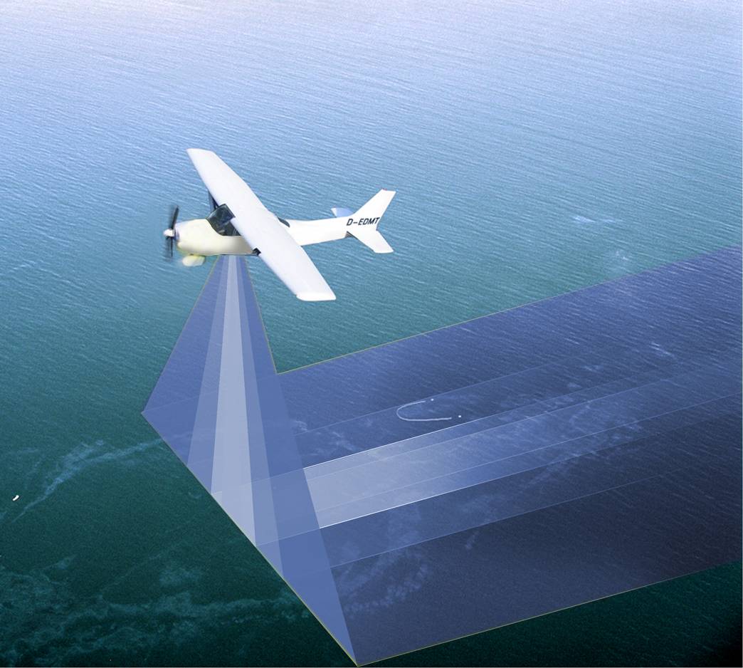
MSRC has developed a multi-tiered approach to remote sensing in order to complement and expand on traditional human aerial spotting. This approach is based on the concept that "height of eye" and "vertical viewing angle" are key to any surveillance. The technology provided by Ocean Imaging Corporation enables MSRC to significantly enhance its day and night aerial remote sensing through infrared/multi-spectral technology.
"Ocean Imaging has a decades-long history in unique, innovative remote sensing technology development and its transfer to operational use, including ocean condition maps for fishing fleets to monitoring changes in coastal ecosystems to tracking spilled oil at sea," Dr. Jan Svejkovsky, president of Ocean Imaging, said. "Our technology was used nearly every day for over three months on the Deepwater Horizon spill, and we have capitalized on that experience with further enhancements going forward."
Ocean Imaging systems were designed to be portable in nature. As such, they will be mounted in MSRC contracted planes on all three coasts for rapid deployment. The oil characterization capability of these systems will be used for real time tactical use in spills, providing a second set of eyes for determining actionable oil versus sheens, filtering out false targets that are always a challenge to the human eye, and providing information at night to expand the operating window.
Proprietary Ocean Imaging technology also makes available wide-area oil mapping that can be a critical feed to the Common Operating Picture (COP) at the strategic response level.