ICEYE to Deliver SAR Imagery to EMSA

ICEYE announced the start of a multi-year framework contract with the European Maritime Safety Agency (EMSA) to support their efforts in managing various aspects of maritime operations with Synthetic Aperture Radar (SAR) data.
Among its many missions, EMSA, a European Union agency, provides technical expertise and operational assistance in reducing the risk of maritime accidents and assisting in response and recovery from marine pollution from ships and oil installations. The agency supports the maritime surveillance activities of the national authorities of EU Member States linked with a wide range of coast guard functions.
ICEYE, which owns the world's largest SAR satellite constellation, will deliver SAR imagery to EMSA over these next years to enhance their operational support to a wide range of European organizations, in the scope of EMSA's Earth Observation Services.
"Just like our satellites, maritime operations operate around the clock. Radar imaging technology can see the earth day and night and in all weather conditions", said Pekka Laurila, ICEYE Co-Founder and Chief Strategy Officer. "Space based imagery is an ideal tool to quickly, efficiently and effectively support maritime disaster response and recovery operations, as well as to enforce EU maritime regulations and support local authorities."
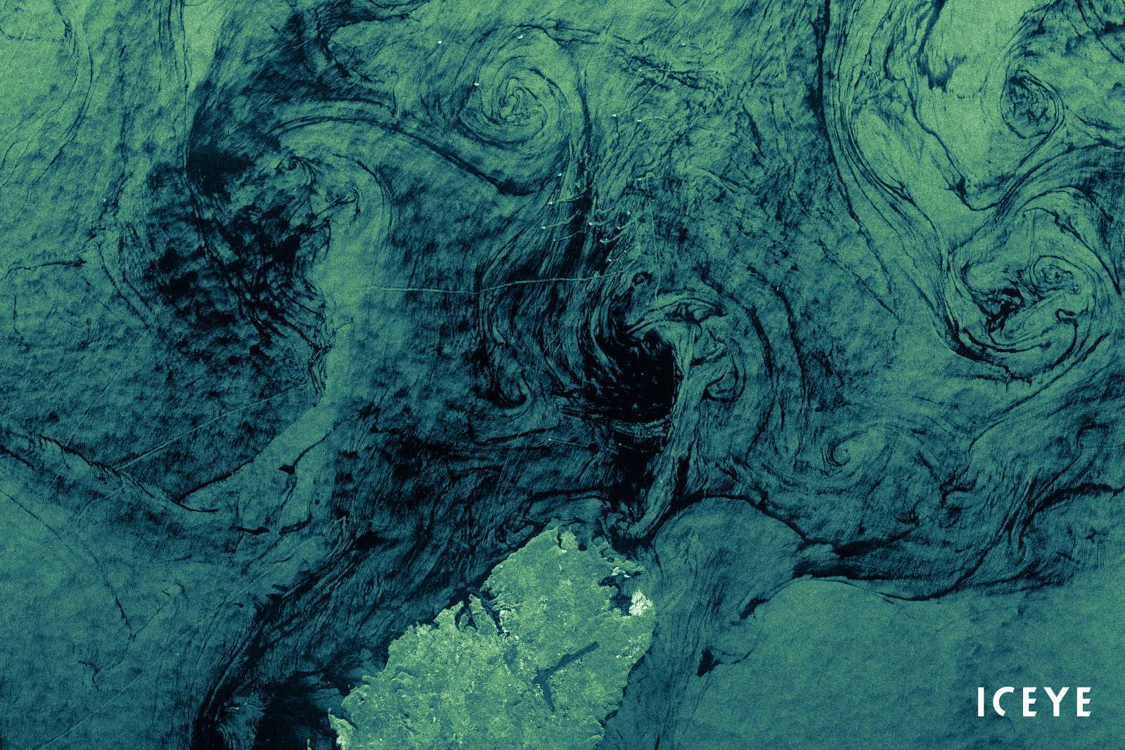
At any given time, 70% of the Earth is covered in clouds or darkness. Unlike traditional Earth observation satellites, ICEYE's small radar imaging satellites can form high-resolution images of areas of the Earth in daylight, at night, and through cloud cover. In other words, they can "see" any part of the Earth multiple times a day. ICEYE's satellites can collect images over wide areas and even more detailed images over smaller points of interest such as a ship or oil facility.