El Faro Investigators Call for Better Weather Forecasting


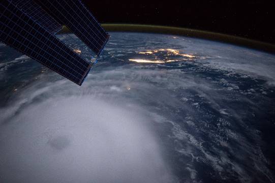
 The eye of Hurricane Joaquin is visible in the lower left corner of this image taken from the International Space Station October 2, 2015. (Photo: NASA)
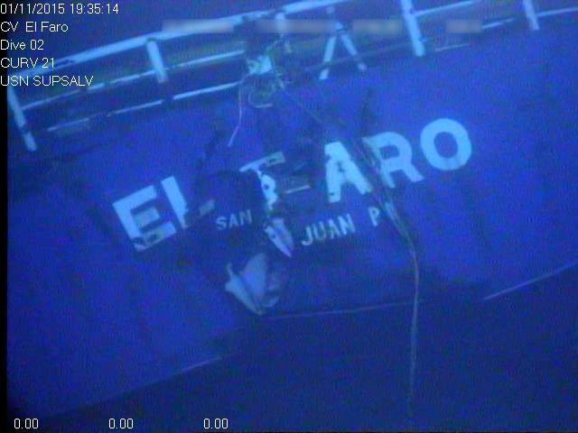
 El Faro wreckage on the seafloor (Photo: NTSB)
New recommendations coming out of the investigation into the 2015 sinking of U.S. cargo ship El Faro call for efforts to improve the weather information available to mariners.
All 33 crew on board died when the 790-foot El Faro sank close to the eye of Hurricane Joaquin near the Bahamas on October 1, 2015, two days after leaving Jacksonville, Fla. en route to Puerto Rico.
Now, as part of its ongoing investigation into the incident, the National Transportation Safety Board (NTSB), noting how Hurricane Joaquin and several other major storms had significantly deviated from their forecasts, has issued 10 safety recommendations aimed at enhancing the availability of weather information to mariners with a new emphasis on improving tropical cyclone forecasting.
The NTSB noted it has yet to determine the probable cause of, or contributing factors in, El Faro’s sinking, but has issued the recommendations based meteorological facts gathered thus far, plus discussions with the National Weather Service (NWS) and U.S. Coast Guard (USCG)
The goal of the recommendations, which include improving weather forecasting methods and increasing the frequency of certain advisories and alerts, is to improve the accuracy of hurricane and tropical cyclone forecasts and make them more accessible to voyage planners and at-sea mariners, NTSB said.
“As we enter the 2017 hurricane season we are reminded of the power and devastation associated with these storms,” said NTSB Acting Chairman Robert L. Sumwalt. “Storm avoidance is a life-saving skill at sea. And having frequent, up-to-date and reliable weather information is key to effective storm avoidance – and to saving lives.”
Safety recommendations like these are typically released at the conclusion of an investigation but can be issued at any point in the investigative process.
“We are getting these recommendations out as the hurricane season begins so that the work on these safety improvements can start immediately,” said Sumwalt.
Two recommendations are addressed to the National Oceanic and Atmospheric Administration (NOAA), seven to the NWS and one to the USCG.
To NOAA:
- Develop and implement a plan specifically designed to emphasize improved model performance in forecasting tropical cyclone track and intensity in moderate-shear environments.
- Develop and implement technology that would allow National Weather Service forecasters to quickly sort through large numbers of tropical cyclone forecast model ensembles, identify clusters of solutions among ensemble members, and allow correlation of those clusters against a set of standard parameters.
To the NWS:
- Work with international partners to develop and implement a plan to ensure immediate dissemination to mariners, via Inmarsat-C SafetyNET (and appropriate future technology), of the Intermediate Public Advisories and Tropical Cyclone Updates issued by the National Weather Service, in a manner similar to the current process of disseminating the Tropical Cyclone Forecast/Advisory.
- Modify your directives to ensure, for all tropical cyclones of tropical storm strength or greater within your jurisdiction, that your facilities issue, at the 3-hour interval between regularly scheduled Tropical Cyclone Forecast/Advisories, an Intermediate Public Advisory, a Tropical Cyclone Update, or another product available (or expected to be available) to mariners via Inmarsat-C SafetyNET (and appropriate future technology), and that the product include the coordinates of the current storm center position, maximum sustained surface winds, current movement, and minimum central pressure.
- Modify your directives to ensure that the “next advisory” time in a Tropical Cyclone Forecast/Advisory clearly indicates when to expect the next update of “current” or forecast information for that particular tropical cyclone.
- Quantitatively define “significant change” in terms of both the track and intensity of a tropical cyclone to guide the issuance of Special Advisory packages.
- Ensure that tropical cyclone graphic products issued by entities such as the National Hurricane Center, the Central Pacific Hurricane Center, the Guam Weather Forecast Office, the Joint Typhoon Warning Center, and Fleet Weather Center–Norfolk are made available in near-real time via the FTPmail service.
- Allow users to schedule recurring, automated receipt of specific National Weather Service products through an enhanced FTPmail service (and appropriate future technology).
- Develop and implement a plan for soliciting feedback from the marine user community, particularly ship masters, about the accuracy, timeliness, and usability of weather services to mariners.
To the USCG:
- In collaboration with the National Weather Service, provide timely broadcasts of the Tropical Cyclone Forecast/Advisories, Intermediate Public Advisories, and Tropical Cyclone Updates to mariners in all regions via medium-frequency navigational TELEX (NAVTEX), high-frequency voice broadcasts (HF VOBRA), and high-frequency simplex teletype over radio (HF SITOR), or appropriate radio alternatives (and appropriate future technology).
The NTSB also issued a safety alert advising mariners of available weather forecast products and alerts that can help in assessing the track and severity of hazardous weather systems.
The El Faro investigation is expected to be completed later this year when investigators will present their findings to NTSB members who will determine the accident’s probable cause and contributing factors in a public meeting in Washington, D.C.