Geo Sessions 2025

Last year, Geo Sessions brought together over 5,300 registrants from 159 countries, with attendees representing education, government agencies, consulting, and top geospatial companies like Esri, NOAA, Airbus, Planet, and USGS. At this year's Geo Sessions, NV5 is raising the bar with a focus on artificial intelligence, thermal imaging, and hyperspectral capabilities, technologies that are transforming how organizations see, understand, and act on geospatial data.“Last year’s sessions proved there’s a huge appetite for actionable geospatial knowledge…
SevenCs Upgrades Chart Validation Tool
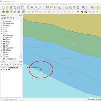
SevenCs has released a new version of the chart validation tool, 7Cs Analyzer. 7Cs Analyzer Version 4.2. comes with new features to make chart validation more flexible and customizable.Shape File ExportMost chart production tools have a built-in shape file reader. Therefore, we have included a new module in Version 4.2. It gives users the opportunity to save the validation log file in ESRI shape file format. The shape files contain the features that require attention as well as the associated validation messages.
Hyper-Smart Container Sets Sail
Dutch Port of Rotterdam has sent the hyper-smart Container 42 on a two-year data-collecting mission around the world.During this journey, the container – which houses an array of sensors and communications equipment – will be measuring changes in parameters like vibration, slope, position, sound, local air pollution, humidity and temperature.The unit has also been fitted with solar panels, which can be used to determine how much power a container can generate during a given journey by ship, train or truck. The container will be making its first stop in early June, in Munich, Germany. Here it will be presented to the public during the…
Robotic SAR: New ICARUS Ready by 2016
On 9-10 July 2015, at the Portuguese Navy Base of Alfeite (Almada) in Lisbon, 24 Project Partners from 9 countries demonstrated the ICARUS (Integrated Components for Assisted Rescue and Unmanned Search Operations) system, as final step of the ICARUS European project (http://www.fp7-icarus.eu/) funded by the European Commission under the Seventh Framework Programme for Research and Innovation (FP7). Started in 2012, ICARUS has been devoted to develop advanced robotic platforms, which can support crisis intervention teams in detecting, locating and rescuing humans in danger, in maritime and land disaster scenarios.Unmanned Search and Rescue (SAR) devices offer valuable tools for saving human lives and for speeding up the SAR process.
Will Robots Aid Maritime Search and Rescue?
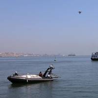
The ICARUS European project aims to develop robotic tools to assist crisis intervention teams. Playing a role in developing the maritime component of this project was NATO Center for Maritime Research and Experimentation (CMRE), whose assistance including enhanced autonomy and integration between Unmanned Surface Vehicles and Unmanned Aerial Vehicles. On July 9-10, 2015, at the Portuguese Navy Base of Alfeite (Almada) in Lisbon, 24 Project Partners from nine countries demonstrated the ICARUS (Integrated Components for Assisted Rescue and Unmanned Search Operations) system…
Date for Diary: BlueTech & Blue Economy Summit & Expo
The Maritime Alliance promotes the 6th Annual event Novemeber 12-13, 2014 at the McMillin Companies Event Center in San Diego, CA as a unique opportunity to understand trends, network with leaders from the public and private sector, see innovative technologies by the exhibitors, and identify possible partners. Recent studies are helping us understand the size and dynamic nature of the Blue Economy and particularly the BlueTech sector that is enabling us to explore, measure and develop ocean industries like never before. And financial and strategic investors are recognizing the opportunity evidenced by an increasing number of M&A and financing transactions - four sizeable transactions announced in the San Diego BlueTech community in the last 120 days alone. Leaders from the U.S.
Acclaimed Launches EPOCH for OMM
Software specialists The Acclaimed Software Company Ltd. announced the development of EPOCH , a marine management system on behalf of Offshore Marine Management Limited (OMM). EPOCH is an ESRI-GIS, web-based management system, providing reporting from offshore sites to onshore bases. For example, OMM’s German subsidiary uses EPOCH to manage and control guard vessel operations for offshore wind interconnector installations in the German sector of the North Sea. The Acclaimed are inviting visitors to Oceanology International in March at London’s Excel Center to try out this novel management tool on their Stand Number H555. EPOCH allows operators to manage their offshore assets, vessels, operations, personnel and data from one comprehensive system.
Oceans '13 MTS/IEEE San Diego Preview
Heeding the call to join “An Ocean in Common,” authors flooded the Oceans ‘13 MTS/IEEE San Diego technical program committee with a record number of abstracts in a single day. Special topics include an Ultra-deep track discussing current and prospective robotic technologies, plus a panel of scientists to consider research questions. Oceans2013 Chair Bob Wernli, and Co-Chair Kevin Hardy, developer of the unmanned landers for James Cameron’s DeepSea Challenge Expedition, will be the session conveners. “James’ intention is to be certain the door remains open to other explorers,” Hardy said.
Dogger Bank (UK) Cable Route: OMM Completes Assessment
Offshore Marine Management (OMM) completes a feasibility study for Forewind’s planned North Sea wind energy development. The study was undertaken to assess route feasibility options along one of the development’s 160km long export cable corridors. The scope of work required OMM to analyse survey data, establish a Burial Protection Index (BPI) and carry out a burial assessment to recommend cable burial depths along the route. This was used to advise on the potential need for corridor widening and cable protection measures, including advising on appropriate techniques for cable burial and protection along the route. OMM used its in-house Esri GIS facilities to assess the data provided for geology…
Sustainable Ocean Summit 2013

The Sustainable Ocean Summit 2013 (SOS 2013), organized by the World Ocean Council (WOC), is an international ocean business community gathering dedicated to industry leadership and collaboration in developing solutions to ocean sustainability challenges. Washington D.C. The theme of SOS 2013 is “Oceans 2050–The Ocean Business Community and Sustainable Seas.” The SOS is designed for the diverse range of ocean industries: shipping, oil and gas, fisheries, aquaculture, tourism, offshore renewable energy…
New Esri Ocean Industry Manager Takes the Helm

Drew Stephens Leads GIS for Ocean and Coastal Environments Industry. Esri has hired Drew Stephens to expand the market for GIS within the ocean industry. Esri, the world leader in GIS, has accelerated the development of its ocean technologies via the Esri Ocean GIS Initiative. As Esri's industry manager for ocean and coastal environments, Stephens will play a key role in this effort through his diverse background and GIS experience. "Stephens has worked with Esri for many years promoting the use of GIS to design sustainable practices for land and sea," Esri chief scientist Dr.
New Esri Ocean Industry Manager: Drew Stephens

Drew Stephens to lead Esri's Geographic Information Systems (GIS) for Ocean and Coastal Environments Industry. Esri has hired Drew Stephens to expand the market for GIS within the ocean industry. Esri, the world leader in GIS, has accelerated the development of its ocean technologies via the Esri Ocean GIS Initiative. As Esri's industry manager for ocean and coastal environments , Stephens will play a key role in this effort through his diverse background and GIS experience. "Stephens has worked with Esri for many years promoting the use of GIS to design sustainable practices for land and sea…
Esri Joins World Ocean Council
Esri's chief scientist Dawn Wright will share her geospatial expertise with WOC's Coastal and Marine Spatial Planning (CMSP) and Ocean Science working groups. Esri is a world leader in GIS. "Geospatially referenced information is critical to addressing environmental challenges in the fluid, dynamic, interconnected marine world," said Paul Holthus, executive director, WOC. WOC members are oil and gas, seafloor mining, shipping, fisheries, aquaculture, tourism, and offshore renewables companies. WOC develops and implements programs that improve the science, data, and maps needed to address the challenges of sustainable ocean use. For example, WOC helps ocean organizations understand and participate in geospatial activities that support robust ocean use maps.
Esri Introduce ArcGIS for Maritime Charting, Bathymetry Data
Esri has released a new solution to support users in port management, maritime transport, coastal management, offshore energy, nautical chart production, and maritime defense. ArcGIS for Maritime: Charting, and ArcGIS for Maritime: Bathymetry, are part of the ArcGIS system and enable users to create, manage, and share maritime-related data and metadata. Together, these solutions provide a comprehensive geospatial platform for nautical chart production and bathymetric data management. "ArcGIS for Maritime will save time and money for organizations that use bathymetric and nautical data," said Timothy Kearns, maritime program manager, Esri.
Esri GPS Base Station Joins National Network
Esri recently installed a GPS base station to assist its GIS developers and to support surveyors, engineers, scientists, and those in public works and public safety in the community surrounding the Esri campus in Redlands, California. The base station, named GISA, has been accepted by the National Geodetic Survey (NGS) and incorporated into the national Continuously Operating Reference Station (CORS) network. "GPS, originally designed as a US Department of Defense system, has become part of everyday life, with the technology in all types of devices from smartphones to shipping containers," said Brent Jones, Esri surveying and engineering industry manager.
NOAA Begins Production With Esri
GIS Creates Integrated Data Workflow for More Efficient Chart Production. The National Oceanic and Atmospheric Administration (NOAA) has implemented a new nautical charting system based on Esri GIS technology to produce more navigational products than ever before without increasing its budget or personnel needs. The new system, NCS II, is based on Esri Nautical Solution, and it allows NOAA to centralize the management of hydrographic data for US coastal waters. Since accepting Esri Nautical Solution as part of its production system in 2009…
NOAA to Deliver More Charts, Faster

Revolutionary Change in NOAA Nautical Chart Production Means More Products, Faster, for Maritime Use. NOAA's development of a new navigational chart processing system, designed to meet the changing needs of the maritime community, moves into initial limited production on September 21. The new system, which slims down the current map production process while it beefs up performance, represents a technological leap forward in creating the navigational charts used to speed ships and products safety through the nation's maritime transportation system.
ESRI to Offer Consulting Services Through SeaPort-e
The Naval Surface Warfare Center (NSWC) Dahlgren has named ESRI an approved prime contractor on the SeaPort Enhanced (SeaPort-e) online portal. By being listed on SeaPort-e, ESRI can make available a broad range of engineering, technical, and programmatic services related to geographic information system (GIS) and information technology. ESRI can provide these services to the U.S. Navy, the U.S. Marine Corps, and the Defense Threat Reduction Agency (DTRA). SeaPort-e offers these defense organizations a fast, cost-effective, electronic procurement procedure for providing tasking orders for professional support services from commercial firms. The contracting office for SeaPort-e is NSWC Dahlgren.
Horizon Marine adds Web Mapping Service to Eddy Watch
Horizon Marine has added a new Web Mapping Service (WMS) to its suite of web-based mapping products available to Eddy Watch subscribers. This new product allows clients to import Horizon Marine’s proprietary data into their own Geographic Information System (GIS). These data layers include tropical storm tracks, GPS drifter data, Loop Current and eddy fronts, satellite imagery, and forecast charts. Once the Horizon Marine WMS has been added to an end user’s GIS, the layers continually update, eliminating the need for clients to add new layers just to update their maps. This new WMS seamlessly integrates into GIS applications such as ESRI’s ArcGIS and is compliant with the standards for Web Map Services as laid out by Open Geospatial Consortium, Inc.