iNavX Debuts IN-APP Charts, Maps Purchase Capability
iNavX, the benchmark marine navigation mobile application, in partnership with Fugawi X-Traverse, today launched its chart and map in-app purchase program. Now enabled with one-touch purchase and download, iNavX gives boaters the most streamlined access to the broadest set of marine charts and maps from multiple providers. iNavX users will gain intuitive download capabilities for all of their favorite chartsand navigation data such as Navionics’ worldwide chart catalog, Canadian Hydrographic Service (CHS) charts; Fugawi Aboard quilted Canadian and US charts; NV Charts for Europe, the US and the Caribbean; Theyr weather; Waterway Guide…
Fugawi Aboard Combines US, Canada Raster Charts
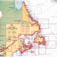
Fugawi Aboard, a newly launched product from Northport Systems Inc., combines U.S. and Canadian raster charts, based on National Oceanic Atmospheric Administration (NOAA) and Canadian Hydrographic Service (CHS) nautical charts, into quilted regions for use on compatible chartplotters. Fugawi Aboard combines more than 2,000 NOAA and 600 CHS raster navigation charts on one quilted product. Packed with coastline detail for the entire United States and Canada, Fugawi Aboard delivers the look and feel of vector charts with the unmatched detail and familiarity of paper charts.