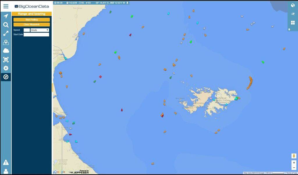
BigOceanData Provides VMS to Falkland Islands

BigOceanData has been awarded a contract to provide the Government of the Falkland Islands with its vessel monitoring system (VMS) capability for another five years. For the first time the system will include AIS data, which will be integrated with existing Inmarsat tracking data from the fishing vessels.
BigOceanData has been supplying the Falkland Islands government with its vessel monitoring system (VMS) for over 10 years. The system is based on an in-house client/server enterprise IT system and Inmarsat cooperative tracking. This latest contract extends that service for another five years, updating the client/server software and adding access to BigOceanData's web tracking capability with full AIS services for the South Atlantic region. The AIS data (combined satellite and terrestrial) will be fused with the other tracking data generated by the co-operatively tracked vessels from the enterprise system.
Over 150 vessels will be monitored by BigOceanData via the co-operative tracking devices. The system will also be used for monitoring other vessels operating in or passing through the Falkland's exclusive economic zone (EEZ) and so will play an import role in combating illegal fishing.
The deep South Atlantic is famous for the most remote and hostile waters in the world, yet it has some of the richest fishing grounds to be found anywhere. Terrestrial AIS has very little coverage there, but polar orbiting AIS satellites will provide the data necessary to deliver an accurate and up-to-date picture of maritime activity throughout the region.
BigOceanData and its predecessors have over 20 years' experience of working with government agencies around the world, tracking boats fishing within their territorial waters and ensuring compliance with quotas and regulations. A wide range of data sources are used to maximize the accuracy of the data, including AIS, Inmarsat-C and ARGOS. As well as delivering all the standard position, track and identification data on individual vessels, its systems can also provide a range of other features including geofence management and automatic alerts triggered by specific events such as overdue reporting, a panic button, tampering or geofence incursions.