

High-tech Solution Helps Track Illegal Vessel Activity

Finnish startup ICEYE launched its global Dark Vessel Detection solution to help governmental maritime security customers monitor their waters for illegal vessel activity.
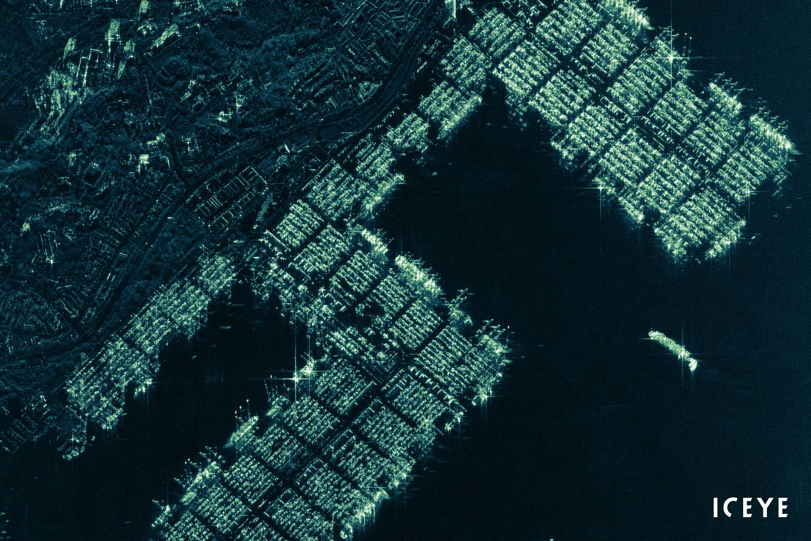
The high-tech solution, which combines synthetic-aperture radar (SAR) satellite data from ICEYE and automatic identification system (AIS) data from vessels, is used as a source of actionable information for governments monitoring their Exclusive Economic Zones (EEZ), day and night, and even through cloud cover.
“Dark Vessel Detection offered by ICEYE is built for governments around the world for improving the maritime safety of their regions,” said Steve Young, Vice President, Business Development and Sales, ICEYE. “This unique solution enables authorities to take action based on reliable information. Data users can improve their enforcement activities against illegal transshipments of goods, help them in addressing illegal fishing, and assist in curbing drug and human trafficking.”
While vessels engaged in illegal activities can choose to turn off their AIS transponders to avoid detection from authorities, ICEYE’s Dark Vessel Detection service’s core is built on the company’s own radar imaging satellite constellation data, which provides a reliable source of information at all times of the day and in all weather conditions. ICEYE’s customers have access to both location information and radar satellite images of all detectable vessels - even when they do not have their AIS transponders turned on.
“Together with our partners, ICEYE has developed a unique dark vessel detection capability for solving far-reaching maritime safety issues,” said Pekka Laurila, Chief Strategy Officer and Co-founder, ICEYE. “Our roadmap to achieve near-real time delivery capabilities for dark vessel data, on a global basis, is very short. With the introduction of our current standardized data format, actionable information is available already today.”
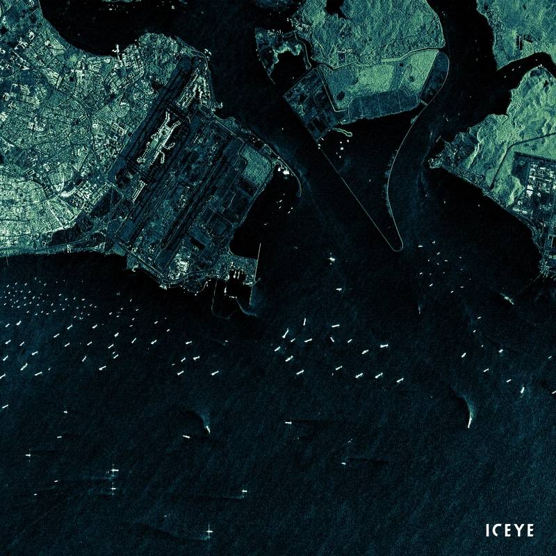 ICEYE radar satellite image from Singapore on January 26, 2019. Image shows different vessels sailing in the Singapore Strait, near the International Airport of Changi and its surrounding areas. (Image: ICEYE)
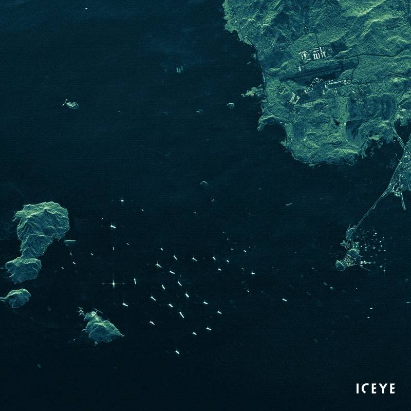 ICEYE radar satellite image of Port of Panama City on April 3, 2019. Image shows several vessels sailing in the Gulf of Panama. (Image: ICEYE)
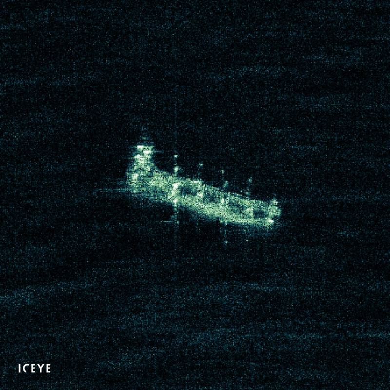 ICEYE radar satellite image from Busan, South Korea, taken on October 23, 2019. Image shows clear structures of a vessel sailing near Dongsam-dong. (Image: ICEYE)


