New Radar Interface for Rose Point ECS
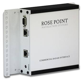
Rose Point Navigation Systems announces the launch of its new Commercial Radar Interface, delivering a solution for interfacing marine radars with Rose Point ECS.
The design of the Commercial Radar Interface uses an all-digital interface for data transfer that ensures a high level of image fidelity with the radar's display.
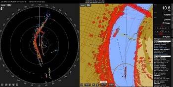
The Commercial Radar Interface was designed to combine the benefits of radar images with the navigation tools built into Rose Point ECS. It provides an overlay of the radar image on any chart, giving users a complete picture of their environment and reducing stress while navigating in challenging situations. Radar overlay allows mariners to quickly and accurately interpret the source of radar echo returns on their charts, significantly reducing the amount of time required to identify targets. False echoes can now be instantly identified with nautical chart data, accurately reflecting real-time radar images.
Rose Point’s development team invested significant resources to ensure the digital interface provides the highest quality images available. The radar echo image’s transparency is fully adjustable and matches the scale and presentation of the chart. Operators have the option to control the radar directly within Rose Point ECS and the ability to control radar ranges, clutter and filter settings, as well as commonly used plotting tools. Mariners can also alternate easily between radar overlay and a traditional radar display using Rose Point ECS’ split panels or a full-screen radar on a secondary monitor.
The Commercial Radar Interface was designed for fast and easy set up and installation right out of the box while other analog-based radar interfaces require complicated installation and radar adjustments. As long as the vessel has a compatible radar with the current firmware, it can be installed in minutes by connecting both the radar and computer to the interface box with standard ethernet cables. The software receives the radar data from the interface box and displays it onto the chart while also computing the proper location using heading and relative positioning information provided by a digital compass and GPS.
The ability to integrate a radar image with Rose Point ECS’s Commercial Radar Interface improves situational awareness for commercial mariners. For example, mariners can now match a radar echo with AIS data to immediately identify radar targets. It also provides mariners the ability to determine the relative size of a vessel by portraying AIS targets on the chart screen with radar images of their tows clearly overlaid on the chart.
Martin Golden a commercial captain with Reinauer Transportation, said, “Rose Point’s Commercial Radar Interface is the perfect solution for target management. In heavy fog I can immediately identify all my targets with chart and AIS data directly within Rose Point ECS and determine whether an unknown radar target is just a buoy or a small fishing boat.”
The Commercial Radar Interface is available now from Rose Point or an authorized Rose Point dealer.


