

Geo Sessions 2025

Last year, Geo Sessions brought together over 5,300 registrants from 159 countries, with attendees representing education, government agencies, consulting, and top geospatial companies like Esri, NOAA, Airbus, Planet, and USGS. At this year's Geo Sessions, NV5 is raising the bar with a focus on artificial intelligence, thermal imaging, and hyperspectral capabilities, technologies that are transforming how organizations see, understand, and act on geospatial data.“Last year’s sessions proved there’s a huge appetite for actionable geospatial knowledge…
SevenCs Updates WMS ChartServer
SevenCs has released WMS ChartServer, version 5, which provides enhanced functionality across several fronts.Greater interoperability is the key to WMS ChartServer’s support of spatial queries; this support takes the depth and relevance of information on offer to a new level, using GeoJSON-formatted coordinates.Interoperability and valuable context were also the benefits fueling the development of bounding boxes that cover more than 360° of latitude. These give customers compatibility…
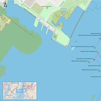
Singapore Launches GeoSpace-Sea Initiative
GeoSpace-Sea, a new database on Singapore's waters, from its coastlines to the seabed, was launched yesterday (June 28) by the Maritime and Port Authority of Singapore (MPA).GeoSpace-Sea aims to provide comprehensive geospatial data for port and coastal planning, among other things, as well as environmental management.MPA, together with 11 other government agencies and the Tropical Marine Science Institute from National University of Singapore, will develop GeoSpace-Sea in phases.“The marine knowledge generated through the GeoSpace-Sea initiative will serve us well in the areas of marine and coastal spatial planning, marine science R&D, marine conservation, climate change adaptation, and disaster response,” said Dr Lam Pin Min, Senior Minister of State for Transport and Health.
TGS Acquires Spectrum
Seismic survey company TGS-NOPEC Geophysical Company (TGS) said it will acquire rival seismic survey company Spectrum ASA.The transaction is expected to be completed as a statutory merger pursuant to Norwegian corporate law between TGS and Spectrum, with merger consideration to Spectrum shareholders in the form of 0.28x ordinary shares of TGS for each Spectrum share, in addition to a cash consideration of $0.27 multiplied by the Exchange Ratio subject to the transaction closing after the ex-date for the TGS dividend payable in th third quarter of 2019 (expected to be early August 2019).Definitive merger documents are expected to be entered into during May…
Songa Bulk Merge with Axxis Geo Solutions
Norway-based Songa Bulk AS, an investment vehicle established to invest in dry bulk assets, has made an agreement to merge with company Axxis Geo Solutions (AGS).Per deal, Songa Bulk will assume the assets, rights and obligations of the Houston-based AGS against issuance of shares in Songa Bulk to existing shareholders of AGS.The exchange ratio in the Merger is based on an equity value of Songa Bulk of NOK 17.93 million, corresponding to a price per share of NOK 0.5, and an equity value of AGS of NOK 514.82 million, corresponding to a price per share of NOK 0.7.The shareholders of AGS will receive 1.4 shares of Songa Bulk per one share in AGS…
PGS Updates on Seismic Acquisition Contract in South America
Norwegian seismic player Petroleum Geo-Services ASA (PGS) updated on changes of the contract for the 3D survey in South America announced November 14, 2018.The vessels Ramform Atlas and Ramform Tethys mobilized early December 2018 for this survey. The contract had an estimated total duration of approximately 13 vessel months and an estimated value in excess of $75 million, the marine geophysical company said.Due to unresolved issues affecting the survey, both vessels have been on paid standby from December 23, 2018.The client, ExxonMobil, has notified PGS that the Ramform Atlas is no longer required. PGS will receive payment for mobilization, work performed, standby and demobilization.
GPS, Ice Profiling Sonar Used in Sea Level Variation Study
ASL Environmental Sciences said that Dr. David Holland of New York University, in collaboraon with Dr. Natalya Gomez at McGill University, is leading an invesgaon of sea level variaons in the Disko Bay region of western Greenland.According to a statement from the company with over 40 years of experience in oceanographic, acoustic, remote sensing and ice research products and scientific consulting services, a shore-based system compares the direct arrival of GPS signals to the signals reflected off the sea surface to obtain sea level.The presence of sea ice and icebergs complicate the measurements. A shore-mounted camera provides information…
UKHO Shares Marine Geospatial Data with Guyana
The UK Hydrographic Office (UKHO) has officially handed over marine geospatial data to the Guyanese Government after a campaign of hydrographic surveying.Delegates from the UKHO presented the data to government officials at a special event to celebrate the completion of the survey. Two workshops were held to brief ministers and provide technical support for applications of the data, which will help Guyana support the development of its marine economy.The data, which was collected over a period of four months between 2016 and 2017, will initially be used to update nautical charts of the Demerara River. This will enable ships to confidently reduce under-keel clearance and maximise cargo-carrying capacity…
Shearwater Completes Acquisition of Schlumberger's Seismic Fleet
Norway-based provider of marine geophysical services Shearwater GeoServices Holding announced the completion of the acquisition of the marine seismic acquisition assets and operations of WesternGeco, the geophysical services product line of Schlumberger.The owner of world’s largest fleet of high-end seismic vessels said in a release that the transaction was completed following receipt of relevant regulatory approvals and satisfaction of customary closing conditions.“We are now an industry-leading full-range geophysical services company with a solid financial and strategic platform. We are eager to move ahead as one strong combined business with global reach…
UK Funds Study on Navigation of Autonomous Ships
The United Kingdom Hydrographic Office (UKHO), a government agency has contributed to a new UK government-funded study on navigational requirements for autonomous maritime vessels.According to UKHO, it worked together with partner organisations L3 ASV and the Maritime and Coastguard Agency (MCA) to identify the future data requirements for autonomous shipping, and explore how navigational and wider geospatial data can be used to enable the safe navigation of smart and unmanned autonomous vessels.The study, funded by the Department for Transport’s Transport Technology Research Innovation Grant (T-TRIG), started by exploring the characteristics of current navigational data and charts in terms of what they comprise, their structure and how they are updated.


