Researchers to Visit ‘Battle of the Atlantic’ Wreckage
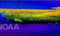
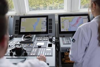
Researchers from the U.S. National Oceanic and Atmospheric Administration (NOAA) and its partners are set to visit what remains of two ships—a German U-boat and a Nicaraguan freighter – which sank off Cape Hatteras during World War II’s “Battle of the Atlantic,” which pitted the U-boats of the German navy against combined Canadian, British, and American forces defending Allied merchant ships. By July 1942, the United States had been in World War II for less than a year, but the fight was coming to the nation’s shores.
MSRC CEO to Retire in April 2017
The Marine Spill Response Corporation (MSRC), the nation’s leading oil spill response organization, has announced that Steven T. Benz, the company’s President and CEO, will be retiring on April 30, 2017. Tim Plummer, Chair of the MSRC Board of Directors, said “We are thankful to Steve for his many years of strong leadership. During his tenure, he has solidified MSRC as the preeminent spill response organization in the nation, as demonstrated by the critical role MSRC played in the “Deepwater Horizon” response.
MSRC Announces Ocean Imaging Remote Sensing Contract
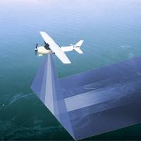
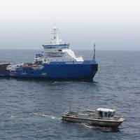
The Marine Spill Response Corporation (MSRC) has entered an exclusive contract with Ocean Imaging Corporation for cutting edge remote sensing capability. Ocean Imaging will provide its proprietary aerial surveillance technology as part of MSRC's overall strategy for enhancing the ability to tactically position response resources in the optimal areas of oil migration for responding to spills. The announcement was made today at the Clean Gulf Conference at the Tampa Convention Center in Tampa, Fla., where both MSRC and Ocean Imaging technology are present.
Fairweather Forms New Subsidiary Tulugaq
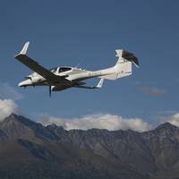
Following the recent acquisition of VDOS, a worldwide company in airborne remote sensing operations, Fairweather, LLC has announced the formation of subsidiary Tulugaq, LLC -- the result of a partnership between Fairweather, LLC, Olgoonik Corporation and Kaktovik Iñupiat Corporation. The company was formed to bolster Fairweather’s remote sensing and real-time scientific data collection capabilities utilizing specialized manned and unmanned airborne assets to support offshore oil and gas exploration and production efforts in the Arctic.