USCG Navigation Center: Steering a steady course for safe, secure, efficient waterways


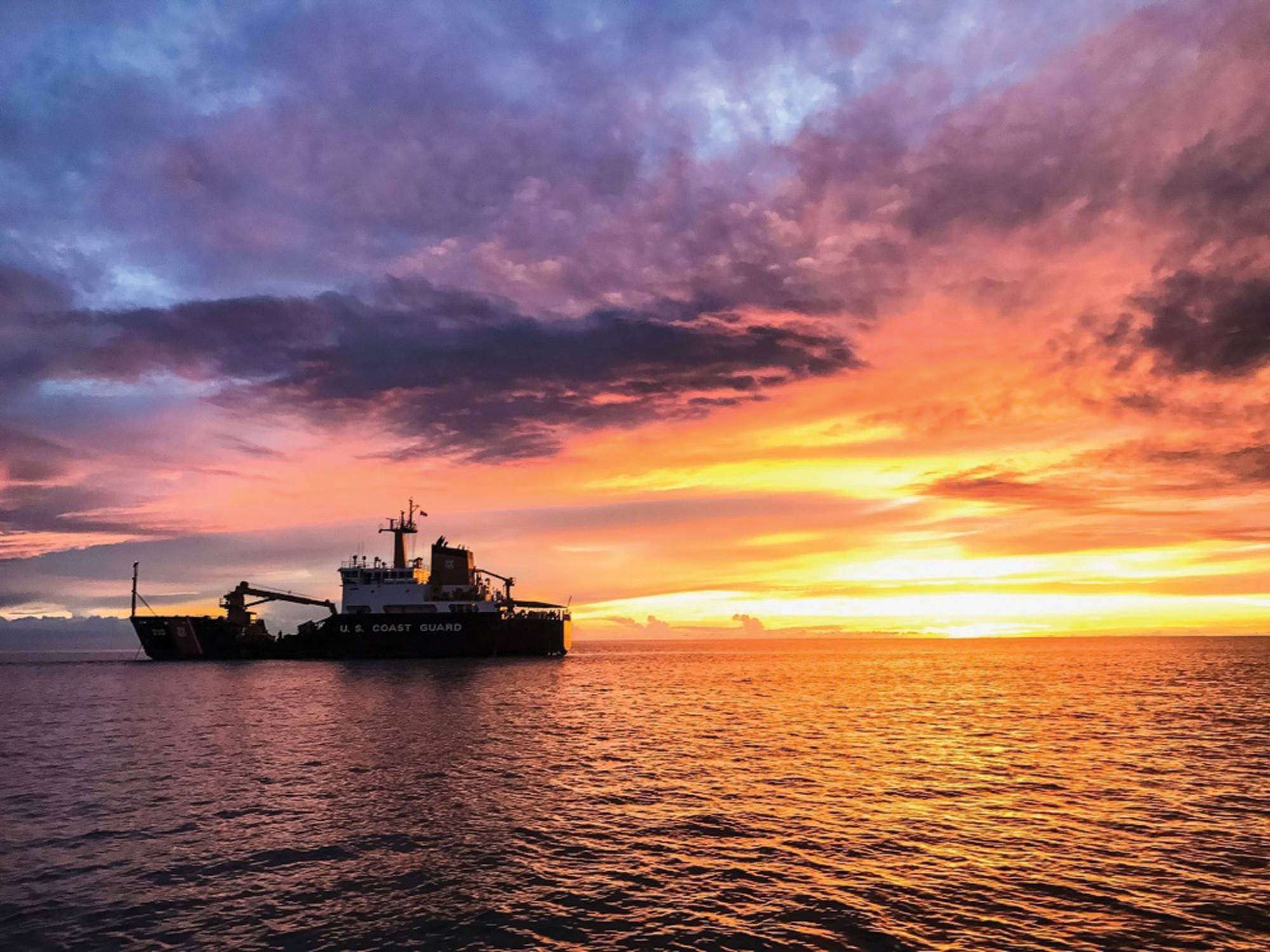
 Coast Guard Cutter Cypress at sunset. Photo by Petty Officer 3rd Class Lora Ratliff, U.S. Coast Guard District 8.
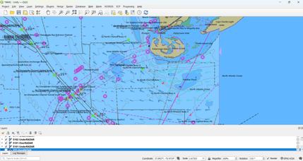
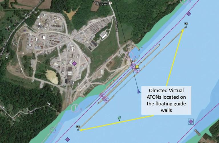 Electronic navigation charts display virtual buoys on the Olmsted Locks and Dam floating guide walls. These markers are the first wave in a project to improve safety and efficiency of maritime operations. (Photo by USACE)
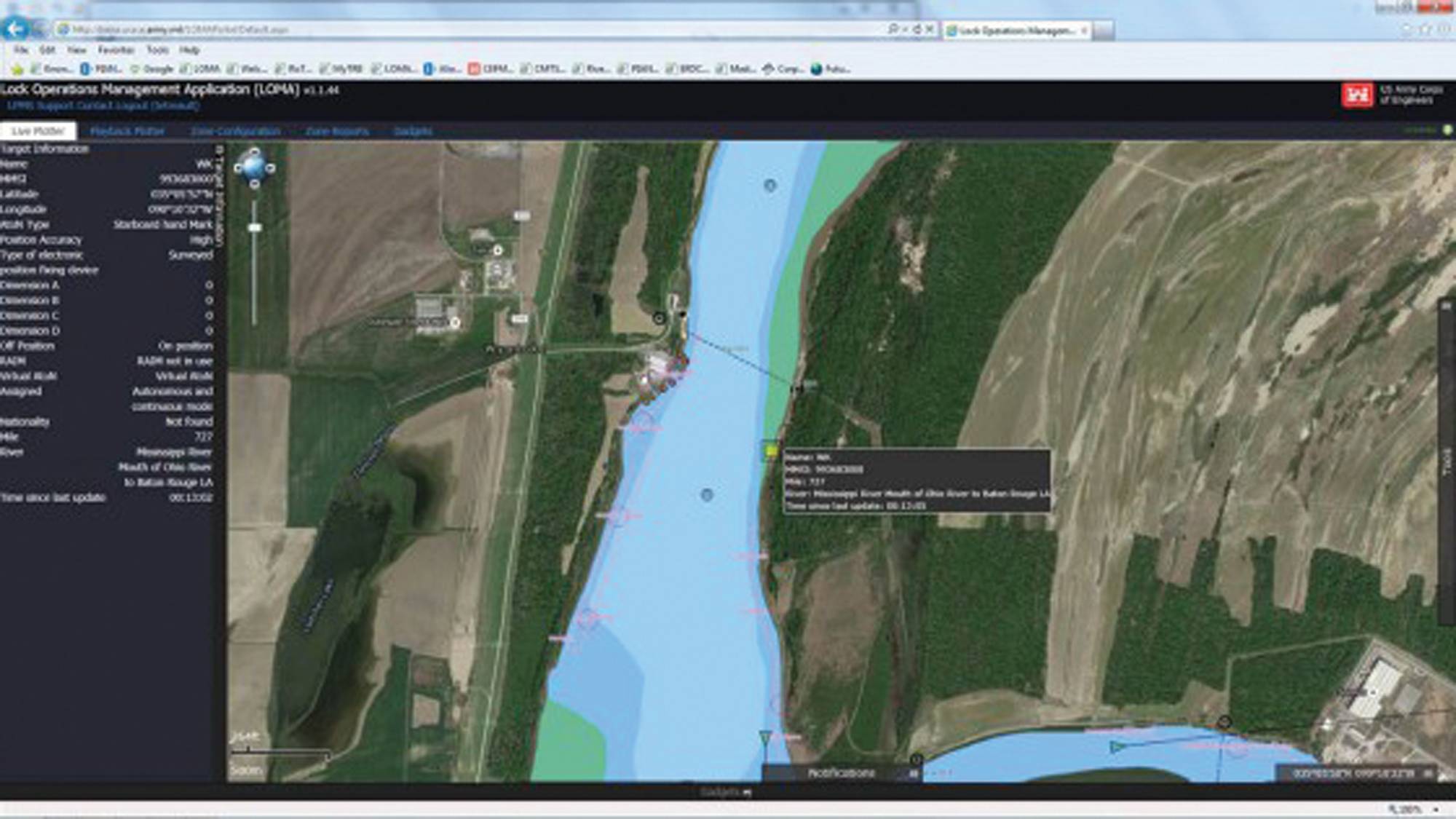
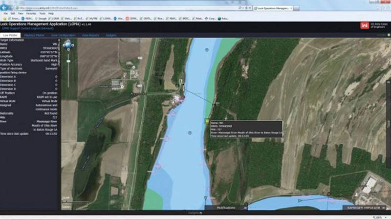 The above screenshot shows the display of the virtual aid to navigation established in partnership between the U.S. Coast Guard and the U.S. Army Corps of Engineers on the Mississippi River. The virtual aid is significant in that it allows mariners to see a hazard when it is not possible to place a floating aid to mark it. U.S. Coast Guard image.
 The crew of oceangoing buoy tender U.S. Coast Guard Cutter Maple follows the crew of Canadian Coast Guard Icebreaker Terry Fox through the icy waters of Franklin Strait, in Nunavut Canada, August 11, 2017. U.S. Coast Guard photo by Petty Officer 2nd Class Nate Littlejohn.
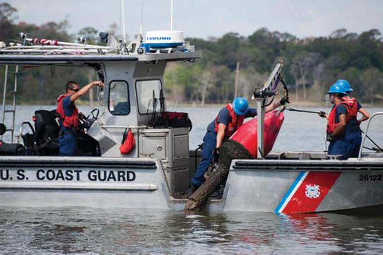 Coast Guard personnel assigned to Aids to Navigation Team Galveston work a navigational buoy in the San Jacinto River. Coast Guard photo by Petty Officer 2nd Class Prentice Danner
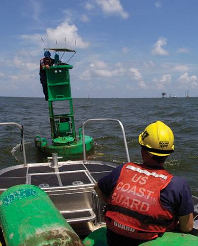 Aids to Navigation team members from Dulac, La., straighten a solar panel that charges the aid’s lighting system. U.S. Coast Guard photo by Petty Officer 3rd Class Thomas Atkeson.


The U.S. Coast Guard’s Navigation Center (NAVCEN) is involved in a number of activities that have an impact on all Americans, even if they don’t realize it.
From motorists checking directions with their Global Positioning System (GPS) to boaters to ships coming and going to U.S. ports, the NAVCEN plays an unseen but vital role.
With a staff of19 officers, 17 enlisted personnel and 19 civilians, NAVCEN falls under the Director of Marine Transportation Systems (CG-5PW) at USCG Headquarters, and is a tenant command at the Telecommunication and Information Systems Command (TISCOM) base in Alexandria, VA.
The center is constantly interacting with Coast Guard units, headquarters offices, government agencies, maritime stakeholders and GPS users around the world.
NAVCEN supports the U.S. Aids to Navigation Information Management System (USAIMS) and Integrated Aids to Navigation Information System (Legacy IATONIS) databases that serve as the official record of all USCG and private aids to navigation aids to navigation (ATON).
“We provide oversight to the 48 thousand – aides, buoys, fixed structures, that are in the United States that the Coast Guard maintains and manages, to help provide safe, navigable waterways for everyone,” said Capt.. Russell Holmes, the NAVCEN commanding officer. “They’re all listed in the U.S. Aids to Navigation Information Management System USAIMS.”
The legacy IATONIS system produces the weekly and annual Light List which are available for downloading from the NAVCEN website. USCG District offices use IATONIS to create a weekly Local Notice to Mariners, which is available to download from the NAVCEN website. Coast Guard ATON units—such as the inland waterway and ocean going buoy tenders--use USAIMS to update the status and condition of the aids when they inspect and service them. The Coast Guard plans to migrate functionality from the legacy IATONIS system to USAIMS to create one integrated application for all ATON activities.
Most mariners, including weekend pleasure boaters, are familiar with “notices to mariners,” and just about everyone has seen a lighthouse or one of the “aids to navigation” that mark channels or warn of shoal water. The NAVCEN manages those local notices to mariners (LNMs) notices, and promulgates them through a broad public distribution system.
LNMs can warn mariners about hazards such as a buoy that is off station, a light that is extinguished, an abandoned vessel, or a recent change to a navigational chart, as well as announce safety and security zones. With the widening of the Panama Canal, larger Post-Panamax ships are now calling at East Coast ports, which have been dredged to accommodate them. That means charts need to be updated with the new depths, or navigational markers repositioned.
“People can report discrepancies on the NAVCEN website, such as if a structure is missing, or a buoy is off station, or a light is burning dim or extinguished,” said Holmes. “We make that information available to the district for action. The best way we have of knowing that an aid is not working properly is when we get a report from the public.
Mariners and pleasure boaters can also report discrepancies using the Coast Guard Boating Safety mobile app. “We average about 15 or 20 a month that are reported through the mobile app. They’re paying attention. But people aren’t fully aware of it yet.”
“Each district has a relationship with their local Coast Guard auxiliary, which has programs to go out and verify aids – either by boat or by air,” said Gene Schlechte, NAVCEN’s Engineering Division chief.
NAVCEN works with the Department of Transportation and the Committee on Marine Transportation Systems, which is made up of 28 federal agencies, to coordinate our activities, and is part of the Future of Navigation working group. The center works with National Oceanic and Atmospheric Administration (NOAA), the Army Corps of Engineers, and the National Geospatial Intelligence Agency, which are responsible for coastal, inland, international and military-related charts. “We have a close relationships with these agencies,” said Holmes. “The Army Corps of Engineers is dependent on NOAA ‘s survey fleet for bottom contour information; NOAA is dependent on the Coast Guard for updates on visual aids to navigation, and we’re dependent on the Army Corps for information about dredging.”
With the advent of electronic charts, updates can be made and sent to users in days or weeks instead of months or years. And as charts are updated, the center provide up-to-date electronic charts to Coast Guard cutters and boats.
Global Positioning System
DOT tasked the Coast Guard as the civilian lead for the US government on GPS because of the Coast Guard’s experience with LORAN and Omega radio-navigation systems, which were the terrestrial precision navigation and timing systems of their day. Now we rely on global navigation satellite systems (GNSS), which use line-of-sight radio transmissions to provide geospatial position, including altitude or elevation, and time information. GPS is the U.S. GNSS, and uses a constellation of satellites. GPS isn’t the only GNSS. The European Union has Galileo; Russia has GLONASS; and China has the Beidou system. There are also other countries that operate systems with limited regional coverage.
Until a recent organizational shift to the newly formed CG Cyber Command, the NAVCEN managed the civil Nationwide Differential GPS (NDGPS) System that employs a network of ground-based reference stations to augment the satellite signals and broadcasts the difference between the positions indicated by the GPS satellite system and known fixed terrestrial positions by calculating differential corrections for its own location and time. The DGPS service also alerts users if any GPS satellite is providing abnormal performance.
NAVCEN participates as the Deputy Chair and Executive Secretariat of the Civil GPS Service Interface Committee (CGSIC), which is chaired by DOT CGSIC is the organization that provides the primary U.S. government interface with civilian GPS users. NAVCEN’s GPS responsibilities include receiving GPS outage reports and coordinating the investigation of those incidents with other government agencies. Another Department of Homeland Security entity, the National Coordinating Center for Communications which is part of the National Cybersecurity & Communications Integration Center (NCCIC), deals with a lot of the commercial telephone entities and companies. “They rely on the timing piece of GPS and around 80% of all users are actually using GPS for the extremely accurate time,” said Holmes.
“People can call us if there is a problem with GPS,” Holmes said. “We gather information from other agencies to share with the public, and we hold periodical meetings with experts who speak about the system, developments, technologies, and different applications of how to use GPS. It’s an open forum where it’s basically a free shot on goal for anybody to ask questions.”
From a resiliency perspective, while we are dependent on GPS for so much, if we lose GPS or satellites for navigation, we still have physical buoys in the waterways. ““We all use our GPS while driving, but we haven’t taken down all the exit signs off of the highways, or the street signs off the roads. So we’re not just going to remove every buoy out of the waterway,” said Holmes. “It’s another situational tool to give you awareness of where you are.”
Automatic Identification System
AIS is the Automatic Identification System, and is found on just about all commercial vessels, including towing vessels--and even some recreational boaters. AIS uses Very High Frequency (VHF) radio signals to autonomously exchange information between vessels for collision avoidance. AIS broadcasts information about ship type, length, width, draft and more. “AIS utilizes GPS, so it can provide your location, course and speed. In the past, you’d use your yellow grease pencil and you’d do a plot and a point on a radar screen, then wait three minutes and do another plot, or wait six minutes and use the 3-minute or 6-minute rule to figure out the course and speed of a vessel, so you know how close that vessel will be, and whether you need to maneuver to avoid a collision,” said Holmes. “Now you can click a button and then instantly you have all of that information at your fingertips. So it helps from a marine safety and navigation perspective, but it also helps for maritime domain awareness, because we can see which vessels are coming in and out of our ports, and where they’re transiting. It also helps with environmental compliance such as speed zones in areas where we need to avoid right whales or low-sulphur fuel emission requirements. If we find a spill, we can see who has been in that area. We can observe that from a distance, just by tracking the vessel movements with AIS. That’s why the NAVCEN can support so many of the Coast Guard’s missions.
“We do historical data requests for a lot of Coast Guard units and other federal government agencies where they want to do analysis of vessel movements when they may be tracking a vessel from a law enforcement perspective or for marine planning such as wind farm placement,” said Holmes. “AIS gives us more domain awareness of what’s traveling within our ports and within our rivers and waterways, and it also helps us with doing data analysis to be able to help figure out where the Army Corps might need to dredge more, or where NOAA might need to update charts because you always have waterways that are moving over time, and so you might have a chart that shows land, but now, by looking at AIS data, well you can see a bunch of vessels that are driving over what appears to be land on a chart, but clearly there’s enough water under their keel for them to safely transit.”
Historical AIS data can be analyzed to inform decisions of dredging or changes to waterways. “The center developed the Vessel Information Verification Service (VIVS) to improve the quality of AIS static data, which in turn improves data analytics and maritime safety on the waterways,” Holmes said. “We can look how the trends have changed over time, to be able to continue to provide a safe and secure waterway for all users to be able to operate in.”
The center produces heat maps to display large-scale traffic patterns. Data can represent different parameters or information, with different colors to indicate traffic density. The Coast Guard can use vessel traffic heat maps to visualize historical trends by location or vessel type for planning.
AIS also helps port partners and command centers track where Coast Guard assets are. “We educate stakeholders to understand better where the different resources and assets are that are available to help for search and rescue, environmental response, or just from a maritime situation awareness perspective,” said Holmes.
The NAVCEN is currently focused on accurate static data, such as vessel dimensions, as well as the correct location of the GPS antennae on the vessel.
“Pilots want to know the correct dimensions of the vessel that’s coming around the turn, but they also want to know where that GPS antenna is in relationship to those dimensions. When they see that vessel on their display, what they’re seeing is the location of the GPS antenna. They want to know much ship is ahead of that antenna, and how much ship is behind it,” said Schlechte.
The center has found that many vessels are actually broadcasting inaccurate AIS information. “We don’t believe it’s intentional. Maybe they didn’t enter the proper information when they installed their transponder, and so they don’t even realize that they’re broadcasting something wrong. Here at NAVCEN we’ve worked with the Operations Support Center (OSC) in Martinsburg, West Virginia, so that mariners can visit our website and type in any vessel name and it will pull up what they’re actually broadcasting via AIS, and what we think they should be transmitting, based on a collection of different databases and the documentation that registered with the Coast Guard and their FCC license. This helps users see whether or not they need to correct their information. If our Coast Guard inspectors are going aboard a vessel they can also can use the Marine Information for Safety and Law Enforcement (MISLE) system to see that information, and help get those discrepancies resolved,” Holmes said.
Taking the long view
Long Range Identification and Tracking (LRIT) provides an enhanced level of maritime domain awareness (MDA), with a real-time reporting mechanism to monitor all U.S. flagged vessels, wherever they are, and international vessels bound for U.S. ports. LRIT is both a U.S. and International Maritime Organization (IMO) requirement. It was developed before AIS, and while AIS is open-source, LRIT is encrypted, and uses iridium and INMARSAT equipment. “We have access to all U.S. flagged vessels, and all international vessels that are within a thousand miles of the US coast,” Schlechte said. “It’s a world-wide system, so countries that participate in the IMO program can identify those ships coming into their ports, and where they are. All LRIT data goes to the IMO, and we get the information that we are entitled to receive from the IMO.”
NAVCEN’s LRIT watch currently monitors over 7000 international vessels within 1000 miles of any U.S. coast, and over 830 U.S. vessels around the world.
Ships must provide notice-of-arrivals to the National Vessel Movement Center 96 hours before they come into port, providing information about the vessel, cargo, crew and previous ports of call. This helps the Coast Guard decide which vessels to board before they come into a port.
“We share the information with the harbor pilots,” Homes said. “They know from the ship agents which ships they’re working with, and if they see a vessel coming in that they’re not planning to help, they might alert us so we can investigate closer. Maybe we should go board that vessel, either out at sea or when it hits the dock, and figure out what is the nature of its business. Sometimes larger recreational yachts don’t realize that they’re supposed to report that they’re coming in to port, or you might have other entities that aren’t actually docking at a port, but they’re coming in just to exchange crewmembers by boat, and then they’ll leave again. But it’s not very frequently that most people aren’t announcing. The Coast Guard works with the harbor pilots every day for the vessels that are coming in and out of the port. In some cases they won’t bring a vessel in until we’ve given the clearance for that ship to come in. It’s kind of a fail-safe,” Holmes said. “Our port partners are good about contacting us when something doesn’t seem normal.”
According to Holmes, ship owners are being more proactive in ensuring their ships are compliant, because they don’t want their ships delayed for inspection. “If the Coast Guard finds a lot of discrepancies when they pull into port and then get detained, then it impacts their ability to offload and onload their cargo, and their ability to stay on schedule to their next port and subsequent ports. They may tie up the dock, which also has a big impact on a port. And if they get detentions in the United States from the Coast Guard, it could impact their ability to call at other ports around the world. Others will look at our detention rates and percentages, and may step up their inspections. Whereas if you appear to be doing the right thing and you don’t have any deficiencies every time we come on board, we’re starting to talk more about how do we get to more risk-based decision making, and maybe we don’t need to go on board and squeeze every life jacket.”
The center’s Navigation Information Service is a 24/7 watch. “It’s like a help desk for anybody with navigation-related questions,” Schlechte said. “But because we’re always manned up, when people are not sure of who else to call, they call us with all kinds of calls about the Coast Guard.