Shipping Lanes Re-routed off California Coast
Effective June 1, 2013, West Coast shipping lanes are being adjusted to protect endangered whales, & OceanGrafix's new charts incorporate those changes.
OceanGrafix, the first and only company to offer NOAA print-on-demand nautical charts, today announced the availability of updated nautical charts that reflect imminent changes to shipping lanes. Effective June 1, 2013, the International Maritime Organization (IMO) is amending vessel traffic separation schemes in an effort to enhance navigational safety and to protect endangered whales.
The IMO adjustments to shipping lanes, which are backed by National Oceanic & Atmospheric Administration (NOAA) research, will affect waterways along the California coast, from Long Beach all the way north to San Francisco, including Cordell Bank, Gulf of the Farallones, and Monterey Bay National Marine Sanctuaries, as well as prime commercial fishing grounds. The charts impacted include charts 18724, 18647, 18649, 18728, 18729, 18744, 18725, 18746, 18645, 18721, 18640, 18680, 18700, 18720, 18740 and 18022.
“Through our partnership with NOAA, we are able to provide updated nautical charts that accurately reflect these new and amended travel routes,” said Ron Walz, OceanGrafix president. “All boaters, both commercial and recreational, need to be aware of these IMO-approved changes and adjust accordingly.”
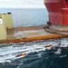
In recent years, nearly a dozen endangered whales have been killed by confirmed or likely ship strikes along the California coast. By moving vessels away from whale feeding and migration areas, the new routes will potentially reduce the risk of such strikes. Blue, humpback, and fin whales, which are known to be seasonally abundant in these areas, are all protected by the Endangered Species Act, the Marine Mammal Protection Act, and the National Marine Sanctuaries Act.


