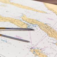
ECDIS is Not a Replacement for Terrestrial Navigation

I guess it was only a matter of time. After years of debating whether or not Celestial Navigation should be taught it is now time to debate the relevance of Terrestrial Navigation. The argument is same: why do I need to know this if there is technology available to do it for me?The answer is also the same. If you want to be a professional mariner than your knowledge base and skill sets should far exceed that of a weekend boater that follows the direction of their chart plotter…
Bulk Carrier Hit Offshore Platform Due to Charting Error, Poor Bridge Resource Management, NTSB Finds
On January 7, 2021, the dry bulk carrier Ocean Princess struck the uncrewed/out-of-service oil and gas production platform SP-83A while operating 24 miles south of Pilottown, Louisiana. Now, some 19 months later, the National Transportation Safety Board has released an investigation report which showed that poor bridge resource management and a charting error led to the bulk carrier striking the oil and gas production platform.The 24-person crew of the Ocean Princess was drifting overnight in the Gulf of Mexico before going to New Orleans to load a cargo of grain. The master planned to drift throughout the night with the engine on 15-minute standby, keeping clear of traffic and platforms, NTSB said.Area where the Ocean Princess contacted platform SP-83A, as indicated by a red X.
UKHO to Stop Paper Chart Production in 2026
The death of the paper chart may finally be coming to fruition, as the UK Hydrographic Office (UKHO) announced its intention to develop options for the withdrawal from global paper chart production by late 2026, as commerical and pleasure boating use of electronic charts continues full steam ahead, and theADMIRALTY Maritime Data Solutions digital navigation portfolio can be updatedin near real-time, greatly enhancing safety of life at sea (SOLAS). The phased withdrawal of paper…
Electronic Navigational Charts: An Update and Some Issues
In November 2019, the Office of Coast Survey (OCS), part of the National Oceanic and Atmospheric Administration (NOAA), announced the start of a five-year program to “sunset” all raster and paper nautical charts.NOAA has produced electronic navigational charts (ENCs) since 1993. In the 2019 notice, NOAA writes that “ENC sales increased 425% since 2008, while sales of paper charts are now half of 2008 levels.”For NOAA and mariners, a focus on electronic charts and publications promises many advantages. With a singular focus, NOAA can use its resources more efficiently.
NOAA Begins Transition Exclusively to Electronic Navigation Charts
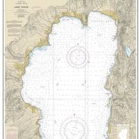
NOAA will begin to implement its sunset plan for paper nautical charts this month, starting with the current paper chart 18665 of Lake Tahoe. After August, NOAA’s electronic navigational chart will be the only NOAA nautical chart of the area.This is the first traditional paper chart to be fully supplanted by an electronic chart as part of NOAA’s Office of Coast Survey Raster Sunset Plan, which includes a new process to notify mariners of the transition of individual paper charts to electronic charts.
Fines for Cruise Ship Grounding Total $100,000
A French cruise company and ship’s Master have been fined $70,000 and $30,000 respectively for endangering human life and entering a prohibited zone following a grounding incident in the remote New Zealand Subantarctic islands.French company Compagnie du Ponant and Captain Regis Daumesnil, a French citizen, were sentenced Tuesday in the Wellington District Court after pleading guilty to charges following the January 2017 grounding of the cruise ship L’Austral on an uncharted rock at the Snares Islands.Both Maritime NZ and the Department of Conservation (DOC) brought charges against Captain Daumesnil, with DOC also prosecuting the company.
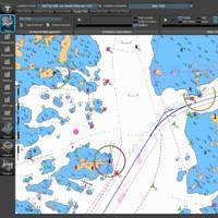
C-MAP Updates Its Integrated Maritime Suite
C-MAP has announced a new version of its Integrated Maritime Suite (IMS) 2.0 – a flexible, streamlined tool for navigational planning and voyage execution.Significant customer collaboration was included in the development of IMS 2.0, integrating C-MAP’s chart and publication management to further enhance bridge planning capability and drive efficient workflows.IMS 2.0 brings a new level of integrated tools to the onboard planning station by combining modules for chart and publication management…
Taking the Plunge into Digital
It’s a matter of when – not if. Digital is with us, and while many industries have embraced its potential, there is still some reticence in the shipping sector to take the plunge. Norwegian navigation expert Nautisk has rethought its entire product offering to embrace digital, so what have they learned? Nautisk’s head of marketing, John Dawson, explains. Nautisk has been a specialist chart agent for more than 100 years, and our core product base has been paper charts and printed publications for the shipping sector.
NYK Introduces New Navigation Support Tool
Nippon Yusen Kabushiki Kaisha (NYK), the Monohakobi Technology Institute and Japan Radio have jointly developed a support tool that enables officers to better manage and share navigational information. The tool will be sold by JRC under the name “J-Marine NeCST”. The International Maritime Organization (IMO) has made ECDIS (Electronic Chart Display and Information System) mandatory by 2018 on international voyages by passenger vessels over 500 gross tonnage (GT) and cargo vessels over 3,000 GT. However, additional navigational information cannot be written by hand on ECDIS, as can easily be done on a conventional paper chart. J-Marine NeCST solves that problem by including a very useful input function that lets users write directly on electronic charts.
nv Charts Updates Florida, Bahamas, Caribbean Charts
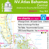
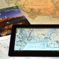
nv charts has announced the release of their newly updated chart sets for Florida, the Bahamas and the Caribbean for 2016/17 in paper and digital format. In addition to being updated, the new NV.Atlas format brings a modern, handy design to the charts that’s practical and easy to use. The chart set includes a download of digital charts, including free navigation software, plus the free nv charts Mobile App for iOS and Android mobile devices. The App includes free digital updates for this chart set for 2016/17.
Electronic Charts on a Paper Scale
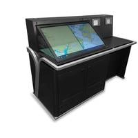
JRC and Alphatron Marine have launched a new digital AlphaChartTable comprising of a dramatically increased 46-inch touch display where routes can be planned on a “paper chart” scale. By use of the digital chart table, navigators are now given an intuitive and user friendly interface to plan optimal routes by touch operation. The software gathers and overlays the data officers require, including ENCs, weather data, tidal information, digital publications, and other services like piracy updates – all on a single 46-inch display.
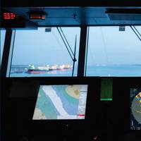
Simrad Debuts Maris ECDIS900 MK5, MK15
The Simrad Professional Series has launched a new lineup of professional-grade Electronic Chart Display and Information Systems (ECDIS)– theSimrad MARIS ECDIS900 MK5 and MK15.Available in 19-, 24-, and 26-inch widescreen monitors, the ECDIS900 Series is IEC61174:2008 Ed3type-approved for use on all SOLAS vessels operating under the ECDIS Carriage Mandate. The ECDIS900 MK5 and MK15 are based on a standard Windows interface using common controls including toolbars, tabbed panels, hotkeys, and right-click context or ‘pop-up’ menus. Integrating the latest features captains require, the ECDIS900 Series includes advanced route-planning tools…
UKHO Calls on Shipowners Regarding Updated ECDIS Standards

IHO announces new ECDIS Standards; 12 months to complete transition. Following the announcement of updated ECDIS Standards by the International Hydrographic Organization (IHO), the UKHO is encouraging all shipowners to speak to their ECDIS manufacturers to ensure a smooth, timely transition. The technical standards that govern the display of Electronic Navigational Charts (ENCs) within an ECDIS are the responsibility of the International Hydrographic Organization (IHO), the international body that coordinates the activities of the community of national hydrographic offices.
Tankers Switch to Digital Navigation
In July 2015 international regulation requires all tankers to be compliant with IMO rules for the use of ECDIS and ENCs. As many shipping companies start planning that changeover Global Navigation Solutions (GNS) has today published a white paper, The Ultimate Guide to Going Digital, a seven-step plan to help managers plan everything from new ways to buy charts, manage inventories, update charts, demonstrate compliance, passage plan, as well as dealing with the increased administration.
NAVTOR AS, Nautic AB Launch Complete Navigation Solution

E-navigation specialist NAVTOR has joined forces with Nautic AB, a provider of navigational equipment, charts and publications to the Swedish market, to launch NAVTOR NAUTIC AB. This jointly owned operation, based in Gothenburg, Sweden, will now leverage the expertise of the two businesses to offer a navigational data package to the international shipping industry. This, NAVTOR Managing Director and CEO Tor A. Svanes says, created an obvious synergy and the potential for real customer benefits.
New Bahamas Northwest Chart Set Upgrade
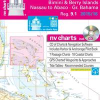
nv charts announces the release of its newly updated chart set for Region 9.1, Bahamas Northwest, including Bimini and Berry Islands, Nassau to Abaco, and Grand Bahama, for 2015/2016 in paper and digital format. The chart set includes a CD of digital charts, including free navigation software, plus the free nv charts Mobile App for iOS and Android mobile devices, for real-time navigation with tablet devices. The App includes free digital updates for this chart set for 2015/2016. Nv charts are relied on for accuracy and dependability by recreational boaters, professional mariners, and the U.S.
Jeppesen Wins IHMS Contract in Singapore
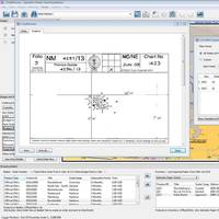
Jeppesen has been awarded a contract to develop and implement an Integrated Hydrographic Management System (IHMS) for the Maritime and Port Authority (MPA) of Singapore, a governmental agency established to develop Singapore as a premier global hub port and international maritime center, as well as to advance and safeguard Singapore’s strategic maritime interests. The contract is for two years, with an optional three-year extension. The Jeppesen IHMS will provide multiple functionalities, including bathymetric data handling, management and storage integrated with Jeppesen’s dKart Source Management system and dKart Office tools for ENC and paper chart production and maintenance.
NOAA Certifies More Printing Agents
The availability of paper "print-on-demand" nautical charts continues to expand, as NOAA's Office of Coast Survey has added three more printing companies to its roster of certified agents for paper charts. "The most recent printers to join the NOAA paper chart program represent the enduring connections between maritime tradition and progress," said Capt. Shep Smith, chief of Coast Survey's Marine Chart Division. "Companies with histories going back decades, and even centuries, support a firm foundation for the continuing production and delivery of U.S. Iver C. Weilbach & Co.
Transas Adds Paper Chart Functions to Navi-Planner 4000
Navi-Planner 4000 has been known for electronic charts, publications and other data management for several years. Recognizing the fact that a lot of shipping companies continue using paper charts, Transas has added a new functionality to its voyage planning software providing one tool for both, electronic and paper charts management to its customers. Users can import complete vessel's inventory or manually select paper charts held onboard. Navi-Planner 4000 then connects directly to the Transas chart server ashore to gather all outstanding Notices to Mariners within a few seconds.
A Closer Look at Dynamic Navigation for High Speed Craft
FRC International launched the innovative ‘DYNAV’ dynamic navigation system for high speed craft at Chalmers University of Technology in Gothenburg, Sweden in October. The DYNAV launch event enabled attendees from Scandinavia and Europe to come together with the objective of improving seafarer safety, operational performance and interoperability on fast craft. Professional sectors organizations included Search & Rescue, Navy, Special Forces, Coast Guard, law enforcement, maritime pilots, maritime legislators, training organisation and boat builders.
No Fear, NOAA Paper Charts Still Near

The announcement that the federal government will stop bulk lithographic printing of nautical charts brought some understandable angst, however NOAA say they may be changing the chart production process but they will NOT stop the production of paper charts. The Agency explain they are working with private companies to make them better: printed in brighter colors and available for fast delivery to the door. Most importantly, they are up-to-date to the moment ordered. These improved paper charts are NOAA-certified print-on-demand (POD) nautical charts created by NOAA Coast Survey cartographers.
ChartWorld Notices to Mariners Managing Tool
ChartWorld eNtM delivers digital Notices to Mariners (NtMs) on a weekly basis. The service includes paper chart tracings and corrections for all other publications previously delivered in the paper NtM format. eNtM is integrated with ChartWorld’s digital chart catalogue ChartBrowser. The outstanding user-friendliness of the tool, combined with low volume data transmission and attractive monthly fees, is a breakthrough method on the market. Each vessel is provided with a complete database of digital NtMs of the last three years.
New Navigational Product Trio from NOAA
NOAA highlight new US Chart 1, new chart of California waters with IMO TSS shown, and a beta mobile chart app for boaters. New U.S. For the 65 years since the U.S. Coast and Geodetic Survey issued the first edition of U.S. Chart No.1 in 1948, mariners have had a standard guide for understanding the symbols, abbreviations and terms used on paper nautical charts. In a major step forward, a new edition of that guide also describes the symbols specified by the International Hydrographic…